Business Details
41 Years
experience
Your Trusted Partner for Land Surveying Solutions
Since 1985, Flatirons Surveying has been a premier provider of land surveying services across Colorado, dedicated to bridging the natural world with clients' land use needs. Our expertise combines traditional surveying practices with modern innovation, ensuring precise and reliable results for both public and private sector clients. With a focus on integrity, adaptability, and quality, we have grown into a comprehensive surveying firm serving residential, commercial, and governmental projects. Our employee-owned model fosters a culture of accountability and long-term commitment to excellence, supported by advanced technologies like LiDAR and photogrammetry. Headquartered in Boulder with offices in Denver and Longmont, we maintain a strong regional presence while delivering nationwide solutions.Our team of licensed professionals brings decades of collective experience, ensuring every project benefits from technical precision and personalized service. We prioritize client relationships, offering tailored solutions that address unique challenges while adhering to strict regulatory standards. From boundary surveys to reality capture, our services are designed to meet evolving industry demands with unmatched accuracy. As industry leaders, we remain committed to advancing surveying practices through continuous training and adoption of cutting-edge methodologies. Our legacy of trust and reliability positions us as the preferred partner for surveying needs across Colorado and beyond.

Services
Residential Services
Boundary Surveys
Design Surveys
Construction Layout
Reality Capture
Details
- Year established: 1985
Highlights and features
- We offer over 35 years of specialized land surveying experience in Colorado.
- Our services integrate cutting-edge technology like LiDAR and photogrammetry.
- We operate as an employee-owned company committed to accountability and quality.
- Our team includes licensed professionals with expertise in diverse surveying disciplines.
- We maintain regional offices in Boulder, Denver, and Longmont for local accessibility.
What people say
Responsive to our needs
Depth of staffing
Reliable, adaptable, friendly
Precise and accurate
Super dependable
Services
Boundary Surveys
Boundary Surveys establish precise property lines through advanced measurement techniques and historical research. Our team identifies easements, encroachments, and boundary markers to resolve disputes and support real estate transactions. Clients benefit from legally defensible documentation that meets state-specific standards for land development and ownership verification.
Construction Layout
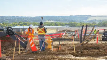
Construction Layout services ensure accurate implementation of design plans through precise field marking of structures and utilities. We utilize robotic total stations and GPS technology to guide grading, foundation placement, and infrastructure development. This service minimizes costly errors while maintaining compliance with municipal regulations and project specifications.
Reality Capture
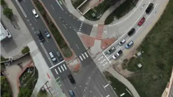
Reality Capture employs LiDAR and photogrammetry to create detailed 3D models of existing environments. Our FAA-certified pilots collect aerial data while terrestrial scanners capture ground-level details for comprehensive spatial analysis. This technology supports clash detection, volume calculations, and as-built documentation across construction and environmental projects.
Design Surveys
Design Surveys provide topographic data and site analysis for infrastructure planning and development. We combine elevation certificates, utility mapping, and ALTA standards to create foundational datasets for architects and engineers. These surveys ensure regulatory compliance while optimizing design efficiency for commercial and residential projects.
Residential Services
Residential Services include improvement location certificates, legal descriptions, and FEMA elevation certifications for property transactions and renovations. Our team addresses floodplain requirements, setback verifications, and boundary concerns specific to single-family and multi-family developments. Clients receive cost-effective solutions that meet lender and municipal requirements for residential properties.
People
Tom Willis
President
With over 40 years of surveying experience, Tom Willis leads Flatirons Surveying as President. A licensed Professional Land Surveyor in four states, he specializes in project management for engineering and construction clients while maintaining the company's core values since assuming leadership in 2022.
Jess Kuntz
Vice President
Jess Kuntz, Vice President and Longmont Branch Manager, brings 21 years of surveying expertise. Licensed in Colorado and Kansas, he oversees complex survey types including ALTA/NSPS Land Title Surveys while managing operations at the Longmont office since 2013.
Sterling Bennink
Vice President
Sterling Bennink, with 39 years of experience, manages residential survey operations. His expertise includes floodplain analysis and FEMA requirements, supporting client needs from initial drafting roles to current leadership responsibilities in residential department management.
Andy Bjorlow
Vice President
Andy Bjorlow, Vice President and Denver Branch Manager, specializes in construction layout with 24 years of experience. He provides technical leadership for high-end projects while managing Denver office operations and mentoring construction survey staff.
Zack Gowan
Senior Vice President
Zack Gowan, Senior Vice President, offers over 40 years of surveying experience with federal certification. He manages environmental restoration projects across western states, leveraging expertise in regulatory compliance and complex land survey challenges for government and private sector clients.
Questions
What types of surveying services does Flatirons Surveying offer?
Flatirons Surveying provides boundary surveys, construction layout, reality capture, design surveys, and residential services across Colorado's Front Range.
How can I request a surveying quote?
Use our online quote request form or contact any of our Colorado offices directly for project-specific pricing estimates.
What is an Improvement Location Certificate (ILC)?
An ILC identifies potential property encroachments through visual representation, commonly required for real estate transactions and mortgage financing.
Do you serve both residential and commercial clients?
Yes, we provide tailored surveying solutions for residential developments, commercial projects, and government infrastructure initiatives.
What technologies do you use for surveys?
We employ LiDAR, photogrammetry, robotic total stations, and GPS systems to ensure precise data collection and analysis.
Are your surveyors licensed professionals?
All surveying services are conducted by licensed Professional Land Surveyors with state-specific certifications across multiple jurisdictions.