
Business Details
Your Trusted Land Surveying Partner in Evergreen, CO
At Survey Systems, we have built a reputation as a premier land surveying company committed to quality performance and customer satisfaction. With over 25 years of experience, our expertise spans high-definition 3D laser scanning, hydrographic surveying, and construction development, delivering precise solutions tailored to client needs. Our project management approach ensures adherence to critical milestones, timely problem resolution, and accurate documentation, leveraging proven methodologies to prevent delays and maintain budget integrity. We prioritize innovation and advanced technology, utilizing integrated systems from Trimble robotic total stations to state-of-the-art GPS receivers and multi-beam sonar for seamless data collection and analysis.Our team of certified surveyors and experienced project managers brings technical excellence to every project, emphasizing field efficiency, punctuality, and clear communication. We are dedicated to fostering employee growth through a culture of innovation, commitment, and optimism, ensuring our team reaches full potential while maintaining the highest ethical standards. Operating in strict compliance with USACE, NOAA, and IHO standards, we provide scalable solutions for projects ranging from small land developments to large-scale infrastructure, consistently exceeding client expectations through integrity, perseverance, and a client-centric focus.

Services
3D Laser Scanning
Hydrographic Surveying
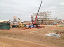
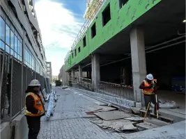
Construction Development
GIS Services
Land Development Surveys
Highlights and features
- 25+ years of experience in land surveying
- Service-Disabled Veteran-Owned Small Business
- Advanced surveying technology
- Experienced certified surveyors
- Proven project management techniques
Services
Hydrographic Surveying
Our hydrographic surveying services utilize single-beam and multi-beam sonar systems to map underwater environments with precision. We support dredging, channel clearance, and structure engineering, adhering to USACE and IHO standards. Clients receive accurate data for capacity tables, obstacle detection, and volumetric analysis.
3D Laser Scanning
Using Trimble and Leica technologies, our 3D laser scanning captures detailed topographic data for construction and infrastructure projects. This enables clash detection, as-built documentation, and integration with CAD/GIS systems, ensuring high-tolerance measurements for complex developments.
Construction Development
We provide control surveys, foundation layout, and grading verification for commercial and civil projects. Our services ensure alignment with design specifications, supporting steel installation, pavement layout, and structural monitoring to maintain project timelines and budgets.
GIS Services
Our GIS capabilities include data acquisition, metadata creation, and integration with existing systems. We deliver digital maps, route planning analysis, and compatibility with all GIS platforms, supporting infrastructure and environmental projects with accurate spatial insights.
Land Development Surveys
We conduct topographic surveys, boundary determinations, and subdivision plats for residential and commercial developments. Our work includes easement descriptions, FEMA floodplain assessments, and ALTA/NSPS standards compliance, ensuring legal and design accuracy.
Questions
What surveying services does Survey Systems offer?
We provide hydrographic surveys, 3D laser scanning, construction layout, GIS services, and land development surveys tailored to project needs.
How long has Survey Systems been in business?
Survey Systems has over 25 years of experience in professional land surveying since its founding in 1994.
What technology does Survey Systems use?
We utilize Trimble GPS, robotic total stations, multi-beam sonar, and advanced software like AutoCAD Civil 3D for precise data collection and analysis.
Does Survey Systems handle large-scale projects?
Yes, we manage projects ranging from small land developments to complex infrastructure with dedicated project managers and field crews.
What areas does Survey Systems serve?
We primarily serve Colorado, including Denver, Evergreen, and surrounding regions, with capabilities for nationwide projects.
Videos