Business Details
50+ Years
experience
Your Trusted Partner for Land Surveying Solutions in Salem, OR
Barker Surveying has served landowners, developers, and professionals in Salem, Oregon since 1972. Our team delivers precise boundary surveys, construction staking, topographic mapping, and ALTA/NSPS land surveys with meticulous attention to detail. We specialize in providing comprehensive property data, including legal descriptions, elevation certifications, and wetlands delineation. As a locally-owned family business, we maintain affiliations with the Better Business Bureau and Home Builders Associations of Marion and Polk Counties, ensuring adherence to industry standards.Our 50-year legacy combines advanced technology with hands-on expertise to deliver actionable insights for residential, commercial, and municipal projects. Clients benefit from free estimates and tailored solutions that address unique surveying challenges. Our demonstrated accuracy in mapping boundaries, easements, and topographical features has earned us recognition from engineers and architects regionally. We remain committed to technical excellence while maintaining personalized service for every client, regardless of project scale.
Services
Boundary Surveys
Construction Surveys
Topographic Mapping
ALTA Surveys
GPS Surveys
Legal Descriptions
Elevation Certifications
Subdivision Plats
Wetlands Delineation
Details
- Year established: 1972
Highlights and features
- Over 50 years of surveying experience since 1972
- ALTA/NSPS-certified land surveying specialists
- Free estimates for all property survey projects
- Family-owned with local market expertise
- Proven accuracy in boundary and topographic surveys
Associations and certifications
- Better Business Bureau (BBB)
What people say
Great, caring staff
Precision surveying
Excellent service
Crisp surveys
Helpful and great to work with
Services
ALTA/NSPS Surveys
Our ALTA/NSPS land surveys provide comprehensive property documentation meeting national standards. These detailed surveys identify boundaries, easements, improvements, and legal encumbrances essential for real estate transactions. Professional surveyors combine GPS technology with field verification to ensure mortgage lenders and title companies receive accurate plat information.
Topographic Mapping
We create detailed topographic maps showing natural and man-made land features. Our surveys document elevation changes, vegetation, utilities, and structures using advanced surveying equipment. These maps help engineers and architects plan construction and land development projects with precise terrain data.
Construction Surveys
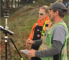
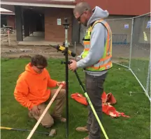
Our construction surveys establish accurate project boundaries and elevation benchmarks for new developments. Surveyors use GPS and robotic instruments to mark building corners, utilities, and infrastructure. This ensures compliance with site plans and building codes throughout the construction process.
Boundary Surveys
We conduct boundary surveys to determine exact property lines and legal descriptions. Our team researches historical records and performs field measurements to identify encroachments and easements. These surveys help resolve disputes and prevent future legal issues during property transactions.
GPS Surveys
Our GPS surveying services provide high-accuracy position data for large-scale projects. Using satellite technology, we collect precise coordinate information for land parcels, infrastructure projects, and environmental studies. These surveys integrate with digital mapping systems for engineering and planning purposes.
Questions
What types of land surveys do you offer?
We provide boundary surveys, ALTA/NSPS land surveys, topographic mapping, construction staking, GPS surveys, legal descriptions, elevation certifications, subdivision plats, and wetlands delineation services.
How much does a property survey cost?
Survey costs depend on property size, required detail level, and terrain complexity. We provide free estimates after understanding your specific requirements and project scope.
Do you serve commercial developers?
Yes, we offer comprehensive surveying services for commercial development projects, including ALTA surveys, site planning, and construction staking for building permits and infrastructure projects.
Are your surveyors licensed?
Our surveying team consists of licensed professionals meeting Oregon state requirements, with expertise in boundary law, geodetic measurements, and modern surveying technologies.
How long does a survey take?
Project timelines vary, but most residential surveys complete within 3-5 business days. Complex commercial projects requiring multiple survey types may take 1-2 weeks depending on scope.