Business Details
34 Years
experience
Professional Land Surveying Services in Colorado
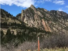
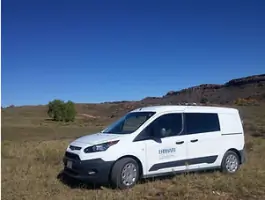
Ehrhart Land Surveying is a Colorado-based company dedicated to providing professional land surveying services with a focus on personalized client relationships. Established in 1992, our team combines decades of experience with a commitment to accuracy and timeliness, addressing the unique needs of each project. We specialize in boundary surveys, ALTA/NSPS Land Title Surveys, topographic surveys, subdivision plats, and FEMA elevation certificates, serving clients across the Rocky Mountain region. Our principal surveyors oversee every project, ensuring meticulous design, budgeting, and scheduling while maintaining adherence to ethical standards. Fully insured with errors and omissions, general liability, and workers' compensation coverage, we prioritize practical solutions and client satisfaction.Our mission emphasizes fostering positive relationships and delivering user-friendly services that meet the highest professional benchmarks. With expertise in GPS surveys, aerial photography control, and construction layout, we resolve complex challenges while maintaining transparency and accountability. Our vision drives organizational excellence and sustainable growth, supporting meaningful outcomes for clients and communities. Recognized for integrity and reliability, we serve as a trusted partner for commercial, residential, and municipal projects throughout Colorado and beyond.
Services
Boundary Surveys
ALTA Surveys
Land Survey Plats
Topographic Surveys
Subdivision Plats
FEMA Elevation Certificates
Construction Layout
As-Built Surveys
Condominium Maps
Easement Surveys
Details
- Year established: 1992
Highlights and features
- We offer over 30 years of combined surveying experience with a focus on Colorado's unique terrain.
- Our team provides personalized project coordination directly managed by licensed principals.
- We specialize in resolving complex boundary and development challenges with advanced GPS technology.
- Fully insured with errors and omissions, general liability, and workers' compensation coverage.
- Committed to ethical practices and timely delivery of surveying solutions since 1992.
Services
Boundary Surveys
Boundary Surveys determine property lines by analyzing legal descriptions and physical evidence. We locate or set monuments to define parcel corners, resolving disputes and supporting fence installations. Our surveys identify encroachments and conflicting boundary evidence while adhering to Colorado statutory requirements.
ALTA Surveys
ALTA/NSPS Land Title Surveys meet national standards for commercial property transactions. These detailed surveys show boundaries, improvements, easements, and encroachments to satisfy lender and title insurance requirements. We follow 2021 ALTA minimum standards while addressing site-specific challenges.
Topographic Surveys
Topographic Surveys map natural and man-made features including elevations, contours, structures, and drainage patterns. These surveys support engineering and architectural design for development projects, providing critical data for site planning and regulatory compliance.
Subdivision Plats
Subdivision Plats create new parcels through consolidations or large-scale developments. We navigate local jurisdiction requirements across Colorado's Front Range, preparing legal maps for 1-lot consolidations up to 400-lot communities while ensuring regulatory compliance.
FEMA Elevation Certificates
FEMA Elevation Certificates document building elevations relative to flood risk zones. These certificates support flood insurance requirements and Letter of Map Amendment (LOMA) applications, providing critical data for property owners in flood-prone areas.
People
John P. Ehrhart
President
Licensed surveyor since 1986 with Colorado experience since 1992. Balances family life with songwriting and restorative justice facilitation. Leads Ehrhart Land Surveying's commitment to client-focused solutions.
Jon Huckabee
Project Manager
BS in Outdoor Recreation with Environmental Science minor. Pursuing surveying degree from University of Wyoming. Demonstrates technical talent and passion for land surveying excellence.
Ian Ehrhart
Crew Chief
Experienced surveyor and musician fronting Jesus Christ Taxi Driver. Combines field expertise with creative energy to deliver accurate surveying results across diverse projects.
Olivia Baxter
Survey Technician
CSU graduate in Ecosystem Science & Sustainability with international research experience. Contributes technical skills and musical creativity to surveying projects in Colorado's varied terrain.
Ryan Wright
Survey Technician
Construction Management graduate with surveying experience since 2015. Combines technical expertise with outdoor enthusiasm, maintaining focus on precision during field operations.
Questions
What types of land surveys do you specialize in?
We specialize in boundary surveys, ALTA/NSPS Land Title Surveys, topographic surveys, subdivision plats, FEMA elevation certificates, and construction layout services.
Do you serve areas outside of Colorado?
While based in Colorado, we primarily serve clients throughout the Rocky Mountain region, including adjacent states.
How long does a typical land survey take?
Project timelines vary by complexity, but we prioritize timely delivery while maintaining accuracy and adherence to local regulations.
Are your surveyors licensed and insured?
Yes, our team includes licensed professionals, and we maintain full insurance coverage including errors and omissions.
Can you assist with commercial property surveys?
We provide ALTA/NSPS surveys for commercial properties, meeting lender and title insurance requirements for transactions.
What information should I provide before a survey?
Clients should share property deeds, existing plats, and specific project requirements to ensure accurate survey planning.