
Business Details
33 Years
experience
Professional Land Surveyors in Lawndale, NC
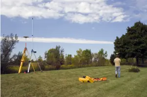
Founded in 1993, Lattimore and Peeler have built a reputation as trusted land surveyors serving the Charlotte region and beyond. Our team combines over 50 years of combined experience with advanced technical expertise to deliver precise, cost-effective surveying solutions for residential and commercial clients. Specializing in boundary surveys, topographic mapping, construction staking, and certified floodplain assessments, we prioritize accuracy and efficiency while maintaining open communication throughout every project.As licensed professionals with certifications from the North Carolina Board of Examiners for Engineers and Surveyors, we adhere to the highest industry standards. Our commitment to client satisfaction is reflected in our personalized service approach, which addresses unique project requirements while respecting budgets and timelines. With a focus on innovation and reliability, we continue to serve as a leading surveying resource for property owners, developers, and municipalities across North and South Carolina.


Services
Topographic Survey
Mortgage Survey
Construction Survey
Boundary Survey
Site Plan
ALTA Survey
As-Built Survey
Elevation Survey
Floodplain Survey
GPS Mapping
Details
- Year established: 1993
Highlights and features
- We offer over 50 years of combined surveying experience.
- Our team includes Certified Flood Plain Surveyors.
- We provide precise and cost-effective surveying services.
- Available for projects across North Carolina and beyond.
- Experienced in handling both residential and commercial surveys.
Associations and certifications
- CFS
Services
Topographic Survey
Our topographic surveys map natural and man-made features across properties of all sizes. Using advanced GPS technology, we create detailed elevation models that support drainage analysis, development planning, and construction projects. Clients receive precise digital deliverables suitable for municipal submissions and engineering design.
Mortgage Survey
We conduct mortgage surveys to meet title insurance requirements, identifying building locations and potential encroachments. These surveys verify zoning compliance and building code adherence for residential transactions. Our ALTA-compliant documentation satisfies lender requirements while protecting property owners' interests during real estate transfers.
Construction Survey
Our construction surveys establish precise project boundaries and utility locations before development begins. By translating architectural plans into physical markers, we ensure accurate placement of structures, roads, and infrastructure. This service prevents costly errors during residential and commercial building projects.
Boundary Survey
We determine exact property boundaries using historical records and field measurements. This service resolves disputes, supports land divisions, and clarifies easement locations. Our licensed surveyors provide legally defensible documentation for property owners and legal professionals.
Site Plan
We create comprehensive site plans incorporating survey data for construction projects. These plans show elevations, setbacks, utility lines, and proposed structures to meet municipal permitting requirements. Our integrated approach streamlines approvals for residential subdivisions and commercial developments.
People
Dobbin Lattimore
Licensed Professional Land Surveyor
Licensed since 1991, Dobbin holds a Bachelors in Engineering from NC State University. He previously chaired Cleveland County's Planning Board and serves as a Certified Flood Plain Surveyor. Active in professional organizations including NCSS and NSPS.
Don S. Peeler
Licensed Professional Land Surveyor
Licensed since 1992, Don earned a Civil Engineering Associates Degree from Gaston Community College. He maintains North Carolina building contractor credentials and volunteers as a fireman and Boy Scout leader while serving NCSS.
Questions
What survey services do you offer?
We provide boundary surveys, topographic mapping, construction staking, mortgage surveys, site plans, ALTA surveys, floodplain certifications, and GPS mapping for residential and commercial clients.
How much does a land survey cost?
Survey costs vary by project complexity. Basic property surveys start around $500 while large-scale developments may require customized quotes. Contact us for a detailed estimate based on your specific needs.
Do you serve areas outside Charlotte?
While based in Lawndale, we serve clients throughout North Carolina, Spartanburg SC, and will travel for larger projects. Our survey teams operate across multiple counties with mobile equipment support.
What makes your firm different?
Our combined 50+ years of experience, CFS certification, and local knowledge distinguish us. We offer rapid turnaround times while maintaining strict accuracy standards through modern GPS and GIS technologies.
How long does a typical survey take?
Most residential surveys complete within 1-3 days. Larger commercial projects may require additional time depending on property size and terrain complexity. We provide timeline estimates during initial consultations.