Business Details
27 Years
experience
Professional Land Surveying Services in Hickory, NC
Bunton Surveying & Mapping was founded in 1999 with a commitment to delivering precise and professional land surveying services. Our team combines over 45 years of collective experience with state-of-the-art technology, including JAVAD GPS equipment and Carlson CAD software, to ensure accurate results for every project. We specialize in serving both commercial and residential clients across Alexander, Burke, Caldwell, and Catawba counties in North Carolina. Our dedicated field crews and highly qualified staff prioritize efficiency, offering services such as ALTA surveys, boundary disputes, construction stakeout, and topographical mapping.With a legacy rooted in expertise dating back to 1975, we maintain affiliations with the National Society of Professional Surveyors and the Better Business Bureau. Our focus remains on client satisfaction, providing on-site consultation and tailored solutions to meet diverse surveying needs. We approach every project with integrity, ensuring timely completion while upholding the highest standards of quality. Our dedication to excellence has solidified our reputation as a trusted partner in professional land surveying.
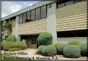

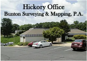
Services
ALTA Surveys
Boundary Surveys
Estate Division
Construction Stakeout
Topographical Surveys
Cemetery Location
Subdivision Surveys
Details
- Year established: 1999
Highlights and features
- Over 45 years of combined experience in professional land surveying
- State-of-the-art GPS and CAD technology for accurate results
- Highly qualified field crews and staff with specialized expertise
- Serving Alexander, Burke, Caldwell, and Catawba counties since 1999
- Committed to efficient, client-focused service with on-site consultation
Associations and certifications
- Better Business Bureau
- National Society of Professional Surveyors, Inc.
- North Carolina Society of Surveyors
- Graduate Surveyors Institute
What people say
Highly accurate results
Professional and knowledgeable staff
Timely project completion
Generational expertise
Advanced surveying technology
Services
ALTA Surveys
Our ALTA surveys meet the highest industry standards for commercial property transactions. We provide detailed boundary analysis, easement identification, and title report integration. This service ensures legal compliance and minimizes risks for property buyers and lenders.
Boundary Surveys
We precisely determine property boundaries using advanced GPS technology and historical records. Our boundary surveys resolve disputes, support land development, and establish legal markers. Clients receive comprehensive documentation for legal and planning purposes.
Construction Stakeout
Our construction stakeout services ensure accurate implementation of architectural plans. We use robotic instruments and CAD software to mark building corners, utilities, and grading points. This guarantees alignment with design specifications and regulatory requirements.
Topographical Surveys
We create detailed topographical maps showing natural and man-made features. Using Leica robotic instruments and Carlson software, we capture elevation data, vegetation, and structures. These surveys support engineering, zoning, and environmental assessments.
Subdivision Surveys
Our subdivision services include minor and major lot divisions. We handle plat preparation, regulatory approvals, and physical boundary establishment. This ensures compliance with local ordinances while optimizing land use for residential or commercial development.
People
Carl D. Bunton
Founder & Former President
Carl founded the company in 1999 after a 24-year career in professional surveying. He established Bunton-Hefner Surveying Co. in 1987 and brought extensive expertise in boundary disputes and land development.
Derek R. Bunton
President
Derek co-founded the firm in 1999 and holds Professional Land Surveyor license #4808. He specializes in CAD drafting and project management, ensuring technical excellence across all surveying services.
Cole Bunton
Field Crew Member
Cole contributes to field operations with hands-on experience in GPS data collection and stakeout procedures. As part of the third-generation team, he maintains the company's commitment to precision and client service.
Questions
What land surveying services do you offer?
We provide ALTA surveys, boundary surveys, construction stakeout, topographical mapping, subdivision planning, and cemetery location services for residential and commercial clients.
How long has your company been in business?
Bunton Surveying & Mapping was established in 1999, though our team's collective experience in land surveying spans over 45 years.
Which areas do you serve?
We primarily serve Alexander, Burke, Caldwell, and Catawba counties in North Carolina's Unifour region.
What technology do you use?
Our equipment includes JAVAD GPS systems, Leica robotic instruments, and Carlson CAD software for precise data collection and analysis.