Business Details
Professional Land Surveying Services in Gastonia, NC
Origin Land Surveying and Mapping Land Surveying and Mapping has been a licensed land surveying firm serving all 100 counties of North Carolina since 2007. Our team of licensed professionals specializes in 3D laser scanning, GPS/GIS control, and environmental land surveying, utilizing advanced technology to deliver precise terrestrial and three-dimensional spatial data. With expertise in commercial, industrial, and construction layout services, we adhere to North Carolina General Statutes to ensure accurate boundary mapping and topographical analysis. Our commitment to detail and client satisfaction is reflected in our long-standing relationships with engineers, attorneys, and construction professionals. We pride ourselves on solving complex surveying challenges, from mapping river bottoms to 3D scanning of water treatment facilities.Our services support critical infrastructure projects, boundary litigation, and environmental compliance, backed by decades of field experience. Clients consistently praise our professionalism, timely execution, and ability to handle intricate projects with precision. Headed by David J. Skiba, Jr., PLS, our firm combines technical expertise with personalized service to meet diverse client needs. We maintain rigorous standards in safety compliance, forensic mapping, and utility location using ground-penetrating radar. Our dedication to innovation and accuracy has made us a trusted partner for public and private sector clients across North Carolina.
Services
3D Laser Scanning
Commercial Land Surveying
Construction Layout
Environmental Land Surveying
GPS/GIS Control
GPR Services
Industrial Land Surveying
ALTA/ACSM Surveys
Topography
FEMA Elevation Certificates
Highlights and features
- We offer 15+ years of experience in North Carolina land surveying with licensed professionals.
- Our team utilizes advanced 3D laser scanning and GPR technology for precise data collection.
- We specialize in complex projects like boundary litigation and infrastructure surveys.
- All work complies with North Carolina General Statutes for surveying accuracy.
- Client testimonials highlight exceptional attention to detail and timely delivery.
Associations and certifications
- Professional Land Surveyor (PLS)
- North Carolina Professional Land Surveyor (NCPLS)
What people say
Attention to detail
Timely and professional
Go above and beyond
Highest recommendation
Excellent to work with
Services
3D Laser Scanning
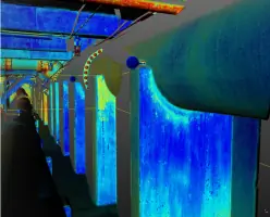
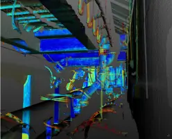
Our 3D laser scanning service captures millions of data points for complex projects, including industrial facilities, bridges, and historical preservation. Using time-of-flight and phase-shift technology, we generate georeferenced point clouds for volumetric calculations and as-built mapping. Clients benefit from enhanced accuracy in design, construction, and forensic analysis applications.
Commercial Land Surveying
We provide ALTA/ACSM surveys, topography mapping, and cemetery layout services for commercial developments. Our work includes route surveying, vineyard mapping, and earth volume analysis to support real estate transactions and infrastructure planning. Clients rely on our precise boundary demarcation and compliance with regulatory standards.
Construction Layout
Our construction layout service ensures accurate staking and as-built documentation for new developments. We perform wall and device stakeout during construction, adhering to North Carolina statutes for engineering design surveys. This guarantees seamless project execution from planning to final record drawings.
Environmental Land Surveying
We conduct BMP design surveys, FEMA flood plain mapping, and wetlands delineation to support environmental compliance. Our services include monitoring well mapping and Brownsfield site assessments, helping clients meet regulatory requirements for land development and conservation projects.
GPR Services
Using ground-penetrating radar, we locate buried utilities like gas lines, sewer pipes, and underground storage tanks. This non-invasive method detects depths and positions of subsurface features, ensuring safety during excavation and infrastructure projects across North Carolina.
People
David J. Skiba, Jr.
Licensed Professional Land Surveyor
David J. Skiba, Jr., PLS, leads Origin Land Surveying and Mapping Land Surveying and Mapping Land Surveying with over 15 years of experience in North Carolina land surveying. His expertise spans 3D scanning, boundary litigation, and infrastructure projects, earning consistent praise for technical precision and client collaboration.
Questions
What areas do you serve?
We provide land surveying services across all 100 counties of North Carolina.
What technologies do you use?
We utilize 3D laser scanning, ground-penetrating radar, and GPS/GIS technology for precise data collection.
Are your surveyors licensed?
Yes, all our services are performed by licensed Professional Land Surveyors (PLS) in North Carolina.
What industries do you work with?
We serve commercial real estate, construction, environmental agencies, and legal professionals for boundary litigation.
How long have you been in business?
Our 3D scanning services have operated since 2007, with extensive prior experience in traditional surveying methods.
Can you handle complex projects?
Yes, we specialize in challenging tasks like mapping river bottoms and 3D scanning of water treatment facilities.