
Business Details
20 Years
experience
Professional Land Surveying Services in Frisco, CO
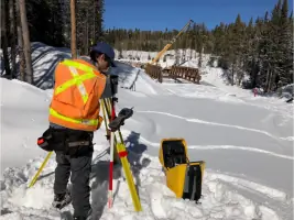
Founded in 2006, Schmidt Land Surveying has established itself as a trusted provider of professional land surveying services in Summit County, Colorado. Our team, led by Liz Schmidt with over 30 years of industry experience, delivers precision and reliability through advanced technology like Trimble total stations and AutoCAD software. We specialize in boundary surveys, topographic mapping, and construction layout, serving residential clients, engineering firms, and commercial developers.Our commitment to quality is reflected in our licensed status, membership in professional organizations like NSPS, and a client-centric approach emphasizing responsiveness and attention to detail. With decades of local expertise in Colorados alpine environment, we ensure accurate, timely solutions tailored to each project's unique challenges.
Services
Improvement Location Certificates
Land Survey Plats
Improvement Survey Plats
Topographic Surveys
ALTA/NSPS Land Title Surveys
Construction Surveying
Details
- Year established: 2006
Highlights and features
- We offer over 30 years of land surveying experience in Summit County's alpine environment.
- Our team uses Trimble GPS and AutoCAD technology for precise, efficient results.
- We provide responsive, client-focused service with personalized attention to detail.
- Our work meets rigorous NSPS and ALTA/NSPS survey standards for commercial properties.
- We maintain a proven track record of accuracy and reliability across 15+ years in business.
Associations and certifications
- PLSC
- NSPS
- Deputy County Surveyor Summit County Colorado
What people say
True professionals
Accurate and efficient
Responsive and communicative
Attention to detail
Second to none service
Services
Improvement Location Certificates
Improvement Location Certificates (ILCs) identify property boundaries and visible improvements like buildings and fences for residential real estate transactions. These surveys help mortgage and title companies assess potential encroachments without requiring boundary monument verification. Our ILCs provide critical data for property transfers while maintaining compliance with industry standards.
Land Survey Plats
Land Survey Plats establish precise property boundaries by locating or setting monuments at lot corners. We combine deed research with field measurements to identify conflicting boundary evidence and easements. These surveys are essential for property development, dispute resolution, and title insurance requirements across Summit County's complex terrain.
Topographic Surveys
Topographic surveys create detailed elevation models using contour lines at one- or two-foot intervals. Architects and engineers use these maps for drainage planning, infrastructure design, and optimal building placement. Our topographic surveys incorporate existing structure elevations to support residential and commercial development projects.
ALTA/NSPS Land Title Surveys
ALTA/NSPS surveys follow national standards for commercial property transactions. These comprehensive surveys include boundary verification, easements, and floodplain data while meeting lender and title company requirements. Our ALTA surveys incorporate Table A requirements to ensure complete due diligence for commercial real estate developments.
Construction Surveying
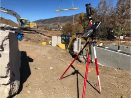
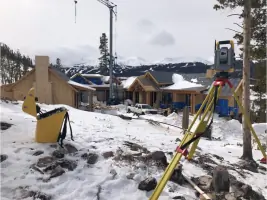
Construction surveying establishes precise building locations and infrastructure alignments before project commencement. We mark horizontal and vertical references for foundations, utilities, and roadways to prevent encroachments. Our layout services ensure compliance with design specifications and local building codes for residential and commercial developments.
People
Elizabeth Schmidt
President and Project Manager
With over 30 years of experience, Elizabeth Schmidt founded Schmidt Land Surveying in 2006. She graduated from Colorado State University in 1989 and has specialized in Summit County's challenging alpine environment since 1990, combining technical expertise with client-focused project management.
Steve Weid
Survey Technician Office Manager
Steve Weid brings diverse technical and operational expertise to our team. With 30 years at Copper Mountain Resort and IT experience since 1985, he manages field operations, office systems, and fleet maintenance while supporting survey crews in Summit County's demanding terrain.
Olaf
Director of Safety & Human Resources
Olaf, our four-legged safety director, has been part of the team since 2009. While not a licensed surveyor, he enthusiastically supports field operations and property corner investigations, embodying our commitment to a positive work environment in Colorado's high country.
Questions
What types of land surveys do you specialize in?
We specialize in boundary surveys, topographic mapping, ALTA/NSPS commercial surveys, improvement location certificates, and construction layout services tailored to Summit County's alpine environment.
How long does a typical land survey take?
Most residential surveys take 1-3 days depending on terrain complexity. Commercial ALTA surveys typically require 5-10 business days including title research and detailed documentation.
Are your surveyors licensed in Colorado?
Yes, Liz Schmidt holds Colorado Professional Surveyor License #37047. Our team meets state licensing requirements and participates in ongoing professional development.
Do you work with residential and commercial clients?
We serve both residential property owners and commercial developers, providing customized survey solutions for real estate transactions, construction projects, and land development.
What technology do you use for surveys?
We utilize Trimble GPS systems, total stations, and AutoCAD Civil 3D software to ensure precise data collection, efficient processing, and accurate digital deliverables for all project types.