
Business Details
33 Years
experience
Professional Land Surveying Services in Maine
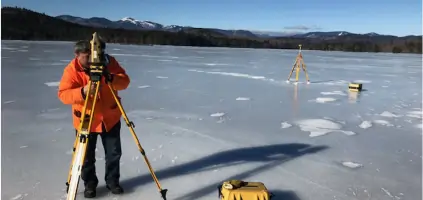
Founded in 1993, Nadeau Land Surveys has built a reputation for delivering precise and reliable land surveying services. Our team of three licensed Maine Professional Land Surveyors combines advanced technology with decades of collective experience to provide boundary surveys, elevation certificates, floodplain management, and underground utility locating services. We prioritize clear communication, ethical practices, and client education, ensuring clients understand our processes and the value of our work.With expertise in GPS/GIS mapping and specialized knowledge of FEMA regulations, we serve Southern and Central Maine, offering tailored solutions for real estate transactions, construction projects, and flood risk mitigation. Our commitment to technical excellence and client satisfaction has earned us long-term partnerships with title companies, realtors, and municipalities.


Services
Boundary Surveys
Elevation Certificates
Mortgage Loan Inspections
Floodplain Analysis
Utility Locating
Subdivision Design
ALTA Surveys
Topographic Surveys
Expert Testimony
Details
- Year established: 1993
Highlights and features
- We offer 30+ years of experience in Maine land surveying and floodplain management
- Our team includes three licensed State of Maine Professional Land Surveyors
- We provide detailed elevation certificates to help reduce flood insurance premiums
- Our surveyors hold national floodplain certifications from FEMA
- We combine GPS/GIS technology with traditional surveying expertise
What people say
Knowledgeable team
Professional and courteous
Thorough documentation
Timely service
Expert testimony
Services
Boundary Surveys
Our boundary surveys precisely determine property lines using historical records and field evidence. We identify easements, encroachments, and discrepancies to prevent disputes. Clients receive detailed plans and metes-and-bounds descriptions for legal documentation.
Elevation Certificates
We prepare FEMA-compliant elevation certificates to assess flood risk and insurance requirements. These documents help clients challenge flood zone designations or reduce insurance premiums through accurate elevation data.
Mortgage Loan Inspections
Our mortgage loan inspections verify building setbacks and flood zone compliance for lenders. This service ensures properties meet federal requirements for mortgage approval while identifying potential risk factors.
Floodplain Management
We provide comprehensive floodplain assessments including LOMA applications and base flood elevation determinations. Our expertise helps clients navigate FEMA regulations and mitigate flood-related risks.
Utility Locating
Using advanced technology, we locate and map underground utilities to prevent damage during construction. This service ensures safe excavation and compliance with local infrastructure regulations.
People
James D. Nadeau
Owner, Instructor
Licensed surveyor since 1993 with multiple floodplain certifications. Former state board chair and FEMA advisory committee member. Combines surveying expertise with real estate experience.
Tom Blake
Professional Land Surveyor
30-year veteran surveyor with forest engineering background. Author of local history books and active member of Maine Society of Land Surveyors.
Mark Carpenter
Professional Land Surveyor
Surveyor since 2002 with expertise in floodplain management. Holds FEMA liaison role for local surveyors' chapter.
Nikki Oteyza
Office Manager
Coordinates educational programs and manages operations. Certified floodplain manager with background in conservation studies.
Questions
What does a boundary survey include?
Our boundary surveys identify property lines, easements, and encroachments through record research and field measurements. Clients receive detailed plans and legal descriptions.
How can an elevation certificate help?
Elevation certificates document building elevations to determine flood insurance rates and support FEMA map amendment requests.
Are mortgage loan inspections required?
Lenders require these inspections to verify flood zone compliance and building setbacks for mortgage approval.
Do you handle commercial properties?
Yes, we provide ALTA surveys, site plans, and construction layout services for commercial developments.
Can you resolve boundary disputes?
Our surveyors provide expert analysis and documentation to resolve property line conflicts through legal channels.
What areas do you serve?
We operate throughout Southern and Central Maine, including Portland, Cape Elizabeth, and Mid-Coast regions.
Videos