Business Details
50+ Years
experience
Your Trusted Land Surveying Experts in Pennsylvania
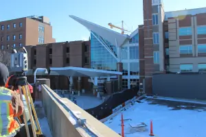
Shaw Surveying was founded in 1960 by Joseph W. Shaw, a Professional Land Surveyor who established the company's reputation for precision and reliability in York County, Pennsylvania. Since acquiring the business in 1998, Jon P. Myers, a Registered Land Surveyor with 20 years of experience, has expanded operations to include a satellite office in Washington, PA, while maintaining a commitment to quality and client satisfaction. Our team combines over 75 years of collective experience with advanced Trimble GPS and total station equipment to deliver accurate boundary surveys, ALTA surveys, topographic mapping, and agricultural conservation easement services. We specialize in residential subdivisions, construction staking, legal descriptions, and FEMA elevation certificates, serving clients across Pennsylvania, Maryland, Kentucky, and Ohio.Our focus on quality control, responsive project management, and hyper-accurate data collection ensures projects are completed on time and within budget. With expertise in both public and private sector projects, we provide tailored solutions for land development, environmental assessments, and telecommunications infrastructure. Our dedication to technical excellence and client collaboration has earned us consistent recognition in the land surveying industry. We maintain transparent communication throughout every project phase, from initial consultation to final documentation. As a second-generation family-owned business, we uphold the same ethical standards and technical rigor established by our founder. Our services support sustainable land use planning while meeting evolving regulatory requirements.


Services
Ag Preservation
ALTA Survey
As Builts
Property Boundary
Topographical
Subdivisions
Const Staking
Legal Descriptions
FEMA Flood Cert
Details
- Year established: 1960
Highlights and features
- We combine over 75 years of collective experience in land surveying
- Our team uses advanced Trimble GPS and total station equipment
- We maintain a satellite office in Washington, PA for regional accessibility
- Our surveyors hold professional licenses in multiple states
- We provide hyper-accurate data collection with quality control processes
What people say
Very professional
Completed on time
Excellent service
Affordable pricing
Timely communication
Services
ALTA Survey
ALTA/NSPS Land Title Surveys meet national standards for commercial real estate transactions. Our surveys identify boundary lines, easements, and property features to support title insurance requirements. We use advanced technology to ensure compliance with current ALTA specifications.
Property Boundary
Boundary surveys establish or verify property lines according to deeds and subdivisions. We mark corners and prepare comprehensive plans to resolve disputes or support land transactions. Our surveys meet state-specific licensing requirements for legal accuracy.
Topographical
Topographic surveys map natural and man-made features with precise elevation data. We document terrain contours, trees, buildings, and utilities to support engineering projects and land development plans using modern surveying equipment.
Ag Preservation
Agricultural conservation easement services protect farmland through legally binding agreements. We create detailed survey plans that define restricted areas and document land features to ensure compliance with preservation requirements and government agency standards.
As Builts
As-built surveys verify construction accuracy during and after project completion. We compare actual improvements to design plans for residential and commercial developments, ensuring proper placement of structures, utilities, and landscaping elements.
People
Jon P. Myers
President
Registered Land Surveyor with 20 years of Pennsylvania licensure. Supervises field and office operations while maintaining quality control standards. Professional reputation spanning three decades with expertise in boundary surveys and land development projects.
Michael P. Chilcote
RPLS
Licensed surveyor with 15+ years of experience managing public and private sector projects. Directly oversees field operations and client communications. Known for responsive service and technical expertise in complex surveying assignments.
Joshua G. Myers
Surveyor
Civil engineering graduate from Penn State Harrisburg with 15 years of field and office experience. Currently pursuing professional licensure while assisting clients with surveying projects. Focuses on accurate data collection and client collaboration.
Questions
What surveying services do you offer?
We provide ALTA surveys, boundary surveys, topographic mapping, agricultural easements, as-built documentation, and legal descriptions for residential and commercial clients.
Which states do you service?
Our primary service areas include Pennsylvania, Maryland, Kentucky, and Ohio with offices in York and Washington Counties, PA.
How do you ensure survey accuracy?
We use Trimble GPS equipment and total stations with data collectors, combined with quality control processes and licensed professionals' expertise.
What's your typical project timeline?
Most residential surveys complete within 2-4 weeks depending on size and complexity. Commercial projects follow agreed-upon schedules with regular progress updates.
How are costs determined?
Survey costs depend on property size, required services, and terrain complexity. We provide detailed quotes after reviewing specific project requirements.