Business Details
50+ Years
experience
Professional Land Surveying Services in Maryland
Since 1972, RTF Associates has established itself as a trusted provider of land surveying and planning services across Maryland. Our team of experienced professionals combines decades of expertise with advanced technology to deliver accurate boundary surveys, land development plans, and environmental assessments. With a focus on ethical practices and client satisfaction, we serve homeowners, developers, municipalities, and legal professionals.Our extensive archive of Carroll County records ensures efficient project execution, while our A+ BBB rating reflects our commitment to reliability. We prioritize open communication and utilize a seamless field-to-finish process to meet the unique needs of every client.

Services
Boundary Surveys
Land Development Planning
Topographic Mapping
Flood Plain Studies
Septic System Design
Construction Stakeout
Environmental Assessments
Property Line Adjustments
Commercial Site Plans
Expert Testimony Services
Details
- Year established: 1972
Highlights and features
- 40+ years of Maryland land surveying experience
- A+ BBB rating for trusted business practices
- Advanced technology for precise survey results
- Extensive local Carroll County records archive
- Comprehensive services for residential and commercial clients
What people say
Accurate surveys
Experienced team
Reliable service
Local expertise
Detailed documentation
Services
Boundary Surveys
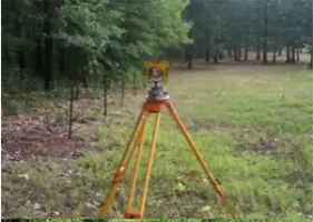
Our boundary surveys precisely define property lines using advanced equipment and historical records. This service helps prevent encroachments during fence installation, landscaping, or construction projects. Clients receive detailed documentation for legal protection and peace of mind.
Land Development Planning
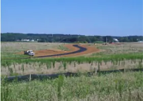
We create comprehensive plans for residential and commercial developments, including subdivision layouts and environmental compliance. Our expertise ensures projects meet local regulations while optimizing land use for developers and municipalities across Maryland.
Topographic Mapping
Our topographic surveys map natural and man-made features with precise elevation data. This information supports construction planning, drainage solutions, and environmental assessments using industry-leading GPS technology and software.
Flood Plain Studies
We conduct detailed flood plain determinations and elevation certifications to help property owners understand flood risks. This service supports insurance requirements and development decisions in flood-prone areas.
Septic System Design
Our environmental health plans include septic system design and sandmound construction plans. We ensure compliance with state regulations while creating practical solutions for residential and commercial properties without municipal sewer access.
People
John E. Lemmerman
Professional Land Surveyor
With decades of experience, John leads survey teams in delivering accurate boundary determinations and development plans. He maintains direct client communication and ensures technical excellence in every project.
Larry Slonaker
Co-Owner
As co-owner, Larry oversees project management and technical operations. His expertise in land development ensures compliance with Maryland's environmental and zoning regulations for complex projects.
Questions
What areas do you serve?
We primarily serve Carroll, Baltimore, Frederick, and Howard Counties in Maryland.
How long have you been in business?
Since 1972, providing land surveying services with over 40 years of local experience.
What survey types do you offer?
We provide boundary surveys, topographic mapping, flood plain studies, septic designs, and development plans.
Are you licensed professionals?
Yes, we're a licensed Maryland corporation with experienced registered land surveyors.
How do you ensure accuracy?
We use advanced GPS technology and maintain extensive historical records for precise results.