Business Details
Professional Land Surveying Services in Hayward, WI
Jesse Suzan Land Surveying has dedicated over 25 years to delivering precise and reliable land surveying services across Northern Wisconsin. Founded by Jesse Suzan, a licensed Professional Land Surveyor since 2002, our firm combines decades of hands-on experience with cutting-edge technology to meet residential and commercial needs. Our expertise spans boundary surveys, GPS mapping, and subdivision plats, ensuring compliance with state and local regulations. Clients consistently praise our integrity, accuracy, and timely execution, with testimonials highlighting our ability to resolve complex boundary issues and provide clear, legally sound documentation. We prioritize direct client communication, handling every project from initial consultation to final plat filing.Our commitment to maintaining industry standards and continuous professional development ensures clients receive technically superior results. By focusing on personalized service and meticulous attention to detail, we have built a reputation as a trusted partner in land surveying. Our work includes thorough deed analysis, monument placement, and conflict resolution, with all deliverables bearing our licensed seal for authenticity. We serve a diverse clientele, including real estate professionals, attorneys, and property owners, ensuring their projects meet regulatory requirements. With a focus on transparency and client education, we guide customers through every step of the surveying process.
Services
Certified Surveys
Boundary Surveys
Lot Surveys
GPS Surveys
Subdivision Plats
Floodplain Surveys
Condominium Plats
Highlights and features
- We offer 25+ years of land surveying experience in Northern Wisconsin.
- Our team holds Wisconsin Professional Land Surveyor licensing (#2635).
- We provide personalized service from project initiation to final documentation.
- We utilize advanced GPS and mapping technology for precision.
- Our work is backed by client testimonials praising accuracy and integrity.
What people say
Expertise, professionalism, timely work
Accurate, appropriately priced
Knowledgeable and reliable
Prompt, answers for clients
Services
Boundary Surveys
Boundary Surveys establish legal property lines through deed analysis and physical monumentation. We research historical records, locate existing markers, and set new monuments to resolve disputes. Clients receive detailed plats with our licensed seal for county filing and future reference.
GPS Surveys
GPS Surveys use high-precision equipment to create accurate digital land maps. This technology enables efficient boundary verification and topographic analysis. Results are delivered in formats compatible with engineering and construction planning software.
Subdivision Plats
Subdivision Plats divide large parcels into smaller lots while meeting zoning requirements. We prepare legal documents for municipal approval, including easement definitions and infrastructure planning. Our plats ensure compliance with state and local development codes.
People
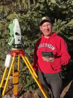
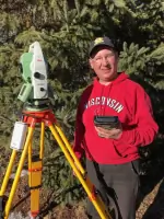
Jesse B. Suzan
Professional Land Surveyor
Jesse Suzan graduated from Nicolet College in 1995 with a degree in Land Surveying. Licensed since 2002, he has operated his own practice, handling all aspects of surveying projects directly. His reputation for accuracy and integrity spans Northern Wisconsin's real estate and legal communities.
Questions
What is a land survey?
A land survey locates, marks, and maps property boundaries and corners, often including topographic details and legal documentation.
When should I get a survey?
Before property purchase, construction, land division, or when boundary conflicts arise to ensure legal clarity.
How are boundaries created?
Boundaries originate from legal documents like deeds or unwritten physical occupation evidence, which we analyze and document.
What does your service include?
We review deeds, set monuments, prepare legal plats, identify conflicts, and file documents with county authorities.
How are survey costs determined?
Fees depend on project complexity, including monument recovery, record research, and mapping requirements.