
Business Details
Your Trusted Land Surveying Partner in Utah
At REDCON, we bring decades of expertise in land surveying, mapping, and geographic scanning to deliver precise, reliable solutions for complex projects. With 35 years of industry experience and a team of licensed professionals boasting 76 years of combined knowledge, we specialize in boundary surveys, construction layout, forensic analysis, and high-definition 3D scanning. Our commitment to cutting-edge technology ensures accuracy and efficiency, while our status as a certified DBE minority-owned business in Utah underscores our dedication to meeting federal project requirements.We serve clients across Utah and the Intermountain West, prioritizing strict adherence to legal standards and client-specific needs. By integrating advanced tools like timed-flight laser scanning and GPS instrumentation, we minimize risks and costs while delivering data-driven results that stand up to scrutiny in both engineering and legal contexts.
Services
Land Mapping
Property Boundary Surveying
Right-of-Way Services
3D Scanning
Construction Surveying
ALTA Surveys
Forensic Surveying
Flood Elevation Certificates
Highlights and features
- We offer 35 years of specialized land surveying expertise in Utah and the Intermountain West.
- Our team has 76 years of combined experience with licensed professionals trained in advanced technologies.
- We utilize high-definition 3D laser scanning for non-invasive, courtroom-admissible forensic data.
- As a certified DBE minority-owned business, we help contractors meet federal project requirements.
- We serve Utah, Idaho, Wyoming, Nevada, and Arizona with regionally tailored surveying solutions.
Associations and certifications
- Disadvantaged Business Enterprise (DBE)
Services
Land Surveying
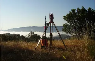
REDCON provides comprehensive land surveying services to establish property boundaries, resolve disputes, and support infrastructure projects. Our licensed surveyors use GPS and conventional tools to ensure legal compliance and precision. Clients benefit from 35 years of regional expertise and adherence to strict documentation standards.
3D Scanning
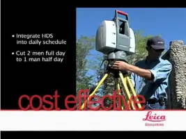
Our high-definition 3D laser scanning captures detailed topographical data from up to 200 meters away, reducing safety risks and project delays. This technology generates accurate digital models for construction, forensic analysis, and as-built documentation without physical contact with surveyed areas.
Forensic Surveying
REDCON conducts forensic surveys using 3D scanning to document accident and crime scenes with court-admissible precision. This non-invasive method preserves evidence integrity while providing scalable data for legal proceedings and expert testimony.
Right-of-Way Services
We specialize in right-of-way and easement surveys to define transportation corridors, utility routes, and legal access points. Our team researches title documents and prepares legal descriptions to support infrastructure projects and property negotiations.
Construction Surveying
REDCON supports construction projects with pre-planning, layout staking, and as-built surveys to prevent costly errors. Our services include scope creation, material selection guidance, and quality assurance throughout the project lifecycle.
Questions
What geographic areas do you serve?
We operate throughout Utah and the Intermountain West, including Idaho, Wyoming, Nevada, and Arizona.
Are your surveyors licensed and certified?
Yes, our team includes licensed land surveyors with 76 years of combined experience and DBE certification.
What technologies do you use for surveys?
We employ GPS instrumentation, conventional total stations, and high-definition 3D laser scanning systems.
Can you handle forensic surveying for legal cases?
Yes, we provide court-admissible 3D scanning and forensic surveying for accident and crime scene documentation.
Do you offer construction project support?
Yes, we provide full-cycle construction surveying from pre-planning to as-built documentation.
How does your 3D scanning improve project safety?
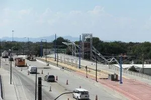
Our remote scanning technology eliminates the need for field crews to enter hazardous areas like active roadways.