Business Details
Expert Land Surveying Services in Farmington, UT
At Utah Land Surveying, we bring decades of specialized expertise to every project, combining technical precision with unwavering client commitment. Founded over 13 years ago, our team has accumulated extensive experience in land surveying, boundary determination, and construction layout services, serving clients across Utah with professionalism and integrity. Our owner, a licensed surveyor with 19 years of industry experience, leads a dedicated team that prioritizes accuracy, transparency, and client satisfaction. We utilize advanced technologies, including aerial drone mapping and LIDAR systems, to deliver comprehensive solutions for residential, commercial, and developmental projects. Our reputation for reliability and excellence is reflected in long-term client relationships and consistent positive feedback.We approach every surveying challenge with meticulous attention to detail, ensuring compliance with legal standards and project-specific requirements. From topographical assessments to property platting, our services are designed to streamline development processes while minimizing risks. We maintain a strong focus on education, clearly explaining survey results to empower informed decision-making for property owners. Our commitment to safety, quality control, and timely delivery has established us as a trusted partner in Utah's surveying industry. With a proven track record in both small-scale and large-scale projects, we continue to uphold our founding principles of precision, integrity, and excellence in every survey conducted.

Services
Land Surveying
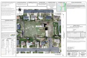
Boundary Surveys
Topographical Surveys
Construction Layout
Aerial Surveying
Property Platting
Resource Surveys
Subdivision Surveys
Quantitative Surveys
Land Title Surveys
Highlights and features
- We offer 19+ years of licensed surveying experience with advanced technological capabilities.
- Our team provides comprehensive services from boundary determination to aerial mapping.
- Client-focused approach with clear communication and transparent reporting.
- Proven track record in both small-scale residential and large developmental projects.
- Committed to legal compliance and minimizing property development risks.
What people say
Fantastic surveyor
Affordable rates
Excellent service
Prompt and pleasant
Great attention to detail
Services
Land Surveying
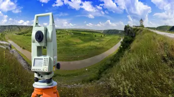
Our land surveying services provide precise measurements and legal documentation for property boundaries. Using advanced GPS and total station equipment, we ensure compliance with state regulations and title insurance requirements. Clients receive detailed maps and reports that facilitate property transactions, development planning, and dispute resolution.
Boundary Surveys
Boundary surveys establish legal property lines through historical research and field measurements. We identify easements, encroachments, and adjacent land records to create accurate boundary descriptions. This service is essential for construction projects, land sales, and resolving neighbor disputes with verifiable data.
Topographical Surveys
Topographical surveys document natural and man-made features of a property, including elevation changes, vegetation, and structures. Our 3D mapping technology produces detailed contour maps that guide grading, drainage planning, and infrastructure development for residential and commercial sites.
Construction Layout
Construction layout services ensure accurate placement of buildings and infrastructure using stakeout surveys. We translate architectural plans into physical markers for foundations, utilities, and roadways. This precision minimizes costly errors during development projects of all scales.
Aerial Surveying
Aerial surveying employs drones with LiDAR and photogrammetry to capture large-area data efficiently. We generate high-resolution orthomosaic maps and 3D models for land analysis, progress monitoring, and volumetric calculations. This technology reduces field time while maintaining survey-grade accuracy for complex projects.
People
Mike
Owner & Licensed Surveyor
With 19 years of surveying experience and 13 years operating Utah Land Surveying, Mike holds associate degrees in drafting and surveying. He maintains professional licensing and combines technical expertise with personalized service, prioritizing client needs while ensuring project accuracy and legal compliance.
Questions
What surveying services does Utah Land Surveying offer?
We provide boundary surveys, topographical mapping, construction layout, aerial drone surveys, property platting, and land title surveys for residential and commercial clients.
How can I schedule a survey appointment?
Contact us via phone or email to discuss your project needs and arrange a consultation. We offer flexible scheduling, including weekend appointments by arrangement.
Which areas in Utah do you serve?
We serve Northern Utah communities including Salt Lake City, Ogden, Layton, Bountiful, and surrounding areas within a 60-mile radius of Farmington.
What information should I provide before a survey?
Share property deeds, previous survey records, and project plans to help us prepare accurate proposals and minimize fieldwork time during your survey.
How does Utah Land Surveying ensure survey accuracy?
We use GPS, robotic total stations, and aerial LiDAR technology combined with licensed professionals' expertise to maintain high precision standards in all surveys.