Business Details
31 Years
experience
Professional Surveying Services in Exeter
Established in 1995, Benchmark Surveys has grown from a local surveying firm into a trusted partner for clients across the UK. Our team of experienced professionals offers a comprehensive range of surveying services, including topographic, measured building, utility, and hydrographic surveys. We utilize cutting-edge technology such as 3D laser scanning, drones, and ground-penetrating radar to deliver precise and reliable data. Our directors bring decades of industry expertise, ensuring every project benefits from technical proficiency and client-focused solutions. We serve diverse clients, from private homeowners to national developers, tailoring our services to meet specific project needs. Our commitment to innovation is demonstrated through advanced methodologies like quad bike and RIB boat surveys in challenging terrains.We maintain rigorous quality standards, with staff certified to Level 5 Utility Surveyor qualifications and equipped with DBS checks for sensitive site access. Our work supports critical infrastructure projects, as evidenced by case studies like the Royal Clarence Hotel restoration and Exeter Underground Tunnels mapping. We prioritize transparency through detailed reporting software and clear communication channels, offering clients both digital records and on-site utility marking. With over 30 years of collective experience, we combine technical excellence with practical problem-solving to deliver survey solutions that enhance project outcomes.
Services
Topographic Surveys
Measured Building Surveys
Utility Surveys
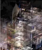
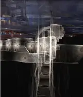
3D Laser Scanning
Drone Surveys
Hydrographic Survey
GPR Surveys
Setting Out
Drainage CCTV & Jetting
PAS128 Surveys
Details
- Year established: 1995
Highlights and features
- We have over 30 years of combined surveying experience across diverse UK projects.
- Our team uses advanced technology including drones, 3D laser scanning, and GPR.
- Level 5 Utility Surveyor certification ensures industry-standard compliance.
- We provide integrated solutions combining topographic, utility, and drainage surveys.
- DBS-checked staff with specialized expertise in historic building documentation.
Associations and certifications
- PAS128
What people say
Extremely diligent
Responsive to requests
Good partnership relationship
Clear reliable results
Accurate measurements
Services
Topographic Surveys
Our topographic surveys create detailed 3D maps of surface features for development planning. Using reflector-less instruments and drones, we measure buildings, terrain, and vegetation at scales from 1:100 for single dwellings to 1:2500 for large infrastructure projects. Outputs include digital terrain models and CAD files for engineering and construction applications.
Measured Building Surveys
We produce precise building documentation using 3D laser scanning and traditional methods. Deliverables include floor plans, elevations, and point clouds with 2mm accuracy. This service supports architectural design, structural analysis, and heritage conservation projects requiring exact dimensional records of existing structures.
Utility Surveys
Our PAS128-compliant utility surveys locate and map subsurface infrastructure including pipes, cables, and drainage systems. We use ground-penetrating radar and electronic tracing to create safety-critical records that prevent utility strikes during excavation projects, with findings marked on-site and digitally overlaid on topographic surveys.
3D Laser Scanning
Advanced laser scanning captures detailed spatial data for creating accurate point clouds and BIM models. We use Trimble X7 and TX6 scanners to generate 2mm precision data for building verification, as-built modeling, and virtual site inspections via geo-referenced 3D meshes.
Drainage CCTV & Jetting
We combine high-resolution CCTV surveys with high-pressure jetting services for drainage system assessment and maintenance. Using Wincan software, we provide visual reports on blockages and defects, followed by immediate cleaning solutions to restore system functionality while maintaining digital records.
People
Helen Richards
Director
With over 30 years of surveying experience, Helen founded Benchmark Surveys and previously served as Surveying Manager at ECC Quarries. She oversees strategic direction while maintaining technical standards across all services.
James Richards
Director
A dual-qualified land and utility surveyor, James manages daily operations and site surveys. He brings 10+ years of experience overseeing both fieldwork execution and office management functions.
Anthony Drew
Senior Land & Measured Surveyor
With a decade in the industry, Anthony specializes in topographic and building surveys. His expertise includes complex site mapping and delivering survey data for major construction and conservation projects.
Josh Rogers
CAD Technician
A drone-licensed technician with 8+ years in measured building surveys, Josh specializes in 3D laser scanning data processing and creating detailed CAD deliverables for architectural and engineering clients.
Sebastian Glover
Senior Surveyor
Bringing 14 years of hydrographic survey experience, Sebastian leads aerial data capture initiatives. He specializes in challenging environments using drone and terrestrial methods to collect topographic data for land and coastal projects.
Questions
What surveying services do you offer?
We provide topographic, measured building, utility, 3D laser scanning, drone, hydrographic, and drainage surveys using advanced technologies.
How long has Benchmark Surveys been in business?
We've delivered surveying solutions since 1995, with directors having 30+ years of combined industry experience.
What technology do you use for surveys?
Our equipment includes Trimble 3D laser scanners, drones, RIB boats, quad bikes, and ground-penetrating radar systems.
Can you handle both small and large projects?
We serve clients from private homeowners to national developers, tailoring our approach to project scale and complexity.
Do you provide utility surveys to PAS128 standards?
Yes, our utility surveys are conducted to PAS128 specifications by Level 5 certified surveyors.
Videos