Business Details
Emergency
services
Professional Land Surveying Services in South Florida
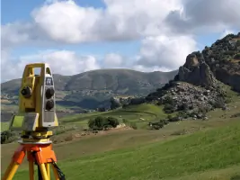
Authentic Surveyors has been serving South Florida's development professionals, property owners, legal representatives, and construction experts since our founding. Our team combines over 25 years of industry experience with cutting-edge technology to deliver precise land surveying and mapping solutions. Our competitive office staff and professional AutoCAD drafters streamline processes to ensure reliable 24-hour turnaround times without additional costs. We maintain rigorous quality standards through comprehensive knowledge of local regulations and client-specific needs.Our surveyors utilize leading-edge equipment to execute accurate land surveys for residential, commercial, and industrial applications. The company's growing client base reflects our unwavering commitment to exceptional service and technical excellence. We guarantee that once you experience our precision and customer-focused approach, you'll recognize the value of authentic surveying expertise.


Services
Boundary Survey
Topographic Survey
Elevation Certificate
Subdivision Platting
Construction Layout
ALTA/ACSM Survey
Right of Way Survey
As-Built Survey
Highlights and features
- We provide 24-hour turnaround service at no extra cost
- Our surveyors have over 25 years of combined industry experience
- We utilize leading technology for precise land surveying
- Our team includes certified AutoCAD drafters
- We serve development professionals, property owners, and construction experts
Services
Boundary Survey
Our boundary surveys precisely define property lines using advanced measurement techniques. This service helps property owners resolve disputes, prepare for development, and ensure compliance with local regulations. Our experienced surveyors document all physical features and legal descriptions to provide accurate land documentation.
Elevation Certificate
We provide FEMA-compliant elevation certificates that determine building elevations relative to flood zones. This critical documentation satisfies insurance requirements and helps property owners understand flood risk. Our certified surveyors use precise measurement tools to ensure accurate elevation data for floodplain management.
Topographic Survey
Our topographic surveys map natural and man-made features for development projects. This service supports drainage design, road construction, and site planning by providing detailed elevation data. We use advanced surveying equipment to create accurate 3D representations of land surfaces for engineering applications.
Subdivision Platting
We specialize in converting large properties into legally recognized lots through subdivision platting. This service ensures compliance with municipal zoning requirements and includes creating detailed maps for official recording. Our team handles all technical aspects of parcel division for residential and commercial developments.
Construction Layout
Our construction layout services establish precise reference points for building projects. We provide accurate staking and measurements to guide construction activities while maintaining compliance with design specifications. This service ensures proper alignment and elevation for foundations, utilities, and structural components.
Questions
What types of surveying services do you offer?
We provide boundary surveys, elevation certificates, topographic surveys, subdivision platting, construction layout services, ALTA/ACSM surveys, right of way surveys, and as-built surveys for residential, commercial, and industrial clients.
How quickly can you complete a survey?
We guarantee 24-hour turnaround for standard surveying requests without additional charges, though complex projects may require additional time based on specific requirements and site conditions.
Are your surveyors licensed and experienced?
Our team includes licensed professionals with over 25 years of combined experience in land surveying, supported by certified AutoCAD drafters and advanced measurement technology.
Do you serve both residential and commercial clients?
We serve property owners, developers, construction professionals, and legal representatives across residential, commercial, and industrial sectors throughout South Florida.
What technology do you use for surveys?
Our surveyors utilize the latest measurement equipment including total stations, GPS systems, and 3D laser scanning technology to ensure maximum accuracy and efficiency.
How do you ensure survey accuracy?
We combine advanced surveying technology with rigorous quality control processes, including multiple verification steps and experienced professional review of all deliverables.