Business Details
25 Years
experience
Professional Land Surveying Services in Newport News
Established in 2001, Michael Surveying & Mapping has built a reputation as a trusted provider of comprehensive land surveying services. Our team of professionals brings over 60 years of combined experience to every project, ensuring precision and reliability across diverse sectors including engineering, municipal, residential, and commercial clients. We operate under the direct supervision of licensed surveyors in Virginia and North Carolina, maintaining rigorous standards of accuracy and compliance. Our commitment to technological advancement is evident in our use of cutting-edge tools like GPS receivers, total stations, and 3-D laser scanning to deliver timely, high-quality results. As active members of the American Congress on Surveying and Mapping, Virginia Association of Surveyors, and Professional Land Surveyors of North Carolina, we uphold industry best practices while offering the flexibility of a small business.Our client-centric approach prioritizes tailored solutions, proactive communication, and adherence to strict ethical standards. This philosophy has earned us recognition from architecture/engineering communities, regulatory agencies, and professionals nationwide. We specialize in services ranging from boundary and topographic surveys to hydrographic studies and underground utility designation, supporting projects from initial design through final construction. Our mission remains focused on delivering value through expertise, innovation, and integrity in every engagement.
Services
ALTA/ACSM Surveys
Boundary Surveys
Construction Surveys
Topographic Surveys
Hydrographic Surveys
Underground Utility Designation
GIS Mapping
GPS Control
Expert Witness
FEMA Certificates
Details
- Year established: 2001
Highlights and features
- We offer over 60 years of combined experience in land surveying
- Our team includes Virginia and North Carolina licensed professional surveyors
- We utilize the latest survey equipment for accurate data collection
- We maintain close client relationships to ensure proactive service
- We are members of leading surveying organizations like ACSM and VAS
Services
ALTA/ACSM Land Title Surveys
We conduct comprehensive ALTA/ACSM land title surveys to meet national standards for property transactions. Our surveys identify boundary details, easements, and improvements while adhering to title insurance requirements. This service supports commercial real estate deals and legal documentation with precise measurements and professional analysis.
Hydrographic Surveys
Our hydrographic surveys map underwater terrain and shoreline features using specialized equipment. This service supports coastal engineering projects, dredging operations, and environmental assessments by providing accurate bathymetric data. We combine GPS technology with sonar systems to create detailed underwater topographic maps for various applications.
3-D Laser Scanning
We utilize 3-D laser scanning technology to create precise digital representations of physical environments. This service captures millions of data points per second to generate detailed as-built models for construction, renovation, and forensic analysis. Our team processes scan data into usable formats for engineers and architects working on complex projects.
Underground Utility Designation
Our underground utility designation service identifies buried infrastructure using electromagnetic detection and ground-penetrating radar. This critical service prevents damage during excavation by mapping water, sewer, electrical, and communication lines. We provide clear markings and documentation to ensure safe and compliant site development.
Topographic Site Surveys
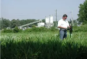
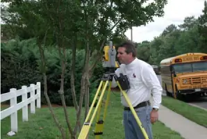
We perform topographic surveys to document natural and man-made features of properties with elevation data. This foundational service supports land development, drainage analysis, and construction planning by creating detailed terrain models. Our surveyors use robotic total stations and GPS systems to ensure high-accuracy elevation measurements for engineering designs.
People
Paul W. Michael, Jr.
President
With decades of experience in land surveying, Paul W. Michael, Jr. leads our firm with a proactive approach to client needs. He ensures technical excellence across all projects while maintaining direct oversight of survey operations. His leadership combines strategic vision with hands-on expertise in boundary analysis and construction staking.
Questions
What types of surveying services do you offer?
We provide ALTA/ACSM land title surveys, boundary surveys, topographic mapping, hydrographic studies, underground utility designation, and construction staking using GPS and 3-D laser technology.
Are your surveyors licensed in Virginia and North Carolina?
Yes, all our projects are supervised by Virginia and North Carolina licensed professional surveyors who maintain direct oversight of field operations and technical deliverables.
How do you ensure survey accuracy?
We use robotic total stations, GPS receivers, and 3-D laser scanners to collect precise measurements. Our team processes data through specialized software to verify accuracy before delivering final documentation.
What industries do you serve?
We work with architects, engineers, municipalities, oil companies, developers, and legal professionals on projects ranging from residential subdivisions to industrial facility expansions across Virginia and North Carolina.
Can you handle emergency surveying needs?
While we prioritize scheduled projects, our team maintains flexibility to accommodate urgent requests for boundary disputes, construction delays, or other time-sensitive survey requirements.