Business Details
31 Years
experience
Emergency
services
Your Trusted Partner for Professional Surveying Solutions
Alphatec Surveyors has been delivering professional surveying services since 1995, serving real estate developers, mortgage entities, engineers, and homeowners across Southeast Virginia and North Carolina. Our commitment to precision is underscored by our investment in cutting-edge GPS, unmanned aerial systems (UAS), and machine control technology, ensuring rapid delivery of accurate topographic data, 3D models, and orthophotography. With decades of combined experience, our team specializes in ALTA/ACSM land title surveys, FEMA flood elevation certificates, and hydrographic assessments, addressing complex topographical challenges unique to coastal regions.We prioritize client satisfaction through innovative methodologies that enhance safety, reduce project timelines, and minimize resource requirements. Our QA/QC processes guarantee compliance with jurisdictional standards, while our expertise in LOMA applications has saved clients significant costs in flood insurance. Recognized for leadership in technological adoption, we maintain affiliations with national and state surveying societies. Our mission is to provide actionable data that empowers informed decision-making, ensuring measurable time and cost savings for every client engagement.
Services
ALTA/ACSM Land Title Surveys
FEMA Flood Elevation Certificates
Topographic Surveys
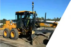
Machine Control Surveys
UAS Aerial Mapping
Hydrographic Assessments
Boundary Surveys
As-Built Surveys
Volume Calculations
Construction Stakeouts
Details
- Year established: 1995
Highlights and features
- We have over 25 years of experience in coastal topographical surveying.
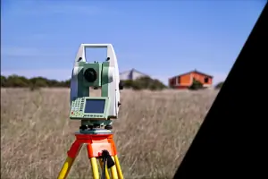
- We utilize cutting-edge GPS and UAS technology for millimeter-accurate data.
- Our team holds certifications in ALTA/ACSM and FEMA flood elevation standards.
- We respond to service requests within hours for urgent projects.
- Our LOMA application expertise reduces unnecessary flood insurance costs.
Services
ALTA/ACSM Land Title Surveys
ALTA/ACSM surveys provide comprehensive mapping for real estate transactions, identifying boundary lines, easements, and improvements. Our certified professionals ensure compliance with national standards, delivering data critical for mortgage and title insurance. Clients benefit from rapid, accurate deliverables that streamline high-value property transfers.
FEMA Flood Elevation Certificates
We conduct FEMA-compliant elevation certificates to determine flood zone classifications and insurance requirements. Our surveys include base flood elevations, structure details, and topographic data. This service helps clients qualify for reduced insurance premiums through LOMA applications, saving time and costs.
UAS Topographic Surveys
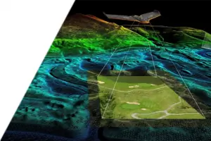
Unmanned aerial systems capture detailed 3D terrain models and orthophotography. This technology enables efficient surveying of large areas with millimeter-level accuracy. Clients gain faster data acquisition, enhanced safety, and seamless integration with construction equipment for site planning.
Machine Control Surveys
GPS-integrated machine control systems optimize grading and excavation projects. Our surveys enable real-time adjustments for precise earthwork, reducing labor and rework. Contractors achieve faster project timelines while maintaining adherence to design specifications.
Hydrographic Assessments
We map inshore waterways and coastal zones for development and flood management. Using sonar and GPS technology, our assessments identify underwater topography and erosion patterns. These insights support infrastructure projects and environmental compliance in sensitive coastal regions.
People
John F. Hill Jr.
President and Project Manager
Licensed surveyor with 43 years of experience in Southeast Virginia. Served as instructor at Old Dominion University and certified expert witness. Oversees QA/QC for all projects.
Seth F. Hill
Assistant Project Manager
BS in Environmental Sciences with expertise in utility location and UAS operations. Completed NCEES LSIT exam and manages unmanned aerial survey projects.
James Sheppard
Surveyor
24+ years of experience in data collection and geodetic control networks. Specializes in GPS survey methods and property research in Chesapeake.
Alan Phillips
CAD Specialist
Responsible for utility research and CAD file preparation. Ensures deliverables meet client-specific standards for local engineering firms.
Questions
What areas do you serve?
We serve Southeast Virginia, including Hampton Roads and Chesapeake, as well as the Outer Banks and Elizabeth City regions of North Carolina.
Are your surveys FEMA compliant?
Yes, our flood elevation certificates meet FEMA requirements and are performed by licensed surveyors to ensure accuracy for insurance and policy purposes.
How does UAS technology benefit my project?
UAS enables faster, safer surveys of large areas with millimeter-level accuracy. It reduces labor costs, accelerates data delivery, and integrates with construction equipment.
Can you help with LOMA applications?
Yes, we submit LOMA applications to challenge flood zone classifications based on precise elevation data, often reducing or eliminating flood insurance requirements.
What emergency services do you offer?
We provide rapid on-site response within hours of initial contact for urgent surveying needs in the Hampton Roads region.
Do you handle commercial and residential projects?
Yes, our services span residential mortgages, commercial developments, and large-scale infrastructure projects using tailored surveying methodologies.