
Business Details
Precision Engineering & 3D GPS Data Preparation Services
Nylander Engineering brings engineering expertise and construction experience to every project, guaranteeing compliance with all federal, state, and local certifications. Our team specializes in highway and transportation 3D GPS machine control data preparation, contractor staking, and site design, leveraging road-tested technology to deliver precision-driven results. With a focus on accuracy, timeliness, and cost-effectiveness, we serve projects ranging from multimillion-dollar interchanges to smaller site developments. Our mission is to provide the highest level of construction staking services, positioning us as a premier firm in the industry.We prioritize client satisfaction through cutting-edge technology integration, licensed engineer verification, and tailored job file solutions. Our 20+ years of experience in digital terrain modeling and earthwork computations ensure efficient project execution. By combining practical construction knowledge with advanced GPS-based tools, we help clients maximize returns on their equipment investments. Our services streamline site preparation, reduce errors, and enhance project timelines through precise data delivery.
Services
3D GPS Data Preparation
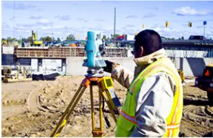
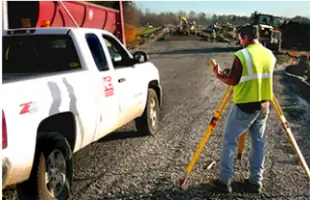
Contractor Staking
Site Design Engineering
Earthwork Takeoffs
Survey Verification
Highlights and features
- We offer 20+ years of specialized expertise in highway and transportation engineering.
- Our patented 3D GPS terra-modeling technology ensures unmatched precision in site work.
- Licensed engineers verify all survey data, guaranteeing compliance with federal/state standards.
- We deliver customized job files for GPS-based machine control equipment optimization.
- Proven track record with projects ranging from $814 million interchanges to small site pads.
What people say
Attention to detail
Highest level of service
Ready attitude
Cost-effective solutions
Critical project management
Services
3D GPS Data Preparation
Our 3D GPS data preparation service creates precise machine control files for construction equipment. This technology links site-specific elevation data to GPS systems, improving accuracy and efficiency. Contractors use these files to reduce rework and complete grading projects faster while maintaining compliance with DOT requirements.
Contractor Staking
We provide physical site staking services that establish exact construction reference points before work begins. Our staking ensures crews can start immediately with minimal error margins. This service supports highway projects, road construction, and site development through accurate field markings and licensed engineer verification.
Site Design Engineering
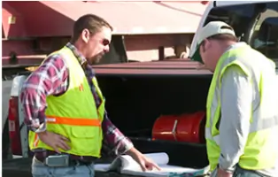
Our site design engineering combines survey data with construction requirements to create actionable project plans. Services include initial site evaluation, cost estimation support, and licensed engineer authorization. This ensures projects meet regulatory standards while optimizing construction timelines and resource allocation.
Earthwork Takeoffs
We perform detailed earthwork quantity computations for project planning and final measurements. These takeoffs help contractors estimate material needs and project costs accurately. Our services cover sub-grade to pavement layers, supporting efficient project management and budget control for sites of all sizes.
Survey Verification
Licensed engineers verify all survey data to guarantee compliance with federal, state, and local certifications. This service prevents costly rework by ensuring accuracy before construction begins. We maintain strict quality control throughout the verification process to meet industry standards.
Questions
What GPS data services do you offer?
We specialize in 3D GPS machine control data preparation for highway, road, and site construction projects using digital terrain modeling technology.
How does your staking service benefit construction projects?
Our precise physical staking establishes accurate reference points, reducing errors and allowing crews to begin work immediately with verified measurements.
Are your services compliant with industry standards?
All work meets federal, state, and local certification requirements, verified by licensed professional engineers throughout the project lifecycle.
What project sizes do you handle?
We support projects ranging from multimillion-dollar interchanges to small site developments like convenience store pads.
How do you ensure data accuracy?
Our process includes electronic file verification, field data collection when needed, and layered file development from sub-grade to pavement surfaces.