
Business Details
50+ Years
experience
Emergency
services
Expert Land Surveying & Engineering Services in Nassau County
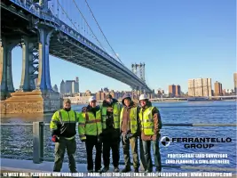
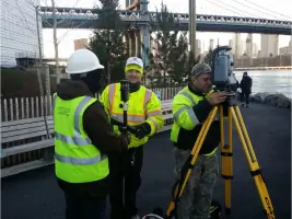
The Ferrantello Group, PC has been a trusted leader in land surveying, engineering, and expert witness testimony for over 50 years. Our team combines cutting-edge technology with decades of experience to deliver precise, legally sound solutions for residential, commercial, and municipal projects across Long Island and New York City. We prioritize client collaboration, using advanced tools like 3D scanning and GPS mapping to ensure accuracy in boundary delineation, site planning, and construction layout. Recognized as Nassau County's top surveyor, we maintain memberships in prestigious organizations like the National Society of Professional Surveyors and hold a New York State Licensed Land Surveyor designation.Our commitment to quality is reflected in our 24/7 emergency service availability, rapid turnaround times, and a proven track record of resolving complex land disputes through expert testimony. With over 250 years of combined team experience, we provide comprehensive services from flood mapping to subdivision consulting, ensuring compliance with zoning laws and municipal requirements.
Services
Land Surveying
Expert Witness Testimony
3D Scanning
Construction Layout
Flood Mapping
Site Planning
Subdivision Consulting
Boundary Retracement
Utility Surveys
Elevation Certificates
Details
- Year established: 1964
Highlights and features
- We offer 50+ years of combined experience in land surveying and civil engineering
- Our team uses state-of-the-art 3D scanning and GPS mapping technology
- We provide expert witness testimony in land dispute litigation
- Our services include emergency surveying with same-day availability
- We maintain active memberships in all major surveying professional organizations
Associations and certifications
- National Society of Professional Surveyors (NSPS)
- New York State Association of Professional Land Surveyors (NYSAPLS)
- American Land Title Association (ALTA)
- American Congress of Surveying and Mapping (ACSM)
- Nassau-Suffolk Civil Engineers & Land Surveyors
What people say
Completed survey on time
Expert legal testimony
Accurate flood certificates
Professional field crews
Proven dispute resolution
Services
Land Surveying
Our professional land surveying services establish precise property boundaries and mapping for real estate transactions, construction projects, and legal documentation. Using GPS and 3D scanning technology, we deliver legally recognized surveys that meet municipal requirements for permits and zoning compliance. Our team handles residential, commercial, and municipal projects across Long Island and New York City.
Expert Witness Testimony
We provide expert witness services for land dispute litigation, including boundary retracement analysis and courtroom testimony. Our surveyors prepare detailed mapping evidence and technical documentation that have successfully resolved cases involving property encroachments, flood damage claims, and zoning violations. With 75-100 expert retainments, we offer authoritative testimony accepted by courts and insurance companies.
3D Scanning & Modeling
Our 3D scanning services create detailed digital models for construction planning and site analysis. This technology enables precise measurements of existing structures and terrain, supporting subdivision planning, building renovations, and infrastructure development. The virtual models serve as legal documents and aid in resolving boundary disputes through visual evidence.
Flood Mapping & FEMA Certification
We conduct FEMA-certified elevation surveys to determine flood risk zones and reduce insurance premiums. Our flood mapping services include detailed elevation certificates that meet federal requirements for property transactions in flood-prone areas. These surveys help homeowners and developers comply with insurance regulations while providing accurate data for construction planning.
Site Planning & Subdivision
Our site planning services cover subdivision mapping, zoning compliance, and infrastructure layout for residential and commercial developments. We analyze zoning codes, prepare conceptual plans, and ensure legal lot divisions that meet municipal requirements. This includes topographic surveys, drainage planning, and utility mapping to support complete land development projects.
People
Frank S. Ferrantello
President
Licensed Land Surveyor with 30+ years experience, leading the firm since 2007. Recognized as one of the world's top 40 geospatial professionals under 40. Specializes in boundary law, expert testimony, and complex land disputes.
Stefanie Mrwik
Human Resources Manager
Manages HR operations and client relations with 15 years of experience in professional services firms. Coordinates project teams and ensures compliance with employment standards.
Questions
Which projects require a land survey?
Land surveys are essential for property sales, purchases, construction projects, subdivisions, and mortgage refinancing to establish legal boundaries and compliance.
Who can perform legal land surveys?
Only licensed New York State Land Surveyors with registration number 50762 can conduct legally recognized surveys for official documentation and municipal submissions.
How long does a survey take?
Standard surveys take 3-5 weeks, with emergency services available for urgent needs. Weather conditions may affect fieldwork timelines.
What services include expert testimony?
We provide expert witness services for boundary disputes, flood damage cases, and legal proceedings with documented evidence and courtroom testimony.
How are survey costs determined?
Costs depend on project complexity, property size, and required accuracy. Contact us for a customized quote based on your specific requirements.
Do surveys expire?
Surveys remain valid indefinitely unless property changes occur. Most clients update surveys during property transactions or major development projects.