
Business Details
23 Years
experience
Professional Land Surveying Services in Denton, TX
Since 2003, KAZ Surveying has delivered fast, accurate land surveying services to clients across commercial, residential, and energy sectors. Our team applies decades of combined experience to ensure reliable results within required timelines, serving Denton, Texas, and surrounding counties. With licensure in Texas, Oklahoma, Colorado, and Arkansas, we combine advanced technology with proven methodologies to meet diverse project needs. Our commitment to integrity, dedication, and innovation drives every survey we complete, ensuring client satisfaction through clear communication and precise execution.Serving industries ranging from real estate to construction, we prioritize client needs with responsive service and technical expertise. Our reputation for quality work and timely delivery has established us as a trusted partner for boundary surveys, topographic mapping, and complex commercial projects. We maintain rigorous standards through continuous professional development and adherence to industry best practices.
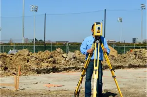
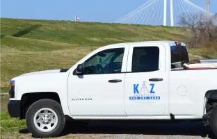
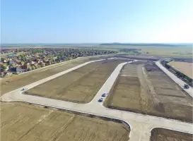
Services
Boundary Surveys
Topographic Surveys
FEMA Elevation Certificates
ALTA/NSPS Surveys
Construction Staking
Platting Services
Easement Surveys
As-Built Surveys
Form Board Surveys
Lot Staking
Details
- Year established: 2003
Highlights and features
- We offer 20+ years of experience in land surveying across multiple states
- Our team utilizes advanced technology for precise boundary and topographic surveys
- We maintain licensure in Texas, Oklahoma, Colorado, and Arkansas
- Our services include ALTA/NSPS surveys and FEMA elevation certificates
- We guarantee timely delivery with responsive client communication
Associations and certifications
- Texas Board of Professional Land Surveying
- Oklahoma Certification
What people say
Quick turnaround
Professional team
Accurate surveys
Dependable service
Great communication
Services
Boundary Surveys
Boundary Surveys identify property lines and corners using advanced equipment. Our team locates existing markers and prepares detailed documentation for legal transactions. This service ensures accurate land division for residential, commercial, and agricultural properties.
Topographic Surveys
Topographic Surveys map terrain features and elevations at specified intervals. We document drainage patterns and utility locations to support construction planning and land development projects. Our surveys provide critical data for engineering and architectural design.
ALTA/NSPS Surveys
ALTA/NSPS Surveys meet national standards for commercial property transactions. We include boundary verification, easement identification, and improvements documentation. These surveys satisfy lender requirements and minimize title insurance risks for complex real estate deals.
FEMA Elevation Certificates
FEMA Elevation Certificates document structure elevations relative to flood zones. Our surveys determine flood insurance requirements and compliance with local regulations. This service is essential for properties in high-risk flood areas requiring insurance coverage.
Construction Staking
Construction Staking establishes precise reference points for building projects. We translate design plans into field markers for foundations, utilities, and infrastructure. This service ensures accurate implementation of architectural and engineering specifications during development.
People
Kenny A. Zollinger
Founder
Kenny Zollinger founded KAZ Surveying in 2003 after gaining extensive experience in the Dallas/Ft. Worth area. He specializes in residential and commercial surveys, bringing expertise in land development and subdivision projects to clients in Denton and surrounding regions.
Questions
What types of surveying services do you offer?
We provide boundary surveys, topographic mapping, ALTA/NSPS surveys, FEMA elevation certificates, construction staking, and platting services for commercial, residential, and energy projects.
Which areas do you serve?
We operate throughout Denton County and surrounding Texas counties, with licensure in Texas, Oklahoma, Colorado, and Arkansas for multi-state projects.
How quickly can you complete a survey?
Most residential surveys take 3-5 business days, while commercial projects vary based on complexity. We prioritize urgent requests and maintain fast turnaround times.
How do I request a quote?
Contact us via phone or email with project details, including location, survey type, and required deliverables. We'll provide a customized quote within one business day.
Are your surveyors licensed?
Yes, our team holds active licenses in four states and maintains professional standards through continuing education and industry certifications.