
Business Details
24 Years
experience
Precision Land Surveying Services in Dallas, TX
Founded in 2002, Global Land Surveying has established itself as a leader in precision land surveying services across Dallas-Fort Worth. Our team of registered professionals brings decades of combined experience, utilizing cutting-edge technologies like 3D LiDAR scanning and photogrammetry to deliver actionable insights for residential, commercial, and development projects. We prioritize accuracy, client collaboration, and innovation, ensuring every measurement supports informed decision-making. With over 22 years of operational history and a commitment to continuous learning, we maintain rigorous quality standards while adapting to industry advancements.Our partnerships with title companies, architects, and developers reflect our reputation for reliability and technical excellence. Backed by ISO-certified processes and a focus on client education, we provide tailored solutions that minimize risks and maximize project success. Our dedication to mentorship ensures the next generation of surveyors upholds the same standards of integrity and precision that define our work today.
Services
Residential Surveys
Commercial Surveys
Topographic Surveys
Drone Services
3D LiDAR Scanning
Matterport 3D Tours
Construction Staking
Platting
Easement Exhibits
Elevation Certificates
Details
- Year established: 2002
Highlights and features
- Over 22 years of experience in residential and commercial land surveying
- Combined 75+ years of expertise in advanced surveying technologies
- Utilize cutting-edge 3D LiDAR scanning and photogrammetry for precise data
- Registered professionals with ALTA/NSPS and geodetic surveying certifications
- Dedicated to client education and transparent, detail-oriented service
Services
Residential Surveys
Our residential surveys provide precise property boundary identification for homeowners, buyers, and developers. We conduct thorough records research, field surveys, and boundary analysis to create detailed maps with easements and improvements. These surveys clarify legal boundaries, support construction permits, and resolve disputes while ensuring compliance with local regulations.
Commercial Surveys
Commercial land surveys support large-scale developments with ALTA/NSPS standards, easement exhibits, and 3D scanning. We deliver accurate data for site planning, zoning compliance, and property transactions. Our services include as-built surveys, height assessments, and aerial mapping to meet regulatory requirements and facilitate construction timelines.
Topographic Surveys
Topographic surveys capture elevation data, natural features, and manmade structures for architects and engineers. Using GPS, LiDAR, and drone technology, we create contour maps and CAD files that guide grading, drainage, and infrastructure planning. Deliverables include spot elevations, breaklines, and georeferenced imagery for design compatibility.
Drone Services
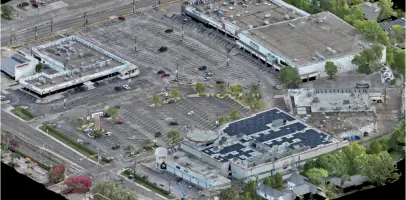
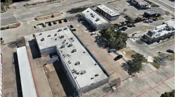
Drone-based aerial mapping provides high-resolution orthomosaics and 3D models for site analysis. This technology enables efficient data collection over large or inaccessible areas, supporting volumetric calculations, progress monitoring, and pre-construction documentation without disrupting ground operations.
3D LiDAR Scanning
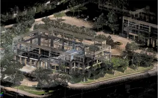
3D LiDAR scanning creates detailed digital representations of landscapes and structures. This technology reduces project risks by providing precise elevation data for land development, infrastructure projects, and environmental assessments. Point clouds and surface models integrate with CAD/BIM workflows for accurate design.
People
Jason Morgan
Founder and Principal
Jason Morgan founded Global Land Surveying in 2002 after starting his career in 1991. He specializes in residential, commercial, and geodetic surveying using AutoCAD, GPS, and LiDAR technologies. A registered professional surveyor, he mentors young professionals and balances family life with auto racing.
Hollie Hebner
Registered Surveyor
Hollie Hebner became a registered surveyor in 2023 after 16 years in the field. She focuses on title research, client education, and geospatial technology. She holds an Associates degree in Land Surveying and enjoys gardening, antique shopping, and family time.
Bobby Martin
General Manager
Bobby Martin oversees field operations and quality control at Global Land Surveying. With 28 years of experience, he manages crews, trains surveyors, and coordinates projects. He enjoys mentoring, sports coaching, and outdoor activities like hunting and golf.
Josh Watkins
Senior Party Chief
Josh Watkins leads survey crews and specializes in AutoCAD and construction staking. He joined Global Land Surveying in 2004, gained experience at TXDOT, and returned to become a senior technician. He mentors new surveyors and enjoys hunting, fishing, and family life.
Questions
What types of land surveying services do you offer?
We provide residential, commercial, topographic, drone, 3D LiDAR scanning, construction staking, platting, and elevation certificate services.
How do you ensure survey accuracy?
We use GPS, robotic total stations, LiDAR, and photogrammetry combined with licensed professionals' expertise to verify measurements and boundary analysis.
Do you serve areas outside Dallas?
Yes, we serve Plano, Frisco, and the entire Dallas-Fort Worth metro area for all surveying needs.
What information is included in a residential survey?
Residential surveys show property boundaries, easements, structures, fences, and floodplain data with official seals from registered professionals.
How long does a typical survey take?
Most residential surveys complete within 3-5 business days, while commercial projects vary based on scope and complexity.
Can you perform surveys for property disputes?
Yes, our boundary analysis and historical records research help resolve property line conflicts with legally defensible documentation.