Business Details
Your Trusted Land Surveying Partner in Galveston, TX
Tricon Land Surveying has established itself as a trusted provider of professional land surveying services in Galveston County, Texas. Founded by Brene Addison, a Registered Professional Land Surveyor with deep local roots, the company combines advanced technology with hands-on expertise to deliver precise and timely results. Our team specializes in residential and commercial boundary surveys, FEMA elevation certificates, construction staking, and ALTA/ACSM surveys, ensuring clients receive accurate data tailored to their specific needs.With a focus on personal attention and client satisfaction, we maintain rigorous standards of safety and precision in every project. Our familiarity with Galveston County's unique geographical and regulatory landscape allows us to efficiently navigate local challenges while upholding state and national surveying standards. By prioritizing clear communication and technical excellence, we aim to be the preferred surveying partner for individuals, businesses, and municipalities throughout the region.

Services
Boundary Surveys
Title Surveys
FEMA Elevation Certificates
Construction Staking
ALTA/ACSM Surveys
Plat Subdivisions
Legal Descriptions
Topographic Surveys
Highlights and features
- We offer 20+ years of local surveying expertise in Galveston County
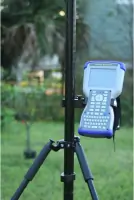
- Our team utilizes advanced technology for precise data collection
- We provide personalized service with direct client communication
- We specialize in both residential and commercial surveying solutions
- Our processes meet state and national land surveying standards
Associations and certifications
- T.B.P.E.L.S. FIRM NO. 10194309
Services
Boundary Surveys
Our boundary surveys precisely determine property lines using advanced GPS technology and historical records. This service helps homeowners and developers resolve disputes, plan improvements, and meet legal requirements. Our team ensures compliance with Texas survey standards while maintaining clear communication throughout the process.
FEMA Elevation Certificates
We provide official FEMA elevation certificates for flood insurance requirements and building permits. Our surveys measure building elevations relative to floodplain data, helping clients obtain accurate insurance rates and comply with local regulations. The process includes detailed documentation and direct submission to relevant authorities.
Construction Staking
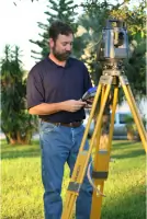
Our construction staking services guide development projects with precise field markings for foundations, utilities, and structures. Using digital plans and total stations, we ensure accurate implementation of architectural designs. This service supports contractors in maintaining compliance with zoning laws and project specifications during all development phases.
ALTA/ACSM Surveys
We conduct comprehensive ALTA/ACSM surveys for commercial property transactions, meeting strict insurance and lending requirements. These detailed assessments include boundary verification, easements, and improvements, following standardized specifications. Our reports help stakeholders make informed decisions about property investments and potential liabilities.
Plat Subdivisions
Our plat subdivision service creates legal descriptions for land division projects, including residential developments and commercial parcels. We handle coordination with local municipalities, prepare required documentation, and ensure compliance with zoning regulations. This process enables clients to legally transfer or develop portions of larger properties.
People
Brene Addison
Registered Professional Land Surveyor
Brene Addison, a Galveston County native, brings extensive local knowledge and technical expertise to Tricon Land Surveying. With over 20 years of experience in land surveying, he specializes in boundary resolution, floodplain mapping, and construction layout. His commitment to precision and client communication ensures reliable results for residential and commercial projects.
Questions
What types of surveying services do you offer?
We provide boundary surveys, FEMA elevation certificates, construction staking, ALTA/ACSM surveys, plat subdivisions, and legal descriptions for residential and commercial clients in Galveston County.
How do you ensure survey accuracy?
We use advanced GPS equipment and robotic total stations combined with traditional methods. Our team follows state standards and double-checks all measurements to maintain precision within 0.02 feet.
Are you licensed in Texas?
Yes, we operate under Texas Board of Professional Engineers and Land Surveyors firm number 10194309. Our principal surveyor holds active RPLS certification with continuing education compliance.
How long does a typical survey take?
Most residential boundary surveys take 1-3 days depending on property size and complexity. Commercial projects may require additional time based on scope and coordination requirements.
Can you help with flood insurance requirements?
Yes, we specialize in FEMA elevation certificates that determine proper flood insurance rates and verify compliance with local floodplain management regulations for Galveston County properties.