
Business Details
46 Years
experience
Your Trusted Partner for Land Surveying Solutions in Houston
South Texas Surveying Associates has been a trusted name in land surveying since 1980, combining decades of experience with cutting-edge technology to serve clients across Texas. Our family-owned business specializes in commercial and residential surveys, including ALTA/NSPS, boundary, topographic, and construction surveys. We pride ourselves on delivering precise, compliant, and timely results, supported by a team of licensed professionals with deep local expertise. Our commitment to quality is reflected in our use of advanced tools like drones and LiDAR, ensuring accurate data collection and efficient project completion.We maintain strong relationships with real estate organizations and adhere to strict industry standards, providing clients with reliable solutions tailored to their unique needs. Our mission is to exceed expectations by prioritizing client satisfaction, transparency, and technical excellence in every project we undertake.

Services
ALTA/NSPS Surveys
Boundary Surveys
Topographic Surveys
Construction Staking
Elevation Certificates
Subdivision Platting
Tree Surveys
UAV LiDAR Surveys
Details
- Year established: 1980
Highlights and features
- We offer over 40 years of experience in Texas land surveying with a focus on precision and compliance.
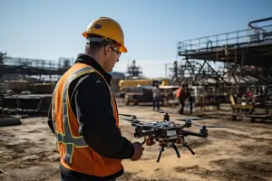
- Our team utilizes advanced technology like drones and LiDAR for accurate data collection.
- We provide tailored solutions for commercial real estate transactions and development projects.
- Our local expertise ensures familiarity with Texas regulations and municipal requirements.
- We guarantee clear communication and fast turnaround times for all survey projects.
What people say
Exceptional professionalism
Attention to detail
Accurate and thorough
Professional service
Simplifies complex tasks
Services
ALTA/NSPS Surveys
Our ALTA/NSPS surveys meet national standards for commercial real estate transactions, providing detailed boundary maps, easement locations, and encroachment data. These surveys are essential for title insurance, legal compliance, and development planning. Clients benefit from our expertise in resolving boundary disputes and ensuring accurate property documentation.
Topographic Surveys
We create detailed topographic maps showing natural and man-made features, critical for construction, zoning, and environmental assessments. Our surveys support architects and engineers in designing infrastructure projects with precise elevation data. Advanced tools ensure high accuracy for land development applications.
Subdivision Platting
Our platting services guide clients through municipal approval processes for land subdivision projects. We prepare legal plats, coordinate with local authorities, and ensure compliance with zoning regulations. This service streamlines development timelines and reduces regulatory risks for residential and commercial projects.
Construction Staking
We provide precise staking for building foundations, roads, and utilities based on construction plans. Our team marks critical reference points to ensure structures align with design specifications. This service prevents costly errors during commercial and residential construction projects.
UAV LiDAR Surveys
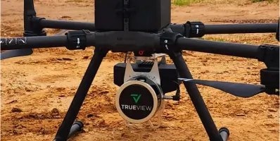
Using drone technology, we capture high-resolution topographic data for large-scale projects. This method reduces field time while maintaining accuracy for applications like mining, forestry, and infrastructure planning. Clients receive 3D models and detailed contour maps for informed decision-making.
People
George Owens
Commercial Broker
Recognized for exceptional professionalism and attention to detail in land surveying services, ensuring client satisfaction through accurate documentation and clear communication.
Kim Wexler
Project Manager
Praises the company's thorough surveys and effective communication with stakeholders, highlighting their role in simplifying complex real estate projects.
James Cart
Homeowner
Commends the professional service received during a home purchase survey, recommending the company for Houston residential transactions.
Questions
What is land surveying and why is it important?
Land surveying measures property boundaries and features to support real estate transactions, construction projects, and legal compliance.
What methods do you use for land surveying?
We use GPS, terrestrial measurements, and aerial drones to ensure accurate data collection for diverse surveying needs.
Do I need a survey for property transactions?
Yes, title companies often require surveys to verify boundaries and prevent legal disputes during real estate transactions.
How much does a land survey cost?
Costs vary based on property size and complexity, typically ranging from hundreds to thousands of dollars with transparent pricing.
Do you offer services outside Houston?
We serve all Texas regions, including Dallas, Fort Worth, and surrounding counties for commercial and residential surveys.