
Business Details
Expert Land Surveying Services in Gainesville, TX
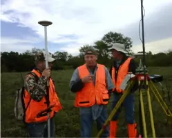
All American Surveying is a family-owned and operated land surveying firm serving North Texas. Founded by industry leaders with decades of combined experience, we specialize in civil, residential, commercial, and municipal surveying. Our team combines traditional methods with cutting-edge technology to deliver precise and reliable results. With over 20,000 surveys completed across multiple counties, we have built a reputation for excellence and client satisfaction. Our services cater to property owners, title companies, lenders, builders, architects, engineers, and commercial developers.We prioritize timely delivery, attention to detail, and personalized service to meet each client's unique needs. Backed by 75+ combined years of expertise in CAD, land surveying, and engineering, we ensure accuracy and efficiency in every project. Our commitment to innovation and customer-centric values has solidified our position as a trusted leader in the industry.
Services
Title Surveys
Boundary Surveys
Topographical Surveys
ALTA Surveys
Flood Certificates
Construction Packages
Concept & Site Plans
UAV Surveying
Highlights and features
- We have completed over 20,000 surveys across North Texas.
- Our team uses state-of-the-art technology for detailed accuracy.
- We guarantee timely delivery of all surveying projects.
- Our leaders have 75+ combined years of surveying and engineering experience.
- Clients praise our responsiveness, attention to detail, and competitive pricing.
What people say
Professional, reliable, efficient
Great attention to detail
Excellent results
Reasonably priced
Timely delivery
Services
Title Surveys
Title Surveys identify property boundaries, improvements, and easements to support land purchases and mortgages. Our surveys ensure compliance with legal requirements and provide clarity for buyers, lenders, and title companies. Clients rely on our precision to mitigate risks in real estate transactions.
Boundary Surveys
Boundary Surveys establish legal property lines for building permits, fence installation, or dispute resolution. We use advanced tools to verify acreage and ensure adherence to municipal regulations. Our results provide a foundation for development and legal documentation.
Topographical Surveys
Topographical Surveys map natural and man-made features to guide construction and land development. We detail elevation changes, vegetation, and structures to support engineering and design. These surveys are critical for infrastructure planning and environmental compliance.
ALTA Surveys
ALTA Surveys meet national standards for commercial property transactions. We adhere to ALTA/NSPS requirements to deliver detailed boundary, easement, and improvement data. These surveys protect stakeholders by ensuring transparency and legal compliance in high-value deals.
Flood Certificates
Flood Elevation Certificates verify compliance with floodplain regulations for property development. We document elevation data to support FEMA filings and insurance requirements. These certificates help clients avoid costly delays and ensure adherence to community floodplain management ordinances.
People
John E. (J.T.) Thompson II
Registered Surveyor
J.T. Thompson has been a licensed surveyor for over 20 years. He began his career in 1978 and has expertise in construction, boundary, and topographic surveys. He leads teams in delivering precise land development solutions.
Questions
What services does All American Surveying offer?
We provide title surveys, boundary surveys, topographical surveys, ALTA surveys, flood certificates, construction packages, and UAV mapping for residential, commercial, and municipal projects.
How long has All American Surveying been in business?
Our team has over 75 combined years of experience. The firm evolved from Thompson Surveying, established in 1993, and now serves North Texas with advanced technology and expertise.
Do you serve individual property owners?
Yes, we cater to individual property owners, title companies, lenders, builders, architects, engineers, and commercial developers across North Texas.
What technology do you use for surveys?
We combine traditional surveying methods with cutting-edge tools like UAV mapping, GPS, and CAD software to ensure accuracy and efficiency in every project.
How do you ensure timely delivery of surveys?
Our dedicated teams prioritize client deadlines and use streamlined processes to complete surveys promptly while maintaining precision and compliance with industry standards.