Business Details
33 Years
experience
Your Trusted Partner for Civil Engineering Solutions
Civil 1 has been a trusted partner in site development since 1993, guiding clients through complex land use challenges across the Northeast. Our team combines over 40 years of hands-on experience with advanced technical tools to deliver strategic civil engineering, land surveying, and permitting solutions. We prioritize collaboration, working side-by-side with developers, municipalities, and design-build firms to transform land into functional, compliant spaces. Our deep regulatory expertise streamlines approvals while our proven process ensures projects move from concept to construction without delays.With LEED-certified professionals and specialized accreditations in erosion control and stormwater management, we provide technical excellence grounded in local knowledge. Our commitment to transparency and client education builds long-term trust, ensuring every project maximizes property potential while meeting environmental standards.
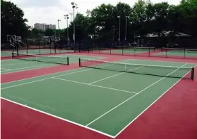
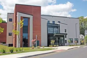
Services
Site/Civil Engineering
Land Surveying
Land Use Permitting
Feasibility Studies
Master Planning
Stormwater Management
Erosion Control
Septic System Design
Details
- Year established: 1993
Highlights and features
- We offer 30+ years of specialized civil engineering experience in the Northeast
- Our team holds LEED, CPESC, and CPSWQ professional accreditations
- We implement a proven process that reduces project delays by 40%
- We maintain direct relationships with local permitting agencies across 6 states
- Our engineers provide technical expertise for complex stormwater compliance
Associations and certifications
- LEED AP
- CPESC
- CPSWQ
What people say
Professional team
Technical expertise
Timely approvals
Accurate surveying
Proactive communication
Services
Site/Civil Engineering
Our civil engineering services provide practical solutions for land development projects. We create site plans that meet local regulations while optimizing land use for commercial, industrial, and municipal clients. Our engineers handle grading, drainage, utility design, and infrastructure planning with technical precision. With expertise in Connecticut's regulatory environment, we ensure projects receive timely approvals while maintaining environmental compliance. Our approach combines strategic planning with hands-on execution to deliver buildable, cost-effective solutions.
Land Surveying
Professional land surveying services support accurate project planning and regulatory compliance. We conduct boundary surveys, topographic mapping, and construction stakeouts using advanced GPS technology. Our surveys meet Connecticut's strict requirements for property development and zoning applications. We provide detailed documentation for site planning, permitting, and legal purposes. With decades of field experience, our surveyors deliver precise measurements that prevent costly design errors and boundary disputes during development projects.
Land Use Permitting
We navigate complex land use regulations to secure project approvals efficiently. Our team prepares applications for zoning boards, wetlands commissions, and state agencies like CT DEEP. We represent clients at public hearings and coordinate with legal counsel to address regulatory challenges. Our deep understanding of Northeast permitting processes reduces approval timelines. We handle special permits, variances, and environmental compliance documentation to ensure smooth project progression through regulatory hurdles.
Feasibility Studies
Our feasibility studies evaluate site potential and identify development constraints early in the planning process. We analyze zoning requirements, environmental factors, and infrastructure needs to determine project viability. Studies include cost estimates for permitting, design, and construction phases. We provide data-driven recommendations that help clients make informed investment decisions. Our assessments prevent costly surprises by identifying regulatory challenges and site-specific issues before design begins.
Stormwater Management
We design compliant stormwater management systems that prevent flooding and environmental damage. Our solutions include detention basins, bioswales, and low-impact development strategies tailored to site conditions. We ensure compliance with CT General Statutes and local inland wetlands regulations. Our engineers create drainage plans that balance environmental protection with site functionality. We also provide stormwater permit applications and system maintenance recommendations to maintain long-term compliance and performance.
People
Curtis C. Jones
President
Civil engineer with 30+ years' experience in Connecticut land use. Licensed in 7 states, LEED-certified, and active in local zoning boards. Holds BS in Civil Engineering from University of New Haven.
Brian J. Baker
Director of Engineering
Connecticut-licensed engineer with 25+ years of permitting expertise. Holds CPESC and CPSWQ certifications for erosion control and stormwater management. Specializes in regulatory compliance for complex development projects.
Emily Jones
Project Manager
Licensed civil engineer with 10 years' experience managing site development projects. Former mechanical engineer at Pratt & Whitney. Specializes in utility design and drainage studies for commercial developments.
Questions
When should I conduct a feasibility study for my project?
Feasibility studies should be completed before design or land acquisition to identify regulatory challenges and site constraints early in the development process.
Can you help with out-of-state permitting requirements?
Yes, we assist out-of-state clients with Connecticut's regulatory processes and serve as local experts for multi-state development projects.
Do you provide stormwater management for small projects?
Yes, we design compliant stormwater solutions for projects of all sizes, including residential developments and small commercial sites.
How long does the land use permitting process take?
Timelines vary by agency, but we typically secure local approvals in 30-60 days and state permits within several months through proactive coordination.
What survey types do you offer?
We provide boundary surveys, topographic mapping, construction stakeouts, as-built documentation, and utility location services for development projects.
How does your master planning process work?
Our master planning includes site analysis, zoning evaluation, infrastructure planning, and phased development strategies that align with regulatory requirements and long-term goals.