Business Details
11 Years
experience
Your Trusted Surveying Partner in Waukon, Iowa
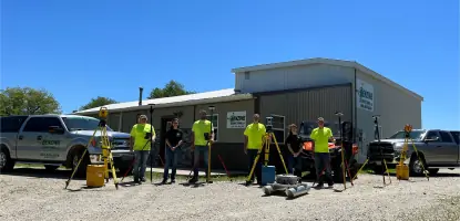
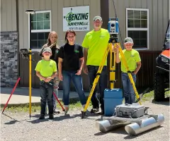
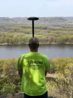
Founded in 2015, Benzing Surveying is committed to delivering precise and timely surveying solutions across Iowa and Wisconsin. Our team combines Ryland Benzings 16+ years of technical expertise in civil engineering and surveying with Shannon Benzings strategic business acumen to meet diverse client needs. Licensed in Iowa and Wisconsin, we serve all levels of government, private companies, and individuals across agricultural, residential, industrial, and commercial sectors. Rylands membership in the Society of Land Surveyors of Iowa, Wisconsin Society of Land Surveyors, and National Society of Professional Surveyors ensures our work aligns with industry standards. As Waukon High School graduates, we take pride in serving our local community while maintaining offices in Waukon, Iowa.Our service portfolio spans boundary surveys, construction staking, hydrographic mapping, and drone-based data collection, supported by FAA-certified operators. Our clients benefit from advanced technologies like sUAS systems with 1 - 1.5 cm vertical accuracy, ensuring safe and efficient project execution. We emphasize education through Rylands role as an adjunct instructor at Hawkeye Community College, sharing expertise in land surveying. Our mission remains focused on quality, accuracy, and client satisfaction across Northeast Iowa and Southwest Wisconsin.
Services
Land Boundary Surveying
Construction Staking
Hydrographic Surveying
Drones Surveying
Topographic Mapping
Subdivision Platting
Earthwork Calculations
ALTA Surveys
FEMA Elevation Certificates
Certified Survey Maps
Details
- Year established: 2015
Highlights and features
- We offer 16+ years of surveying experience in Iowa and Wisconsin.
- Our team includes FAA Part 107 Licensed Commercial Drone Operators.
- We utilize advanced drone technology with 11.5 cm vertical accuracy.
- Combining technical and business expertise from diverse industry backgrounds.
- Affiliated with professional societies ensuring adherence to industry standards.
Services
Land Boundary Surveying
Accurate boundary determination and retracements for property transactions, legal documentation, and development projects. Services include lot surveys, subdivision platting, easement mapping, and ALTA standards compliance.
Hydrographic Surveying
Underwater mapping of rivers, lakes, and channels using remote-controlled boats. We provide pre- and post-dredge surveys, bridge cross-sections, and shallow-water bathymetry for infrastructure planning.
Drones Surveying
Drone-based aerial surveys with 11.5 cm vertical accuracy. Deliverables include orthomosaic maps, 3D point clouds, and volume calculations for construction, mining, and landfills.
Construction Staking
Precise layout for roads, buildings, and infrastructure projects. Includes control benchmarks, earthwork volume analysis, and as-built documentation for roads, bridges, and subdivisions.
FEMA Elevation Certificates
Certified elevation data for floodplain management and insurance compliance. Services include FEMA LOMA filings and detailed property elevation documentation.
People
Ryland Benzing
Surveyor
Ryland has 16+ years of surveying experience with an A.A.S. in Civil Engineering Technology. He taught land surveying at Hawkeye Community College and holds memberships in national surveying organizations.
Shannon Benzing
Business Manager
Shannon brings a B.S. in Business Management and serves as Production Manager at Collins Aerospace, combining business strategy with surveying operations to enhance client service delivery.
Questions
What services does Benzing Surveying offer?
We specialize in boundary surveys, construction staking, hydrographic mapping, drone-based aerial surveys, topographic mapping, and FEMA elevation certificates.
In which areas do you operate?
We serve Northeast Iowa counties including Allamakee, Clayton, Fayette, and Winneshiek, as well as Southwest Wisconsin counties like La Crosse and Vernon.
Are you licensed in both Iowa and Wisconsin?
Yes, our surveyors hold professional licenses in both Iowa and Wisconsin for legal surveying in these states.
How does drone technology benefit your surveys?
Drones provide high-accuracy (1–1.5 cm) data collection safely and efficiently, especially in hard-to-reach areas.
What industries do you serve?
We work with agricultural, residential, commercial, industrial, educational, and governmental clients across various sectors.