Empowering Your Projects with Accurate Measurements
Mohn Surveying, Inc. is a full-service engineering and surveying firm that has been providing professional services to clients throughout the Midwest since 1984. Our company is led by Professional Civil Engineer and Professional Land Surveyor, Roger Mohn, and specializes in land surveying, hydrographic surveying, civil engineering, and drone services. We serve clients in Iowa and Wisconsin, with a particular focus on Northeast Iowa and Western Wisconsin.
Land Surveying Services
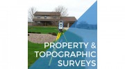
At Mohn Surveying, Inc., we have extensive experience conducting land surveys for a wide range of clients, including municipalities, rural landowners, and commercial developers. Our services include municipal and rural subdivision surveys, single parcel surveys, ALTA/ACSM Land Title surveys, topographical surveys, hydrographic surveys, and site surveys. Our team of licensed land surveyors is committed to providing accurate and reliable data to help our clients make informed decisions about their land.
Hydrographic Surveying Services
Mohn Surveying, Inc. has been conducting hydrographic surveys since 1975, specializing in shallow water hydrographic surveying. Our services include digital data collection using a fully automated bathymetric survey system, as well as complete mapping services with map outputs in various map formats. We provide topographical maps, shaded relief maps, cross-section plots, and engineering construction drawings, among other services. Our team has completed hydrographic surveys for the United States Corps of Engineer projects since 1975, with projects located on inland lakes and major waterways throughout the Midwest.
Civil Engineering Services
Mohn Surveying, Inc. provides civil engineering services for all types and sizes of mapping and construction projects. Our licensed civil engineering division has extensive experience in designing and preparing plans for sediment removal, floodwall, and dock projects, as well as pre and post-dredge volume computations. We are committed to providing the highest quality engineering services to help our clients achieve their goals and ensure their projects' success.
Drone Services
Mohn Surveying, Inc. is licensed to operate a UAS (Unmanned Aerial System), also known as a drone. Our drone survey services complement our land surveying services, providing an additional data collection tool for the preparation of reports, analyses, and mapping. Our team of professionals is dedicated to using the latest technology and techniques to provide accurate and reliable data for our clients.
In conclusion, Mohn Surveying, Inc. is a trusted and experienced engineering and surveying firm that has been serving the Midwest for over 35 years. Our professional team of experts is committed to providing accurate and reliable data to help our clients make informed decisions about their land. Whether you need land surveying, hydrographic surveying, civil engineering, or drone services, Mohn Surveying, Inc. has the expertise and experience to help you achieve your goals.

Be the first to review Mohn Surveying.
Write a Review