Business Details
Expert Land Surveying Services in Southern California
LCF Surveying has been a trusted provider of land surveying, civil engineering, and site development services for over 45 years. Our team, led by Leonard Fowler, a licensed Professional Land Surveyor with extensive expertise, delivers precise and reliable solutions tailored to meet the unique needs of each client. We specialize in boundary surveys, topographic mapping, UAV drone technology, and legal documentation preparation, ensuring compliance with local ordinances and industry standards. Our commitment to quality is reflected in our use of advanced technologies like GPS and drone-based surveys, which enhance accuracy and efficiency for complex projects. With a focus on client satisfaction, we provide free consultations and work closely with property owners, developers, and legal professionals to resolve disputes and prevent future issues.Our experience spans residential, commercial, and industrial projects across Southern California, including subdivisions, solar design surveys, and construction staking. We prioritize transparency, ethical practices, and adherence to the Subdivision Map Act, ensuring all deliverables meet rigorous professional standards. Our services extend to preparing legal documents such as parcel maps, elevation certificates, and encroachment exhibits, which are critical for title insurance and property transactions. By combining decades of field experience with cutting-edge tools, we empower clients to make informed decisions with confidence. Our reputation for excellence is built on consistent delivery of accurate, court-ready documentation and a dedication to resolving challenges proactively.
Services
ALTA Survey
Topographic Survey
Boundary Survey
UAV Drone Survey
Encroachment Survey
Subdivision Survey
Solar Design Survey
Construction Survey
Elevation Certificate
Parcel Merger
Highlights and features
- We have over 45 years of experience in land surveying and civil engineering.
- Our team includes licensed professionals with expertise in legal documentation.
- We utilize UAV drone technology for accurate, cost-effective surveys.
- We provide tailored solutions for residential, commercial, and industrial projects.
- Free phone consultations with licensed land surveyors are available.
Associations and certifications
- Professional Land Surveyor (PLS)
Services
ALTA Survey
An ALTA survey provides detailed location information for title insurance. It identifies boundaries, easements, and improvements to satisfy lenders and title companies. This survey ensures compliance with American Land Title Association standards, reducing risks in property transactions.
Topographic Survey
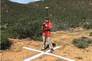
A topographic survey maps natural and man-made features, including elevations and contours. It supports civil engineering and architectural design by providing accurate terrain data. GPS and UAV technology ensure precision for complex sites.
Boundary Survey
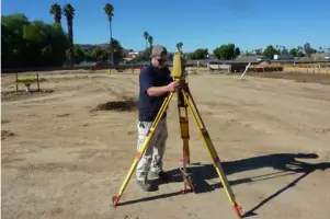
A boundary survey establishes property lines through deed research and field measurements. It resolves disputes and prevents encroachments. Results are documented in legally binding maps and reports for real estate transactions.
UAV Drone Survey
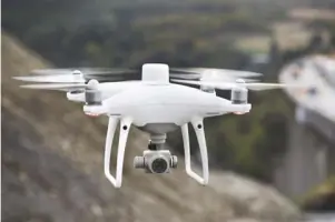
UAV drone surveys capture aerial data for large or inaccessible properties. They provide cost-effective, high-resolution topographic maps. This technology enhances efficiency and accuracy for site planning and construction projects.
Encroachment Survey
An encroachment survey identifies structures crossing property lines. It produces court-ready diagrams to resolve legal disputes. Accurate measurements ensure compliance with boundary agreements and zoning regulations.
People
Leonard Fowler
Principal Surveyor
Leonard Fowler, PLS 7238, has over 45 years of experience in land surveying and civil engineering. He specializes in boundary resolution, legal documentation, and UAV technology. His expertise ensures accurate, compliant solutions for complex projects.
Questions
When should I get a land survey?
A land survey is recommended before purchasing property, dividing land, or starting construction to avoid disputes and ensure compliance with local regulations.
What is an ALTA survey?
An ALTA survey provides detailed boundary and improvement information for title insurance. It meets American Land Title Association standards and is required by lenders for commercial transactions.
How does UAV drone technology benefit surveys?
UAV drones capture high-resolution aerial data quickly and safely. They reduce costs and time for large or complex sites while maintaining high accuracy for topographic and construction surveys.
What legal documents do you prepare?
We prepare parcel maps, elevation certificates, encroachment exhibits, and other legal documents required for property transactions, zoning compliance, and title insurance.
Do you serve residential and commercial clients?
Yes, we serve both residential and commercial clients, including developers, wineries, and solar energy companies, providing tailored surveying solutions for all project types.