Business Details
23 Years
experience
Expert Land Surveying & Mapping Services in San Clemente, CA
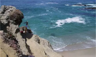
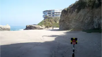
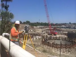
Borchard Surveying & Mapping, established in 2003, is a professional land surveying and mapping firm located in San Clemente. We specialize in providing premium services to architects, individual landowners, legal firms, title companies, builders, civil engineering firms, water districts, and other businesses across Orange County and surrounding areas. Our team employs inventive techniques using state-of-the-art instrumentation, including total stations, electronic data collectors, and GPS technology, to deliver the highest quality products. With over 25 years of experience in the civil engineering and mapping field, our founder, Greg Borchard, PLS, is an expert in legal descriptions and land law, offering expert witness testimony in land dispute cases.We are committed to maintaining the highest professional standards in the industry, providing comprehensive solutions for boundary surveying, final mapping, topographic surveys, ALTA/ACSM surveys, floodplain certifications, construction staking, and more. Our philosophy centers on delivering quality products while ensuring client satisfaction and trust, making us a reliable partner for both public works and private development projects.
Services
Land Surveying
Legal Descriptions
Expert Witness Testimony
Boundary Surveying
Final Mapping
Topographic Surveys
ALTA/ACSM Surveys
Floodplain Certifications
Construction Staking
City Liaison Services
Details
- Year established: 2003
Highlights and features
- Greg Borchard, PLS, has over 25 years of experience in land surveying and legal issues related to property boundaries.
- We use state-of-the-art instrumentation, including GPS and total stations, for accurate and efficient surveys.
- Our team provides expert witness testimony in land dispute cases, ensuring legal compliance and reliability.
- We specialize in ALTA/ACSM surveys, floodplain certifications, and construction staking for complex projects.
- We maintain a reputation for responsiveness and quality in public works and private development projects.
What people say
Expertise in boundary law
Responsive public works support
Accurate documentation
Advanced GPS technology
Experienced team
Services
Land Surveying
Land surveying involves precise measurements and mapping of property boundaries to support real estate transactions, construction, and legal compliance. Clients benefit from advanced GPS technology and expertise in boundary law. Our services ensure accurate documentation for residential, commercial, and public infrastructure projects.
Legal Descriptions
Legal descriptions define property boundaries and ownership rights for real estate transfers and disputes. These documents require expertise in land law and surveying to ensure legal validity. We create comprehensive descriptions that meet municipal and title company requirements for accuracy and compliance.
Expert Witness Testimony
Expert witness testimony provides professional analysis of land boundaries and survey data in legal disputes. Our licensed surveyors offer credible, court-admissible evidence to resolve property conflicts. This service supports clients in litigation with accurate, legally sound interpretations of survey results.
Topographic Surveys
Topographic surveys map natural and man-made features of a property to guide construction and design. These surveys include elevation data, vegetation, and structures for engineering and planning purposes. Clients gain detailed insights to ensure project feasibility and regulatory compliance.
Construction Staking
Construction staking marks precise locations for building foundations, utilities, and infrastructure based on design plans. This ensures alignment with legal boundaries and zoning regulations. Our services reduce errors and delays during construction projects for residential and commercial developments.
People
Greg Borchard
Founder, PLS
Greg Borchard, PLS, founded the company in 2003 after 25 years in civil engineering and surveying. He specializes in legal descriptions, boundary disputes, and public works projects. His expertise includes city liaison services and expert witness testimony, with clients ranging from water districts to civil engineering firms.
Michael Pulice
Project Surveyor
Michael Pulice joined Borchard Surveying in 2007, offering skills in AutoCAD and field mapping. He holds a surveying certificate from Rancho Santiago Canyon College, blending technical expertise with field experience for diverse surveying projects.
Sergio Najera
Project Surveyor
Sergio Najera, a Cal Poly Pomona graduate with a civil engineering degree, joined in 2018. His expertise includes boundary surveys and construction staking, supported by a certification from the National Society of Professional Surveyors as a Certified Survey Technician.
Questions
What services does Borchard Surveying and Mapping offer?
We offer land surveying, legal descriptions, expert witness testimony, boundary and topographic surveys, construction staking, ALTA/ACSM surveys, and floodplain certifications for residential and commercial clients.
Why hire a licensed land surveyor?
Only licensed professionals can legally stamp and record boundary surveys, ensuring compliance with state laws and providing legal protection in disputes.
How do I get city permits for construction?
We assist with zoning research, plan creation, and city approvals, streamlining the process to meet local regulations and avoid costly delays.
What distinguishes Borchard Surveying from competitors?
Our 25+ years of experience, advanced technology, and expertise in legal and public works projects ensure high-quality results tailored to client needs.
What areas do you serve?
We serve Orange County and surrounding areas, including San Clemente, Irvine, Newport Beach, and San Juan Capistrano.