
Business Details
18 Years
experience
Professional Land Surveying Services in Kansas City
Established in 2008, Minney Surveying has built a reputation as a trusted provider of professional land surveying services for both public and private sector clients. Our firm specializes in boundary surveys, topographic surveys, ALTA/NSPS land title surveys, and a comprehensive range of certification services tailored to meet diverse project requirements. Licensed in Kansas, Missouri, and California, we bring decades of technical expertise and a commitment to precision across municipal infrastructure projects, private developments, and complex land transactions. The principal surveyor maintains direct involvement in every project phase, ensuring rigorous quality control from initial proposals to final deliverables. Our focus on personalized service and technical excellence has solidified our position as a preferred partner for clients throughout the Kansas City Metropolitan area.With over 20 years of experience in land development and street improvement projects, our team combines deep local knowledge with national standards compliance. We maintain active leadership roles in professional organizations like the KC Metro Chapter of KSLS and MSPS, reflecting our dedication to advancing industry best practices. Our capabilities span GPS control surveys, subdivision plats, construction staking, and specialized monitoring services that address evolving client needs. By maintaining a streamlined operational structure, we guarantee direct access to senior expertise while delivering efficient, cost-effective solutions. This approach has enabled us to complete thousands of projects with consistent accuracy, earning recognition for reliability in both municipal and private sectors.
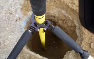
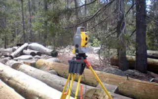
Services
Boundary Surveys
Topographic Surveys
ALTA/NSPS Surveys
Construction Staking
GPS Control Surveys
Subdivision Plats
Elevation Certificates
Right-of-Way Surveys
Legal Descriptions
Monitoring Surveys
Details
- Year established: 2008
Highlights and features
- We offer over 20 years of land surveying expertise with direct principal involvement in every project
- Our team holds professional licenses in three states, ensuring compliance with regional regulations
- We specialize in municipal infrastructure projects and complex private land development surveys
- Our GPS control survey capabilities support high-precision mapping and construction staking
- We maintain active leadership roles in professional surveying organizations for industry advancement
Services
Boundary Surveys
Our boundary surveys establish precise property lines through comprehensive research and field measurements. We analyze historical records, resolve encroachment issues, and prepare legal documentation for real estate transactions. Clients receive detailed maps and certificates that meet state licensing requirements for land development and title insurance purposes.
Topographic Surveys
We create detailed elevation models showing natural and man-made features for engineering and construction planning. Our surveys include contour mapping, drainage analysis, and vegetation coverage data. This information supports site development, floodplain determination, and infrastructure design projects across urban and rural environments.
ALTA/NSPS Surveys
These comprehensive land title surveys meet American Land Title Association and National Society of Professional Surveyors standards. We identify property boundaries, easements, improvements, and encroachments to support commercial real estate transactions. Our deliverables include detailed maps and documentation for title insurance underwriting processes.
Construction Staking
We provide precise field markings for building foundations, utilities, and infrastructure projects. Our staking services ensure accurate implementation of engineering plans through GPS-guided layout and elevation control. This service supports grading, paving, and structural development across residential, commercial, and municipal projects.
GPS Control Surveys
Our GPS control surveys establish high-accuracy reference networks for large-scale mapping and engineering projects. We utilize advanced GNSS technology to create coordinate systems that support boundary determination, deformation monitoring, and infrastructure alignment. This service ensures consistency across multi-phase development projects.
People
Anne Smoke
Principal Land Surveyor
With over 20 years of experience, Anne Smoke leads surveying operations and project management. Licensed in California, Kansas, and Missouri, she specializes in municipal infrastructure projects and land development surveys. Anne serves as Secretary/Treasurer for the KC Metro Chapter of KSLS and MSPS.
Questions
What types of surveying services do you offer?
We provide boundary surveys, topographic mapping, ALTA/NSPS land title surveys, construction staking, GPS control surveys, and specialized certification services for land development projects.
Which areas do you serve?
Our primary service area includes the Kansas City Metropolitan region, with surveying capabilities extending across Kansas, Missouri, and California through our multi-state licensing.
Are your surveyors licensed professionals?
Yes, our principal surveyor holds active licenses in California, Kansas, and Missouri, meeting strict state requirements for land surveying practice and professional accountability.
How do you ensure survey accuracy?
We combine advanced GPS technology with traditional field methods, maintaining direct principal involvement in all projects to guarantee quality control and regulatory compliance.
What experience do you have with municipal projects?
Our team has completed hundreds of surveys for local street improvements and public infrastructure projects, with continuous involvement in municipal development since 2008.