
Business Details
43 Years
experience
Your Trusted Land Surveying Partner in Bluffton, SC
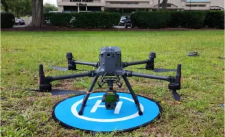
Surveying Consultants has been delivering precise land surveying and mapping services since 1983, establishing itself as a trusted name in the industry. Founded by Terry Hatchell, a Professional Land Surveyor, our firm combines decades of experience with cutting-edge technology to serve clients across the Southeastern United States. Our team specializes in boundary surveys, topographic mapping, and environmental assessments, ensuring compliance with regulatory standards while addressing the unique needs of each project. We prioritize efficiency, completing 90% of quotes within two business days and deploying field teams promptly to maintain project timelines.With offices in Bluffton, South Carolina, and Rincon, Georgia, we serve coastal regions and extend our expertise to federal projects spanning multiple states. Our commitment to quality is reflected in our use of advanced tools like GPS receivers, robotic stations, and drones, while maintaining traditional surveying precision through meticulous fieldwork. We uphold rigorous professional standards, holding licenses and insurance to guarantee reliable, legally sound results for every client.


Services
Boundary Survey
As-Built Survey
Topographic Survey
Wetland Delineation
Elevation Certificate
Details
- Year established: 1983
Highlights and features
- We have over 40 years of experience in professional land surveying since 1983.
- Our team uses the latest GPS and drone technology for accurate measurements.
- We complete 90% of quotes within two business days.
- Our services comply with federal and state regulatory standards.
- We maintain offices in both South Carolina and Georgia for regional accessibility.
What people say
Meticulous work
Timely results
Highest standards
Outstanding job
Thorough documentation
Services
Boundary Survey
A boundary survey precisely defines property lines using GPS technology and historical records. Our team locates physical markers like fences and natural landmarks to create legally accurate maps. This service ensures compliance with local regulations and prevents disputes during real estate transactions or construction projects.
As-Built Survey
As-built surveys document completed construction projects by comparing structures to original plans. We identify deviations and create detailed drawings for regulatory approval. This service ensures adherence to building codes and provides accurate records for future modifications.
Wetland Delineation
Wetland delineation identifies protected ecosystems by analyzing soil, vegetation, and hydrology. Our surveys meet U.S. Army Corps of Engineers standards to support land development compliance. This service helps clients navigate environmental regulations while preserving sensitive habitats.
Elevation Certificate
Elevation certificates document property elevations to determine flood risk. Required by FEMA for insurance purposes, these surveys help homeowners secure accurate flood insurance rates. Our team delivers rapid, precise measurements to expedite policy approvals.
Topographic Survey
Topographic surveys map natural and man-made features, including elevation changes and terrain contours. This data supports site planning for construction or development projects. We use advanced tools to ensure accuracy for engineering and architectural design applications.
Questions
When is a land survey required?
A land survey is required during real estate transactions, property development, construction projects, or boundary disputes to ensure legal accuracy and compliance.
How much does a survey cost?
Cost depends on property size, terrain complexity, and required detail. Contact us for a customized quote within two business days.
What services do you offer?
We provide boundary surveys, as-built documentation, wetland delineation, elevation certificates, and topographic mapping across the Southeastern United States.
Are your surveyors licensed?
Yes, all our surveyors are fully licensed professionals with insurance and 40+ years of combined experience.
Do you serve commercial clients?
Yes, we work with commercial developers, federal agencies, and civil engineers on large-scale projects requiring precise measurements.