
Business Details
49 Years
experience
Professional Surveying & Civil Engineering Services in Houston
Andrew Lonnie Sikes has been a trusted leader in land surveying and civil engineering since 1977. Our firm combines decades of expertise with cutting-edge technology to deliver precise solutions for commercial, industrial, and residential projects. With a family legacy spanning generations, we prioritize safety, innovation, and client satisfaction. Our team holds extensive experience in regulatory compliance, boundary resolution, and infrastructure design, serving clients like Memorial Hermann Health System and ExxonMobil Corp.We specialize in aerial mapping, hydrographic surveys, and GIS integration, ensuring projects meet rigorous standards. Our commitment to education and community involvement underscores our dedication to advancing the profession. With offices in Houston, Texas, we serve Harris and adjoining counties, providing tailored services for complex land development challenges. Our reputation for excellence is built on 45 years of consistent client relationships and technical proficiency.

Services
Civil Engineering
Land Surveying
Hydrographic Surveying
Aerial Mapping
Ortho Imaging
GIS Services
Details
- Year established: 1977
Highlights and features
- We offer over 40 years of experience in land surveying and civil engineering
- Our team includes industry-recognized experts with 28+ years average experience
- We utilize advanced aerial mapping and GIS technologies for precise results
- We maintain strict safety and quality control protocols for all projects
- Our family-run business combines tradition with modern technical expertise
Services
Land Surveying
Our land surveying services provide precise measurements for property ownership and development. We conduct title surveys, boundary resolution, and construction layout using advanced GPS technology. Our expertise includes legal boundary disputes and historical deed research, ensuring compliance with Texas surveying standards.
Civil Engineering
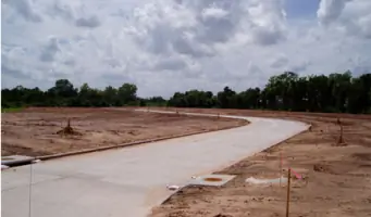
We offer comprehensive civil engineering design for infrastructure projects. Our services include drainage planning, subdivision platting, and utility design. Our team coordinates with regulatory agencies to streamline permitting processes for commercial and residential developments across Houston metropolitan area.
Aerial Mapping
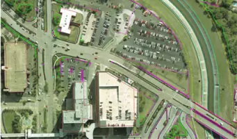
Our aerial mapping division creates detailed topographic maps using stereo photography. We produce contour maps at scales from 1:30 to 1:1000, supporting transportation projects and floodplain analysis. This technology enables efficient data collection over large areas like Texas highways and bayous.
Hydrographic Surveying
We specialize in underwater mapping for river systems and reservoirs. Our services include flowline mapping for Buffalo Bayou and floodplain analysis for the Brazos River. Using specialized vessels, we measure water depths and volumes for dredging projects and flood control planning.
Ortho Imaging
Our ortho imaging services correct distortions in aerial photographs using digital terrain models. We create geometrically accurate images for GIS integration, supporting engineering projects with precise measurements. Our library includes Harris County ortho images dating back three decades.
People
Andrew Lonnie Sikes
President
Licensed Professional Engineer and Land Surveyor with 50+ years experience. Served on Texas Board of Professional Surveyors and NCEES leadership. Adjunct professor at University of Houston. Pioneer in aerial mapping technology since 1971.
A. Lonnie Sikes II
Engineering Division Manager
Licensed Professional Engineer with 20+ years of civil engineering experience. Specializes in municipal infrastructure design. Manages engineering projects for government and private clients. Graduated from Texas A&M University with advanced engineering degree.
Benoit Blouin
Aerial Mapping Director
Registered Professional Land Surveyor managing aerial mapping operations. Expert in photogrammetry and ortho image production. Oversees technical staff and project execution for large-scale mapping initiatives across Texas since 1992.
Questions
What surveying services do you offer?
We provide boundary surveys, topographic mapping, construction layout, hydrographic surveys, and aerial mapping services for commercial and industrial clients.
How long have you served Houston businesses?
We've provided surveying and engineering services to Houston-area clients since 1977, with three generations of family leadership.
What engineering expertise do you have?
Our civil engineers specialize in drainage design, subdivision platting, utilities planning, and regulatory compliance for land development projects.
Do you handle large-scale mapping projects?
Yes, we've completed over 8,000 square miles of aerial photography and mapped 100+ miles of Harris County waterways using advanced photogrammetry.
What industries do you serve?
We work with healthcare systems, educational institutions, chemical companies, and government agencies on infrastructure and development projects.