
Business Details
40 Years
experience
Trusted Land Surveying Services in Wabash, Indiana
Established in 1986, our firm has built a reputation for excellence in land surveying through unwavering commitment to client service, technical precision, and community responsibility. With decades of combined experience in northern and central Indiana, we specialize in delivering tailored surveying solutions for residential, commercial, and municipal clients. Our team combines traditional values with modern technology to ensure accurate boundary determinations, subdivision designs, and construction documentation.We maintain close partnerships with local agencies while providing flood certification services that help homeowners reduce insurance costs. Our focus remains on creating long-term client relationships through transparent communication and superior quality control.

Services
Land Surveying
Subdivision Design
Construction Staking
Flood Certification
Boundary Surveys
Details
- Year established: 1986
Highlights and features
- Licensed Indiana Land Surveyors with 35+ years of local experience
- Specialized flood certification services reducing insurance requirements
- Direct access to Wabash County government agencies
- Proven track record with major regional development projects
- Family-owned business maintaining personalized client relationships
Services
Land Surveying
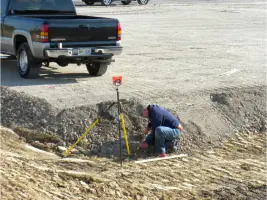
Our professional land surveying services establish precise property boundaries using advanced equipment and historical records. We serve homeowners, developers, and municipalities needing accurate boundary determinations for legal documentation or construction projects. Our team maintains extensive knowledge of Indiana's surveying regulations and local land records.
Subdivision Design
We create comprehensive subdivision designs for residential and commercial developments including platting, zoning compliance, and infrastructure planning. Our services cover complete project management from initial design through final construction documentation. We coordinate with local agencies to ensure regulatory compliance for developers and municipalities.
Construction Staking
Our construction staking services provide precise field markings for building foundations, utilities, and infrastructure projects. We work with contractors to ensure accurate implementation of engineering plans through earthwork calculations and utility mapping. Our team supports both private and public construction projects across Indiana.
Flood Certification
We prepare elevation certificates and flood map amendments to help property owners reduce flood insurance costs. Our services include Letter of Map Amendments (LOMAs) and Letter of Map Revisions (LOMRs) that document property elevations relative to FEMA flood zones. This documentation often eliminates mandatory flood insurance requirements.
Topographical Surveys
We conduct detailed topographical surveys documenting natural and man-made features for development projects. Our mapping services support site planning, drainage analysis, and construction design. We use modern surveying technology to create accurate elevation models and terrain documentation for land developers and engineers.
People
John H Stephens Rls
Founder / Licensed Land Surveyor
Established the firm in 1986 with a focus on client service and quality. Maintains active involvement in local community development projects while overseeing surveying operations. Holds Indiana Professional Land Surveyor license with decades of regional experience.
John O. Stephens
Land Surveyor
Joined the company in 2014 with over 10 years of field experience. Specializes in document research across northern Indiana counties. Graduated from Vincennes University with land surveying degree in 2007. Assists with boundary determinations and construction staking projects.
Questions
What types of land surveys do you provide?
We offer boundary surveys, topographical surveys, subdivision plats, construction staking, and flood certification services for residential, commercial, and municipal clients.
How can a survey help reduce property taxes?
While we don't provide tax advice, our boundary surveys and flood certifications often help property owners avoid unnecessary flood insurance requirements that impact overall ownership costs.
Do you work with out-of-state clients?
Our primary service area covers Wabash County and surrounding Indiana regions. We maintain working relationships with professionals across state lines to support client needs when required.
What information should I provide before a survey?
We recommend having property deeds, previous survey records, and any correspondence about boundary disputes. Our team will guide you through specific requirements during initial consultations.
How long does a typical survey take?
Project timelines vary based on complexity. Most residential surveys complete within 1-2 weeks while commercial projects may require additional time for research and documentation.
Can you help with government permit applications?
Yes, we prepare required survey documentation for zoning permits, subdivision approvals, and construction permits through our familiarity with local government processes.