
Business Details
48 Years
experience
Expert Land Surveying Services in West End, NC
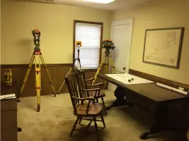
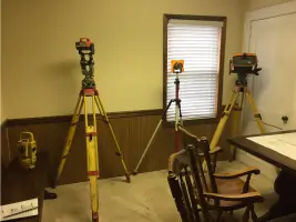
Central Carolina Surveyors has served the Carolinas with accurate and timely land surveying services since 1978. As a family-owned business based in West End, NC, we specialize in residential land surveys, boundary assessments, construction layout, and land planning projects across Moore County and surrounding areas. Our team brings decades of combined experience, with expertise spanning manual measurement techniques to modern robotic total station technology. We prioritize client needs by delivering precise solutions within agreed timelines, supporting real estate transactions, development projects, and property dispute resolutions.Our work extends to prominent communities like Seven Lakes, Tillery Tradition, and Pinewild Country Club. We maintain transparency by requesting property owner details, existing maps, and tax information upfront to ensure project accuracy. While office visits don't require appointments, we recommend pre-visit communication to confirm availability. Client feedback is valued through Google and Facebook reviews, and we emphasize the critical role surveys play in protecting property investments against encroachments and legal conflicts.
Services
Residential land surveys
Boundary surveys
Topographic surveys
Construction layout
Land planning
Details
- Year established: 1978
Highlights and features
- We offer 40+ years of local surveying experience in North Carolina.
- Our family-owned business maintains deep connections throughout Moore County.
- We utilize both traditional and modern surveying technologies for accuracy.
- Our team handles projects from small residential surveys to large developments.
- We provide transparent information requirements for accurate project planning.
What people say
Accurate property boundaries
Timely completion
Professional staff
Detailed documentation
Clear line markings
Services
Land surveying
We provide precise land surveying services to establish property boundaries and features. Our expertise protects real estate investments by identifying encroachments and legal boundary issues. Clients receive detailed maps and documentation essential for property transactions, development projects, and dispute resolution.
Boundary surveys
Our boundary surveys clearly define property lines using professional-grade equipment. This service prevents costly disputes by marking fence lines, landscaping features, and building footprints. Clients receive official documentation that supports legal property ownership and development decisions.
Topographic surveys
We create detailed topographic surveys showing elevation changes and natural features. These surveys support construction planning and land development projects. Our digital mapping integrates with modern design software for accurate project execution across the Carolinas.
Construction layout
Our construction layout services guide building projects with precise field markings. We help contractors maintain proper setbacks and elevations throughout developments. This ensures compliance with local regulations while maintaining design specifications for residential and commercial properties.
Land planning
We offer comprehensive land planning services for residential and commercial developments. Our team creates efficient subdivision plans that meet regulatory requirements. Clients benefit from our local expertise in Moore County and surrounding areas during every project phase.
People
Ronald O. Graham
Licensed Surveyor
Professionally licensed since 1978 with 40+ years of NC surveying experience. Operates primarily from West End, serving Moore County and surrounding areas. Specializes in both traditional and modern surveying methods.
Sonya Williams
Administrative Manager
Key team member since 1989, coordinating daily operations and handling drafting, map recording, and field work. Manages business administration while maintaining technical surveying capabilities across Moore County and surrounding areas.
Devon Graham
Surveyor-in-Training
Joined family business after automotive industry experience. Currently pursuing surveying license while contributing technical expertise. Covers central NC locations including Seven Lakes and Cary areas with modern surveying techniques.
Questions
Why are land surveys important before property purchase?
Land surveys identify boundary encroachments and legal issues that could impact property value. They provide official documentation for title insurance and prevent future disputes over fences, landscaping, or buildings.
What services does Central Carolina Surveyors provide?
We specialize in boundary surveys, topographic mapping, construction layout, land planning, and property division. Our services support residential developments, real estate transactions, and commercial projects across the Carolinas.
How long does a typical survey take?
Completion time varies by project complexity. We provide accurate timelines after reviewing property details like existing maps, deeds, and tax information provided by clients.
What information should I provide before a survey?
Please share property owner name, address, existing maps, deeds, and county tax ID number. This helps us deliver more accurate estimates and complete work efficiently.
Do you serve areas outside Moore County?
While based in West End, we work throughout central North Carolina including Seven Lakes, Pinewild, and Tillery Tradition. Previous projects cover locations from Raleigh to the NC mountains.