Business Details
Professional Drone Photography Services in Reno
First Take Aerial is a passionate drone service provider delivering high-quality aerial and ground solutions to clients across diverse industries in the Reno/Tahoe region. Founded by Tylor Foster, a licensed FAA-certified pilot with a civil engineering background, we combine technical expertise with creative vision to meet unique client needs. Our team specializes in residential and commercial real estate photography, construction progress monitoring, and advanced 2D/3D mapping, leveraging cutting-edge drone technology to enhance project outcomes.With over seven years of hands-on experience since entering the drone industry in 2015, we prioritize precision, safety, and regulatory compliance in every operation. Our commitment to excellence is demonstrated through personalized service, insured operations, and a satisfaction guarantee that ensures clients receive deliverables meeting the highest professional standards. By staying at the forefront of drone innovation, we empower clients to gain competitive advantages through transformative aerial perspectives and data-driven insights.
Services
Drone Photography
Real Estate Marketing
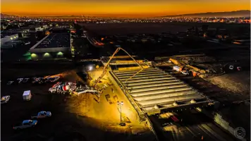
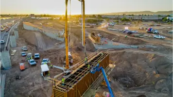
Construction Progress Updates
2D/3D Mapping
360 Photos
Time Lapse
Inspections
Glamour Shots
Highlights and features
- We offer FAA-certified pilots with 7+ years of drone industry experience
- Our team provides insured operations for complete client protection
- We guarantee satisfaction with free revisions for unsatisfactory deliverables
- Specialized in real estate and construction applications since 2015
- We utilize industry-standard Pix4D mapping technology for accurate data
Associations and certifications
- FAA certified sUAS pilot
Services
Drone Photography
Our FAA-certified pilots capture high-resolution aerial imagery using state-of-the-art drone technology. This service provides unique perspectives for real estate marketing, construction documentation, and commercial projects. Clients benefit from precise camera control, optimal lighting techniques, and professional-grade equipment that delivers visually compelling content for marketing and documentation purposes.
2D/3D Mapping
We create detailed orthomosaic maps and 3D models using advanced photogrammetry software. This service enables construction teams to track progress, perform volumetric calculations, and enhance project planning. Clients receive interactive digital deliverables that improve site analysis, stakeholder communication, and documentation accuracy through industry-standard Pix4D technology.
Construction Progress Updates
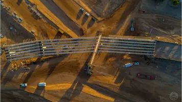
Regular aerial documentation tracks construction milestones and project evolution. This service provides stakeholders with visual progress records, safety inspections, and marketing materials. Clients gain efficient monitoring capabilities without disrupting on-site operations, ensuring timely decision-making and improved project management oversight.
360 Photos
Interactive 360-degree imaging creates immersive property experiences for real estate marketing. This service allows potential buyers to explore properties virtually from any device. Clients benefit from enhanced online engagement, detailed spatial representation, and flexible viewing options that increase property visibility and marketing effectiveness.
Time Lapse
Continuous aerial time-lapse recording captures extended construction processes in condensed video format. This service documents project timelines, showcases completed work, and provides valuable marketing content. Clients receive dynamic visual narratives that demonstrate project scope, team capabilities, and transformational progress over time.
People
Tylor Foster
Founder / Chief Pilot
Civil engineering graduate from Purdue University with 7+ years of drone industry experience. Former construction manager who pioneered drone usage for major contractors before establishing First Take Aerial.
Questions
What areas do you service?
We primarily serve the Reno/Tahoe region including surrounding communities in Northern Nevada and Lake Tahoe areas.
Are your pilots FAA-certified?
Yes, all our operations are conducted by FAA-certified sUAS pilots with current airspace authorizations.
Can you shoot at night?
We have FAA authorization for night operations and controlled airspace flying in multiple states.
What happens if weather affects the shoot?
We schedule flexible time windows to accommodate weather changes and charge 50% of fees for postponements due to weather.
What deliverables can I expect?
Clients receive high-resolution images, 4K video, interactive 3D models, and customized digital content based on project requirements.
How long does delivery take?
Most projects are delivered within a few days after the shoot, depending on the scope and complexity of work required.
Videos