Business Details
Professional Land Surveying Services in Connecticut
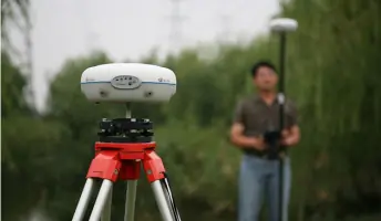
At Connecticut Surveying & Geomatics, we bring over 14 years of dedicated expertise to the land surveying and mapping industry. Our personalized approach ensures clients fully understand their project requirements while our technical innovation leverages real-time network-corrected GPS for sub-centimeter accuracy. Every assignment is executed by licensed professionals utilizing advanced field equipment including Surface Pros and specialized mapping software. We prioritize client communication through individualized consultations to determine optimal service solutions. Our team maintains a steadfast commitment to precision across property line stakeouts, elevation certifications, and construction layouts.With rapid turnaround times and competitive pricing, we serve both residential and commercial clients throughout Connecticut. Our technical capabilities extend to asset-grade mapping, bathymetry, and expert witness testimony for complex projects. Backed by extensive experience in ALTA/ACSM title surveys and GPS control networks, we deliver reliable results for challenging assignments. Client satisfaction remains our highest priority through transparent processes and certified professional execution. Our proven track record demonstrates consistent delivery of accurate surveying solutions tailored to specific project needs.

Services
Elevation Certificates
ALTA/ACSM Surveys
Construction Layout
Property Stakeout
GPS Control Networks
As-Built Surveys
Bathymetry
Expert Testimony
Volume Calculations
Wetland Mapping
Highlights and features
- Licensed land surveyors with 14+ years of experience
- Real-time network-corrected GPS technology for sub-centimeter accuracy
- Personalized consultations for tailored service solutions
- Competitive pricing with rapid project turnaround times
- Proven expertise in ALTA/ACSM title surveys and construction layout
Services
Elevation Certificates
We provide official elevation certificates for flood insurance requirements and FEMA compliance. Our licensed surveyors use precision GPS technology to determine building elevations relative to flood zones. This critical documentation helps property owners secure accurate flood insurance rates while meeting regulatory requirements for coastal and inland floodplain areas.
ALTA/ACSM Surveys
Our ALTA/ACSM standard land title surveys meet strict industry requirements for commercial property transactions. We deliver detailed boundary analysis, easement documentation, and encroachment verification to satisfy lender and title company demands. These comprehensive surveys include topographic features and utility locations for informed real estate decisions.
Construction Layout
We provide precise construction layout services for residential and commercial developments. Our team establishes exact building corners, utility locations, and grading benchmarks using advanced GPS equipment. Contractors benefit from accurate field markings that ensure proper structure placement and compliance with approved site plans.
Property Stakeout
Our property stakeout services clearly define land boundaries through physical marker placement. We analyze historical records and perform field measurements to locate property corners and lines. This service helps resolve disputes, plan improvements, and ensure compliance with zoning regulations for landowners and municipalities.
GPS Control Networks
We establish high-precision GPS control networks for large-scale mapping and engineering projects. Our surveyors create reference frameworks that maintain measurement consistency across extensive areas. These networks support infrastructure development, environmental monitoring, and multi-phase construction projects requiring long-term spatial accuracy.
Questions
What surveying services do you specialize in?
We specialize in elevation certificates, ALTA/ACSM title surveys, construction layout, property stakeout, GPS control networks, and bathymetric surveys for Connecticut properties.
Are your surveyors licensed professionals?
Yes, all our surveying work is performed and certified by licensed Connecticut professional land surveyors with over 14 years of combined experience.
How quickly can you complete a survey project?
We offer rapid turnaround times with most standard surveys completed within 3-5 business days depending on project complexity and site conditions.
Do you serve both residential and commercial clients?
We provide surveying solutions for both residential property owners and commercial developers across Connecticut's diverse landscapes.
What technology do you use for accurate measurements?
Our team utilizes real-time network-corrected GPS systems, Surface Pro tablets with mapping software, and traditional total stations for precise field measurements.