
Business Details
Precision Land Surveying Services in New York
American Engineering has been delivering precision land surveying services in the New York metropolitan area for over four decades. Our commitment to accuracy and innovation is driven by state-of-the-art technology combined with the expertise of our licensed professionals. We specialize in boundary and topographic surveys, civil engineering projects, and architectural design, ensuring clients receive reliable data for property development and infrastructure planning.Our team's deep understanding of regulatory standards and terrain complexities minimizes risks while optimizing project efficiency. Trusted by public and private sector clients, we maintain a reputation for technical excellence and client-focused solutions that meet evolving industry demands.

Services
Land Surveying
Civil Engineering
Architecture
ALTA Surveys
Topographic Surveys
Hydrographic Surveys
Storm Drainage Plans
BIM Modeling
Subdivision Mapping
Site Development
Highlights and features
- We offer 40+ years of specialized land surveying experience in New York
- Our team utilizes state-of-the-art GPS and LiDAR technology
- Licensed professionals ensure regulatory compliance and technical accuracy
- Proven track record with municipal and private sector projects
- Client-focused approach with guaranteed project timeline adherence
What people say
Professional and thorough
Stress-free process
Exceptional land surveying
Accurate results
Expert team
Services
Land Surveying
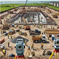
Our land surveying services combine GPS technology and traditional equipment to establish precise property boundaries and topographical features. The team conducts boundary, topographic, and ALTA/ACSM surveys that meet legal requirements for property transactions. With decades of experience, we deliver accurate documentation essential for development projects and land dispute resolution.
Civil Engineering
Civil engineering services focus on infrastructure projects requiring site development plans and storm drainage systems. We create sanitary system designs and grading plans that comply with municipal regulations. Our engineers manage public works projects from concept through construction documentation, ensuring structural integrity and environmental compliance for Long Island communities.
Architecture
Architectural services emphasize functional space planning and sustainable design solutions. We develop site-specific building plans that integrate with topographical data from our surveys. The team creates construction documents meeting local zoning codes, focusing on aesthetic value and structural efficiency for residential and commercial developments across New York.
Hydrographic Surveys
Hydrographic surveying measures underwater terrain features and shoreline characteristics. We map riverbeds, lakes, and coastal areas using specialized sonar equipment to support dredging projects and waterfront development. This data informs erosion control strategies and environmental impact assessments for New York waterways.
BIM Modeling
BIM modeling creates detailed 3D representations of infrastructure projects using survey data. This technology enables virtual construction analysis to identify potential conflicts before physical work begins. Our models improve project coordination for complex developments, reducing costly modifications during actual construction phases across all service areas.
People
Steve Ravn
Licensed Land Surveyor
With over 30 years of experience, Steve Ravn leads survey operations ensuring technical accuracy and regulatory compliance. His expertise in boundary determination and field data collection has established trusted partnerships with municipal agencies across Long Island.
Daniella Ravn
Licensed Architect
Daniella Ravn specializes in integrating survey data with architectural design requirements. Her background in spatial planning ensures building designs align perfectly with site topography while meeting New York State building codes and accessibility standards.
Nathan Louks
Project Manager
Nathan Louks coordinates multi-disciplinary projects from initial surveys through final documentation. He maintains client communication channels and ensures timely delivery of surveying and engineering services across all project types in the metropolitan area.
Brittany Avelaro
Draftsperson
Brittany Avelaro prepares technical drawings and digital models from field data. Her attention to detail ensures survey results translate accurately into construction documents, supporting both private developers and public sector clients throughout New York.
Questions
What surveying services does American Engineering offer?
We provide boundary surveys, topographic mapping, ALTA/ACSM surveys, hydrographic surveys, and construction staking services using advanced GPS and LiDAR technology.
How does American Engineering ensure survey accuracy?
Our licensed professionals combine state-of-the-art equipment with 40+ years of experience to deliver measurements meeting strict regulatory standards and project specifications.
What technology is used for land surveys?
We utilize GPS systems, drones, LiDAR scanning, and BIM modeling to ensure precise data collection and digital representation of terrain features.
Which areas do you serve?
Our primary service area includes New York City and surrounding counties, covering municipal projects and private developments across Long Island.
How are project timelines managed?
We maintain strict scheduling protocols with dedicated project managers to ensure timely delivery while maintaining technical accuracy and documentation standards.