Business Details
15 Years
experience
Professional Surveying & Mapping Services in Maryland
Our company was founded in 2011 with a clear mission to deliver high-quality surveying, mapping, and engineering services to residential, commercial, and municipal clients across Maryland, Delaware, and the District of Columbia. In 2024, we joined forces with Verdantas LLC, a leading environmental science and engineering firm, to enhance our capabilities and provide integrated solutions. Our team brings over 36 years of combined experience in land surveying and mapping, supported by state-of-the-art technology and a deep understanding of zoning regulations and environmental legislation. We specialize in FEMA elevation certificates, boundary surveys, topographic mapping, construction layout, and ALTA/NSPS land title surveys, serving a diverse clientele including developers, attorneys, real estate professionals, and homeowners.Our commitment to excellence is reflected in our 100% success rate for qualified LOMA submissions and our dedication to using advanced tools like dual-frequency GPS, LiDAR, and aerial photogrammetry. We prioritize customer satisfaction by delivering accurate, timely, and affordable services while maintaining the highest professional standards. Our veteran-owned team takes pride in cultivating long-term relationships with clients and continuously improving our processes to meet evolving industry demands.
Services
FEMA Elevation Certificates
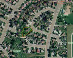
Boundary Surveys
Site Plan Preparation
Topographic Surveys
ALTA/NSPS Land Title Surveys
Construction Layout
Aerial Mapping
Subdivision Design
Details
- Year established: 2011
Highlights and features
- We offer 36+ years of combined experience in surveying and mapping.
- Our team uses state-of-the-art equipment like dual-frequency GPS and LiDAR.
- We guarantee 100% success rate for qualified LOMA submissions.
- Our staff includes certified MD/DE/DC Professional Land Surveyors.
- We provide free estimates and prioritize timely, affordable service.
Services
FEMA Elevation Certificates
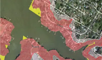
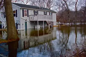
FEMA Elevation Certificates determine property elevations relative to flood hazard zones. These documents help homeowners and businesses reduce flood insurance premiums by providing accurate survey data. Our certified surveyors ensure compliance with NFIP standards and maintain a 100% success rate for qualified LOMA submissions.
Boundary Surveys
Boundary surveys establish precise property lines using title documents and field measurements. This service resolves disputes, prevents encroachments, and ensures compliance with zoning regulations. Our licensed surveyors deliver legally recognized certifications for residential and commercial clients.
Topographic Surveys
Topographic surveys map physical features and surface elevations for design and construction projects. We use GPS, robotic total stations, and LiDAR to create digital terrain models. These surveys support infrastructure development, environmental assessments, and land-use planning across diverse properties.
ALTA/NSPS Surveys
ALTA/NSPS Land Title Surveys meet national standards for commercial property transactions. These detailed surveys identify title exceptions, encroachments, and zoning compliance. We collaborate directly with lenders and title companies to ensure accurate documentation for real estate closings.
Aerial Mapping
Aerial mapping uses drones and photogrammetry to create high-resolution site models. This technology supports large-scale projects with efficient data collection. We integrate aerial data with ground surveys to produce comprehensive mapping for design, construction, and asset management.
People
Charles S. Ruzicka
Founder
With 39 years of experience, Charles founded Precision Surveying & Mapping in 2011. His expertise spans land development, GIS data collection, and construction layout. He previously worked at multidisciplinary engineering firms, enabling our team to deliver comprehensive surveying solutions.
Questions
What services does Precision Surveying & Mapping offer?
We provide FEMA elevation certificates, boundary surveys, topographic mapping, ALTA/NSPS land title surveys, construction layout, aerial mapping, and subdivision design for residential, commercial, and municipal clients.
How can a FEMA Elevation Certificate reduce my insurance costs?
Accurate elevation data from our certified surveyors can demonstrate that your property is above flood risk levels, potentially lowering your National Flood Insurance Program premiums.
Do you serve areas outside Maryland?
Yes, we serve Delaware, the District of Columbia, and collaborate with Verdantas' national network for broader projects.
Are your surveyors licensed?
All our surveyors are licensed as Professional Land Surveyors in Maryland, Delaware, and the District of Columbia.
Can you assist with construction project layouts?
Yes, our team provides precise construction layout services to ensure accurate implementation of architectural and engineering plans.