Business Details
Professional Land Surveying Services in Billings, MT
Essex Surveying has built a reputation as a trusted provider of professional land surveying services across the Mountain West and Alaska. With decades of combined experience, our team delivers precision and reliability through advanced technology and a commitment to client-centric service. Our expertise spans boundary, construction, transportation, and geodetic surveys, supported by licenses in seven states and federal certification. We prioritize clear communication and tailored solutions, ensuring every project meets exacting standards regardless of scale. Our leadership team brings deep technical knowledge and local insight, having worked on complex infrastructure and resource development projects from Montana to Alaska. By integrating GPS and GNSS technologies with traditional surveying methods, we provide data-driven results that meet modern engineering and regulatory requirements.Our track record with government agencies like the Montana Department of Transportation and the Federal Aviation Administration underscores our technical proficiency and adherence to industry best practices. From small boundary disputes to large-scale pipeline routing, we approach every assignment with the same dedication to accuracy and client satisfaction. Our team's extensive field experience across diverse terrains and jurisdictions ensures clients receive actionable insights grounded in real-world conditions. This combination of technical excellence, regulatory compliance, and personalized service positions Essex Surveying as a leader in professional land surveying.
Services
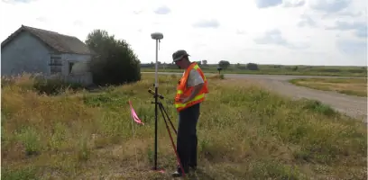
Transportation Surveys
Boundary Surveying
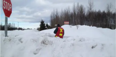
Construction Staking
Oil and Gas Surveys
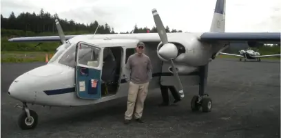
Geodetic Control
Highlights and features
- We offer over 40 years of combined surveying experience across seven western states.
- Our team utilizes advanced GPS and GNSS technology for precise measurements.
- We maintain licenses in seven states and federal CFedS certification.
- Our project portfolio includes complex infrastructure and energy development projects.
- We provide tailored solutions for both public and private sector clients.
Associations and certifications
- CFedS (Certified Federal Surveyor)
Services
Transportation Surveys
We conduct right-of-way surveys and DOT-standard control mapping for highway expansions and railroad infrastructure projects. Our team has completed major assignments for the Montana and Alaska Departments of Transportation, including Seward Highway lane widening and rural airport relocations. Using geodetic control networks and photogrammetric techniques, we provide data for engineering design and construction management of transportation corridors.
Boundary Surveying
Our boundary survey services include property retracements, fence line staking, and legal exhibit preparation for private landowners and federal agencies. We perform multi-section ranch surveys on public and private lands, with extensive experience in Custer National Forest and Fort Berthold Indian Reservation projects. The team also prepares FEMA floodplain certificates and subdivision plats for local governments.
Construction Staking
We provide precise staking for commercial buildings, utility infrastructure, and highway reconstruction projects. Our services include underground utility layout, curb and gutter staking, and right-of-way delineation. The team works directly with contractors and municipal agencies to ensure construction projects adhere to design specifications and regulatory requirements.
Oil and Gas Surveys
We support energy development projects with route location surveys, well pad staking, and pipeline conflict analysis. Our experience includes TransCanada Keystone XL pipeline work in Montana and gas midstream pipeline surveys in North Dakota. We prepare legal exhibits for easements and perform boundary surveys for electrical infrastructure on tribal lands.
Geodetic Control
We establish high-precision geodetic networks for aviation infrastructure and federal projects. Our team has collected data for 70+ FAA monuments in Alaska and performed NGS blue-booked surveys. Using Trimble Business Center software, we integrate multiple data sources to create unified control networks for engineering and design applications.
People
Zamian Essex
Professional Land Surveyor
Zamian Essex is a Montana native and U.S. Military veteran with 19 years of surveying experience. He holds a mathematics degree from Montana State University Billings and specializes in boundary, construction, and GPS surveys across seven western states.
Tim Grant
Professional Land Surveyor
Tim Grant has over 40 years of surveying experience in Montana and Wyoming. He began his career in Cody, Wyoming, and worked as a construction inspector for Billings before becoming a licensed surveyor specializing in transportation and infrastructure projects.
Isaiah Robins
Field Survey Technician
Isaiah Robins brings 6+ years of surveying experience after transitioning from industrial pipe fitting. He specializes in boundary and construction surveys, with fieldwork experience across multiple western states and a focus on precision data collection.
Amber Essex
Project Manager
Amber Essex manages surveying projects with 20+ years of customer service experience, including healthcare administration roles. She specializes in exempt plat planning and subdivision management for Yellowstone County and surrounding areas.
Questions
What geographic areas does Essex Surveying serve?
We operate across Montana, Wyoming, North Dakota, South Dakota, Idaho, Washington, Alaska, and federal jurisdictions.
What types of surveying projects does Essex handle?
Our expertise includes transportation infrastructure, boundary disputes, construction staking, oil/gas development, and geodetic control surveys.
Are your surveyors certified for federal projects?
Yes, we hold Certified Federal Surveyor (CFedS) credentials and have completed projects for agencies like the FAA and BLM.
How does Essex Surveying ensure measurement accuracy?
We combine traditional surveying methods with advanced GPS/GNSS technology and Trimble Business Center software for precise results.
What experience do your team members have?
Our professionals have 6-40 years of experience, including work on major infrastructure projects like the Keystone XL pipeline and Alaska airport expansions.
