Business Details
41 Years
experience
Land Surveying & Engineering Services in Bar Harbor, ME
Nichols Paul F Civil Engineer & Land Surveyor has been delivering land surveying, civil engineering, and land planning solutions across Maine, New Hampshire, and Massachusetts for over 30 years. With professional licenses in all three states, the firm combines technical expertise with deep local knowledge to serve public and private sector clients. Our founder, Paul Nichols, holds a Bachelors degree in Civil Engineering from UMass Lowell and has maintained continuous professional development through seminars on boundary law and GPS innovations. As a member of the Maine Society of Land Surveyors and the New Hampshire Land Surveyors Association, we uphold the highest industry standards. Our work spans boundary resolution, topographic mapping, flood zone certifications, and complex land development projects.Clients benefit from Pauls prior experience with municipal engineering departments and collaborations with conservation organizations. We offer free basic consultation for initial project guidance while providing detailed contractual services for specialized needs. Our reputation for integrity and precision has been built through decades of resolving boundary disputes, designing infrastructure, and supporting land conservation efforts. The firm maintains strong relationships with professional associates and leverages advanced technology to ensure accurate results. From site design to permitting assistance, our comprehensive approach addresses all stages of land development projects.
Services
Boundary Surveys
Topographic Surveys
Flood Zone Certificates
Subdivision Design
Wetland Permitting
Coastal Construction Permits
ALTA/ACSM Surveys
Site Planning
Land Conservation Surveys
GPS Mapping Services
Details
- Year established: 1985
Highlights and features
- We offer 30+ years of experience in Northern New England land surveying
- Licensed in Maine, New Hampshire, and Massachusetts for regional expertise
- Specialize in boundary resolution and complex land development projects
- Provide free basic consultation for initial project guidance
- Maintain active professional development in GPS and boundary law advancements
Services
Boundary Surveys
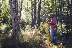
Determine property boundaries through comprehensive research and field measurements. Our surveys include boundary marking, plan drafting, and improvement location. Licensed professionals conduct thorough deed research and physical verification to resolve disputes and support property transactions.
Topographic Surveys
Create detailed maps showing natural and man-made features with elevation data. These surveys support development planning, flood risk assessment, and engineering design. We use advanced GPS technology to capture accurate terrain measurements for construction and conservation projects.
Subdivision Design
Design new lot configurations with required infrastructure planning. Our services include roadways, utilities, and drainage design for residential and commercial developments. We prepare site plans that meet local zoning regulations and environmental protection requirements.
Wetland Permitting
Assist with permitting for projects near sensitive ecosystems. We identify wetland boundaries, prepare regulatory submissions, and design mitigation measures. Our expertise covers both inland and coastal wetland protections under state and federal guidelines.
ALTA Surveys
Conduct precise commercial property surveys meeting national standards. These detailed assessments identify boundary conditions, improvements, and encumbrances to support title insurance. We follow ALTA/ACSM specifications for commercial real estate transactions and developments.
People
Nichols Paul F Civil Engineer & Land Surveyor
Land Surveyor & Civil Engineer
Licensed professional with 30+ years of experience in Northern New England. Holds degrees from UMass Lowell and NH Technical Institute. Specializes in boundary resolution, land development, and conservation projects. Active member of state surveyors associations.
Questions
What areas do you serve?
We provide services throughout Maine, New Hampshire, and Massachusetts with frequent projects in coastal and rural areas.
What survey types do you offer?
We conduct boundary surveys, topographic surveys, ALTA/ACSM surveys, subdivision surveys, and specialized mapping for conservation and development projects.
Do you handle permitting assistance?
Yes, we help with wetland permits, coastal construction permits, and other regulatory approvals required for land development projects.
What engineering services are available?
Our civil engineering services include site design, roadway planning, drainage systems, utility layout, and septic system design for residential and commercial developments.
How much consultation is available?
We offer free basic consultation for initial project questions with detailed contractual services available for complex engineering and surveying needs.