
Business Details
14 Years
experience
Your Trusted Land Surveying Partner in Knoxville, TN
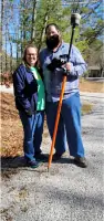
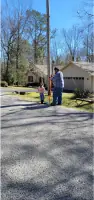
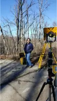
Adam Schmeing Land Surveying has been serving Knoxville and surrounding areas since 2012, delivering precise and reliable surveying solutions for residential and commercial clients. As a family-owned business, we prioritize personalized service and leverage cutting-edge technology, including robotic total stations, GNSS systems, and aerial drone surveying, to ensure accuracy and efficiency. Our team holds licenses in Alabama, Kentucky, Tennessee, and Virginia, and we maintain active memberships in professional associations to stay aligned with industry advancements.With over 13 years of experience, we specialize in boundary surveys, topographical mapping, construction layout, and bathymetric surveys, among other services. Our commitment to innovation and client satisfaction has driven organic growth through referrals, and we offer free consultations to tailor solutions to individual project needs.
Services
Boundary Surveys
Topographical Surveys
Aerial Drone Surveying
Construction Layout
Bathymetric Surveys
Details
- Year established: 2012
Highlights and features
- We have over 13 years of experience in land surveying across four states.
- We use cutting-edge robotic total stations and GNSS systems for precision.
- Our team is licensed in Alabama, Kentucky, Tennessee, and Virginia.
- We offer personalized service and free consultations for tailored solutions.
- We prioritize efficiency to reduce project time and client costs.
What people say
Professional and accurate
Reliable service
Excellent customer support
Cutting-edge technology
Timely project completion
Services
Boundary Surveys
We conduct precise boundary surveys to define property lines using advanced GNSS technology. Our surveys ensure legal compliance and resolve disputes for residential and commercial clients. This service supports construction planning, land development, and title transfers with accurate documentation.
Aerial Drone Surveying
Our aerial drone surveying captures high-resolution orthometric maps and terrain models. This technology enables efficient data collection for large sites, reducing time and costs while maintaining accuracy. Ideal for construction monitoring, environmental assessments, and topographical analysis.
Bathymetric Surveys
We perform bathymetric surveys to map underwater surfaces using specialized hydrographic equipment. This service supports lake, river, and reservoir management by providing depth measurements and submerged feature analysis for engineering and environmental projects.
Construction Layout
Our construction layout services use GPS and robotic systems to mark precise building locations and infrastructure. This ensures alignment with design plans, minimizing errors during development. Clients benefit from reduced rework and adherence to project timelines.
Topographical Surveys
We create detailed topographical surveys to depict natural and man-made features of a site. These maps support land development, zoning, and engineering projects by providing elevation data and terrain analysis for informed decision-making.
People
Adam Schmeing
Licensed Professional Surveyor
Adam Schmeing leads the company with over 13 years of surveying experience. He specializes in boundary, topographical, and hydrographic surveys, leveraging advanced technology to deliver precise results. Adam is a Lifetime Member of the Tennessee and Kentucky Associations of Professional Surveyors.
Missy Schmeing
Team Member
Missy Schmeing contributes to the company's operations in Gatlinburg, TN. Her work supports client communication and project coordination, ensuring seamless service delivery across diverse surveying projects.
Abigail Schmeing
Team Member
Abigail Schmeing assists with surveying projects in Anderson County, TN. She collaborates with the team to maintain the company's standards of accuracy and client satisfaction through hands-on field and office support.
Questions
What services does Adam Schmeing Land Surveying offer?
We provide boundary surveys, topographical mapping, aerial drone surveying, construction layout, bathymetric surveys, and 3D machine control modeling for residential and commercial projects.
Are you licensed in multiple states?
Yes, we are licensed in Alabama, Kentucky, Tennessee, and Virginia, ensuring compliance with regional surveying standards.
Do you use modern technology for surveys?
We utilize robotic total stations, GNSS systems, and aerial drones to enhance precision and efficiency in all projects.
Can you assist with property boundary disputes?
Yes, our boundary surveys help resolve disputes by providing accurate, legally recognized property line documentation.
Is free consultation available?
We offer free consultations to discuss your project needs and provide tailored surveying solutions.