Business Details
9 Years
experience
Professional Land Surveying Services in Bryan, Texas
Bryan Land Surveying is a dedicated team of licensed professionals providing comprehensive land surveying services in Bryan, Texas, and surrounding areas. With expertise in ALTA Title Surveys, Boundary Surveys, and Construction Surveys, we combine advanced technology like Drone LiDAR Mapping with decades of field experience to deliver precise measurements and reliable results. Our commitment to accuracy and client satisfaction ensures property owners, developers, and government agencies receive tailored solutions for residential, commercial, and industrial projects.By adhering to strict industry standards and maintaining open communication, we empower clients to make informed decisions about property boundaries, flood risks, and construction planning. As a locally rooted firm, we prioritize community needs while upholding statewide regulatory compliance and technical excellence.
Services
ALTA Title Survey
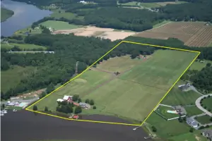
Boundary Survey
Construction Staking
Drone LiDAR Mapping
Elevation Certificate
Topographic Survey
Details
- Year established: 2017
Highlights and features
- We offer licensed Texas land surveyors with state-specific expertise.
- Our team provides boundary surveys with iron pin markers for legal accuracy.
- We utilize Drone LiDAR Mapping for cost-effective, high-accuracy topographic data.
- We deliver elevation certificates to determine flood insurance rates and compliance.
- Our surveyors conduct construction staking to ensure structures meet zoning requirements.
What people say
Accurate boundary markings
Responsive flood certificate service
Modern drone technology
Services
ALTA Title Survey
ALTA Title Surveys establish precise property boundaries and encroachments for commercial transactions. Our team follows national standards to identify easements, structures, and legal descriptions, ensuring lenders and title companies have accurate data for risk assessment. This survey type meets federal requirements for out-of-state lenders and provides comprehensive documentation for property transfers.
Boundary Survey
Boundary surveys determine exact property lines using deed research and physical monumentation. We locate iron pins, rebar, or existing markers to verify lot dimensions and detect encroachments. Our surveys comply with Texas legal standards and include detailed drawings for real estate transactions, fence installations, and subdivision planning.
Drone LiDAR Mapping
Drone LiDAR Mapping captures high-resolution topographic data using unmanned aerial vehicles. This technology creates 3D models and ortho-photographs for construction planning, floodplain analysis, and large-area mapping. Our FAA-certified operators produce cost-effective, millimeter-accurate surveys faster than traditional methods while maintaining compliance with geospatial standards.
Elevation Certificate
Elevation Certificates document building elevations relative to floodplain benchmarks. We measure lowest adjacent grade and finished floor elevations to determine flood risk zones. These certificates qualify homeowners for accurate flood insurance rates and support Letter of Map Amendment requests for properties incorrectly designated in Special Flood Hazard Areas.
Construction Staking
Construction staking establishes precise reference points for new developments. Our surveyors mark building corners, utility lines, and grading benchmarks to guide earthwork and foundation placement. This service ensures compliance with zoning setbacks and prevents costly errors during residential and commercial construction projects.
Questions
What does a licensed Texas land surveyor do?
Licensed Texas land surveyors measure property boundaries, create legal maps, and verify building locations. They ensure compliance with state regulations and provide documentation for real estate transactions, construction projects, and flood insurance requirements.
How much does a boundary survey cost in Bryan, TX?
Cost varies based on parcel size and complexity. A typical residential survey ranges from $500-$1,500. Contact us for a customized quote after reviewing your property details and required deliverables.
Do I need an elevation certificate for my Bryan home?
If your property lies in a FEMA-designated flood zone, an elevation certificate determines flood insurance rates. Even outside floodplains, it provides valuable data for future property improvements and risk assessment.
Can drone surveys replace traditional land surveying?
Drones enhance traditional methods by quickly capturing large datasets but cannot fully replace boundary retracement or legal documentation by licensed surveyors. We combine both approaches for optimal accuracy and efficiency.
How long does a typical construction staking project take?
Most residential staking projects complete within 1-3 days. Larger commercial sites may require additional time depending on infrastructure complexity and site conditions.
What information should I provide before a survey?
Provide property deeds, existing surveys, title insurance documents, and specific project requirements. This helps reduce research time and ensures accurate boundary determination during the fieldwork phase.
Videos