Business Details
14 Years
experience
Professional Land Surveying Services Traverse City
Dontz Surveying & Construction has been a trusted provider of land surveying services in the Greater Grand Traverse region since 2012. Our family-owned business combines over 26 years of collective expertise with advanced technology to deliver precise and reliable surveying solutions. We specialize in boundary surveys, topographic mapping, GIS data integration, and construction staking for residential, commercial, and municipal projects. Licensed and insured professionals ensure every assignment meets strict regulatory standards while maintaining timely service responses.Our commitment to accuracy and client satisfaction has established us as a preferred partner for property developers, architects, and homeowners throughout Northern Lower Michigan. We maintain rigorous quality control protocols while offering 24-hour free estimates to facilitate informed decision-making for land development initiatives.

Services
Boundary Surveys
Topographic Surveys
GIS Mapping
Condominium Projects
Construction Staking
Remonumentation
GPS Subdivisions
Building Site Layouts
ALTA Surveys
Details
- Year established: 2012
Highlights and features
- We offer 24-hour free estimates for all surveying projects
- Our team maintains active professional licensing and full insurance coverage
- 26 years of combined experience in land boundary and construction surveys
- Timely service responses for urgent surveying requirements
- Family-owned business serving Northern Lower Michigan communities
What people say
Exceptional professionalism
Accurate boundary determination
Timely service responses
Professional expertise
Reliable survey results
Services
Boundary Surveys
Our boundary surveys establish precise property lines using advanced GPS technology and historical records. This service prevents disputes through accurate corner monumentation and legal documentation. Clients receive detailed reports meeting Michigan surveying standards for real estate transactions and development projects.
Topographic Surveys
We create detailed elevation models showing natural and man-made features for construction planning. Our topographic surveys support drainage analysis and site development. Data collection follows industry standards for engineering and architectural applications across residential and commercial properties.
GIS Mapping
Our GIS mapping integrates spatial data for land management and urban planning. This service provides interactive digital maps for infrastructure projects and environmental assessments. We deliver actionable insights through layered data visualization and analysis tools for municipal and private sector clients.
Construction Staking
We provide precise field markings for building foundations and infrastructure projects. Our staking services ensure compliance with design plans and zoning regulations. Clients benefit from reduced rework through our verification of elevations, utilities, and structural placements during construction phases.
ALTA Surveys
Our ALTA/NSPS surveys meet national standards for commercial property transactions. This service identifies easements, encroachments, and boundary improvements. We collaborate with title companies to deliver surveys that satisfy lender requirements for risk assessment and insurance purposes.
People
Matthew S. Dontz
Owner
Licensed Professional Surveyor with 26 years' experience. Holds dual certification in land surveying and residential construction. Graduated from Ferris State University with degrees in Land Surveying & Civil Engineering. Specializes in boundary resolution and residential development projects.
Paul R. McClung II
Project Manager
Licensed Professional Surveyor with 14 years' experience. Earned B.S. from Ferris State University and M.S. in Civil Engineering from Purdue University. Expertise in GPS data processing and boundary surveying with specialized AutoCAD drafting skills for complex projects.
Brian D. Brinks
Survey Field Crew Chief
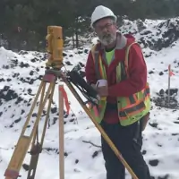
Certified Survey Technician with 50 years' industry experience. Proficient in construction staking, topographic surveys, and oil & gas exploration mapping. Provides field expertise for boundary re-establishment and infrastructure projects across diverse terrain conditions.
Kasi Lynn Forrester
Office and Marketing Manager
Office operations specialist with 7 years' experience in surveying firms. Holds Associate Degree in Human Resources Management from Baker College. Manages billing processes, survey documentation, and marketing initiatives while maintaining client communication protocols.
Questions
What surveying services do you specialize in?
We specialize in boundary surveys, topographic mapping, GIS data integration, construction staking, ALTA surveys, and condominium project layouts for residential and commercial clients.
How long has your company been in business?
Dontz Surveying & Construction has provided professional surveying services since 2012, with our team members collectively holding over 90 years of industry experience.
Do you offer emergency surveying services?
While not providing 24/7 emergency services, we offer 24-hour free estimates and prioritize urgent requests through our standard business hours operations.
Which geographic areas do you serve?
We primarily serve the Greater Grand Traverse Region and Northern Lower Peninsula of Michigan, covering both urban and rural surveying requirements.
Are your surveyors licensed and insured?
All our surveying professionals maintain active Michigan licensing credentials, and the company carries comprehensive insurance coverage for all project types.
How quickly can you complete a survey project?
Project timelines vary by scope but typically range from 3-10 business days. We provide specific completion estimates during our initial consultation process.