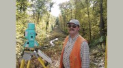
Protect Your Investment with Precise Land Surveying
Turning Point Survey Company, Inc. is a full-service land surveying company licensed in both Massachusetts and Rhode Island. Our company was founded in 2004 by David G. Greenhalgh, PLS, who has over 30 years of experience in land surveying and consultation. David G. Greenhalgh is licensed in Massachusetts since 1989 and Rhode Island since 1990. He is also a member of the Rhode Island Land Surveyors Society and the East Bay Chamber of Commerce, Rhode Island. Our company is fully insured, ensuring the highest level of professionalism and protection for our clients.
Our Services
We provide a wide range of services including Boundary survey, Condominium survey, Court exhibit survey, Construction and site plans, Flood Plain surveys, Land Court survey, Right-of-way and easement, Record or As-built survey, and Subdivisions. Our services are tailored to meet the specific needs of our clients, whether it's to establish specific information about a property before buying or subdividing, or to provide services in the planning of improvements on a property. We also offer surveys that can be tailored to suit the specific legal needs of a client.
About David G. Greenhalgh, PLS
David G. Greenhalgh, PLS, holds a B.S. degree in environmental conservation from the University of New Hampshire and has graduate level coursework in Geographic Information Systems (GIS) from Salem State College, MA. He began his career in land surveying in the mountain village of Breckenridge, Colorado, and later worked for the City of Boulder. He has worked his way up from field crew chief to Director of Surveys for many well-established engineering companies throughout New England. David's attention to detail has earned him an excellent reputation in land surveying throughout southeastern New England.
Frequently Asked Questions
We have answered some of the most common questions regarding land surveying. A Boundary Survey establishes or re-establishes property boundary lines and corners upon the ground. An ALTA/ACSM Land Title Survey is done on commercial property for the purpose of supplying the title company and lender with survey location data necessary for issuing title or extended coverage title insurance. A Topographic Survey locates natural or man-made features such as buildings, fences, trees, streams, and elevations of the land. The cost of a survey depends on several factors including the type of survey, size, shape, and accessibility of the property, type of terrain, vegetation, and time of year, as well as the availability and credibility of existing records and monuments.

Be the first to review Turning Point Survey.
Write a Review


