
Business Details
Your Premier Partner for Accurate Land Surveying Solutions
At Land Surveys Inc., we pride ourselves on delivering precise land surveying solutions with unwavering integrity and meticulous attention to detail. Our team of highly skilled professionals utilizes cutting-edge equipment and techniques to ensure accuracy and efficiency in every project. We approach each assignment with a fresh perspective, tailoring our services to meet the unique requirements of our clients. Our commitment to customer satisfaction is evident in our clear, timely communication and dedication to exceeding expectations. We combine technical expertise with a seamless customer experience, ensuring clients receive reliable, precise results.Our core values of moral integrity, accurate communication, reliable quality, and knowledge-driven professionalism guide every aspect of our work. With extensive experience in boundary surveys, topographic surveys, construction staking, and FEMA elevation certificates, we serve homeowners, developers, and engineers with equal proficiency. Our mission is to be a trusted partner in land surveying, reinforcing our reputation as industry leaders through every project we undertake.

Services
Boundary Surveys
Topographic Surveys
Construction Staking
FEMA Certificates
ALTA Surveys
Highlights and features
- We utilize cutting-edge technology for superior surveying accuracy.
- Our team holds professional licenses in Wisconsin for regulatory compliance.
- We provide transparent, detailed pricing quotes before project commencement.
- We maintain clear communication throughout every project phase.
- We adhere to strict ethical standards and industry best practices.
Services
Boundary Surveys
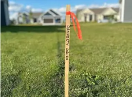
Our boundary surveys precisely define property lines using historical records and modern measurement techniques. This service ensures compliance with municipal requirements for home additions, fencing, and property transactions. We deliver digital and printed plat maps with physical corner markers for clear boundary visualization.
Topographic Surveys
Topographic surveys capture elevation changes and natural/ man-made features for construction planning. We create contour maps that help engineers and architects design site-specific developments. This service is essential for drainage analysis and infrastructure projects requiring precise terrain data.
Construction Staking
Our construction staking services mark building locations, roads, and utilities according to project plans. We ensure accurate implementation of design specifications to prevent costly errors. This service includes stake placement for foundations, drainage systems, and paving projects.
FEMA Elevation Certificates
FEMA elevation certificates determine flood insurance premiums by measuring property elevation against floodplain data. We provide official documentation required by insurance agents for properties in high-risk areas. This service helps property owners understand flood risks and compliance requirements.
ALTA/NSPS Surveys
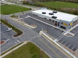
ALTA/NSPS surveys meet national standards for commercial real estate transactions. We document property boundaries, easements, and improvements to satisfy lender requirements. This service includes detailed analysis of title insurance documents and land use restrictions.
People
Phil Landry
President
With over 25 years of experience, Phil Landry leads our team with a commitment to surveying excellence and client satisfaction.
Dan Bednar
Project Manager
Dan Bednar brings 15 years of professional surveying experience, ensuring technical accuracy and timely project delivery for complex assignments.
John Schulz
Project Manager
John Schulz specializes in boundary resolution and land development projects, combining traditional surveying methods with modern technology.
Tom McCormack
Project Designer
Tom McCormack oversees survey design and mapping, ensuring compliance with local regulations and client specifications.
Kelly Landry
Office Manager
Kelly Landry coordinates project logistics and client communications, maintaining our commitment to exceptional service quality.
Questions
Why do I need a property survey?
Surveys establish legal boundaries, prevent encroachments, and are required for building permits and property transactions.
How much does a survey cost?
Costs vary based on property size and complexity. We provide detailed quotes before starting any work.
How long does a survey take?
Most residential surveys take 1-2 weeks, with results delivered within 7 business days after fieldwork completion.
Are your surveyors licensed?
All our surveyors hold Wisconsin state licenses and maintain professional certifications for regulatory compliance.
Can surveys be done in winter?
Yes, we conduct surveys year-round, though snow may affect marker visibility and data collection time.
What if a neighbor disputes boundaries?
Our official plat maps serve as legal evidence to resolve disputes through negotiation or legal proceedings.