Business Details
50+ Years
experience
Trusted Land Surveying Services in Buckley, WA
Holmvig DeWitt Gallion & Associates has provided land surveying services to the Pacific Northwest since 1968. Our expertise spans boundary/lot surveys, ALTA surveys, topographical surveys, platting, construction staking, and land planning. With over 40 years of combined experience, our team delivers thorough, detail-oriented work while maintaining a family-owned, community-focused approach. We prioritize accuracy, objectivity, and clear communication to meet project needs efficiently and cost-effectively. Our commitment to continual improvement ensures clients receive superior service and professionalism.We utilize advanced tools like Leica robotic total stations and AutoCAD Civil 3D software to enhance precision. Our strategic partnerships enable comprehensive support for complex land use and planning challenges. Clients benefit from our deep local knowledge and dedication to solving surveying and engineering problems. We emphasize safety, timely execution, and transparent collaboration with governmental agencies and private clients. This philosophy has established us as a trusted partner for land development and infrastructure projects across diverse industries.
Services
Land Surveying
Boundary Surveys
3D Scanning
Topographical Mapping
Construction Staking
Land Use Planning
ALTA Surveys
Flood Elevation Certificates
Critical Areas Surveys
GIS Data Collection
Details
- Year established: 1968
Highlights and features
- We offer 50+ years of combined experience in land surveying and engineering support.
- Our family-owned business prioritizes community involvement and personalized service.
- We utilize advanced technology like Leica robotic total stations and 3D scanning systems.
- Our strategic partnerships enable comprehensive solutions for complex land use challenges.
- We maintain rigorous safety standards while minimizing site disruptions during surveys.
Services
Land Surveying
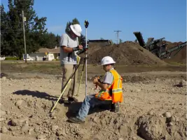
Our land surveying services include precise boundary determination, lot line adjustments, and ALTA/ACSM surveys. We use Leica robotic total stations and GPS systems to ensure compliance with state regulations. Clients receive detailed legal descriptions and site plans for property transactions and development projects.
3D Scanning
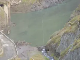
3D scanning services capture detailed site data for infrastructure, mechanical systems, and historical preservation projects. Our technology enables non-invasive measurements of complex structures like bridges and industrial facilities while maintaining safety and minimizing site disruptions during data collection.
Land Use Planning
We provide strategic land use planning support for private developers and public agencies. Our services include feasibility studies, permit coordination, and master planning for residential, commercial, and mixed-use developments. We focus on regulatory compliance and sustainable development practices.
Topographical Surveys
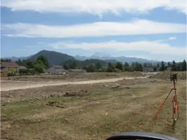
Topographical surveys document natural and man-made features, elevations, and contours for engineering and architectural design. Our team uses advanced equipment to create accurate digital terrain models that support drainage analysis, construction planning, and environmental assessments.
Construction Staking
Construction staking services ensure accurate project implementation using digital site plans and field equipment. We support infrastructure projects with layout verification for buildings, roads, and utilities while maintaining tolerances required for modern construction standards.
People
Rex Gallion
Executive Partner
Raised in Buckley, WA, Rex has 25 years of surveying experience including field and office roles. He previously worked with the Department of Natural Resources managing wildfire crews before joining HDGA.
Spencer Calvert
Executive Partner
Spencer serves as an Executive Partner with extensive land surveying expertise. He contributes strategic leadership to HDGA's engineering support and planning initiatives.
Richard Lang
Chief of Surveys
Licensed in Alaska, Oregon, and Washington, Richard has 40 years of surveying experience including 11 years as Skamania County Land Surveyor and 6 years teaching at Bates Technical College.
Joe Glaser
Office Manager
Joe brings 20+ years of land surveying experience to his role, combining aerospace industry skills with expertise in drafting short plats and construction documentation for diverse projects.
Karl Whitehouse
Project Manager
Karl holds an AAS in Civil Engineering with AutoCAD certification. He has 4 years of drafting experience at HDGA and specializes in integrating field data with digital modeling for complex survey projects.
Questions
What surveying services do you specialize in?
We specialize in boundary surveys, ALTA surveys, topographical mapping, construction staking, and land use planning for residential, commercial, and public sector clients.
Do you offer 3D scanning technology?
Yes, we provide 3D laser scanning services for detailed site modeling, as-builting, and complex infrastructure projects with minimal site disruption.
How long has your company been in business?
Our firm has provided land surveying services since 1968, with our current team maintaining over 55 years of combined industry experience.
What geographic areas do you serve?
We primarily serve the Pacific Northwest, including Washington counties like Pierce, King, Stevens, and Pend Oreille.
Can you support engineering and architectural firms?
Yes, we provide boundary work and site base maps to support design projects for engineers and architects across multiple industries.
Do you handle large-scale development projects?
We have extensive experience with master planning, industrial/commercial sites, residential subdivisions, and urban growth boundary expansions.