
Business Details
38 Years
experience
Your Trusted Partner for Civil Engineering & Land Surveying Solutions
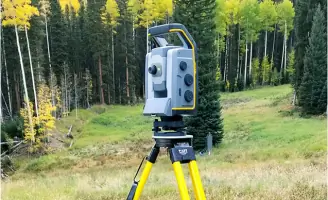
Established in 1988, Foley Associates has dedicated itself to delivering high-quality civil engineering, land surveying, planning, and design services across the southwestern United States. Our team of licensed professionals and technical experts combines decades of local experience with cutting-edge technology, including LiDAR scanning, GPS, and robotic surveying equipment, to ensure precision and efficiency. We prioritize client communication, guiding projects from initial consultation through regulatory approvals while maintaining transparency and adherence to schedules. With a deep understanding of municipal regulations in southwestern Colorado, we address unique project challenges to ensure successful outcomes.Our commitment to excellence, integrity, and service has solidified our reputation as one of the regions leading land surveying firms. Over 30 years of experience serving developers, homeowners, realtors, and utilities has equipped us with a vast library of historic surveys and a nuanced grasp of local community needs. We specialize in transforming client visions into reality, whether for residential additions or large-scale commercial developments, always emphasizing cost-effectiveness and regulatory compliance.
Services
ALTA/NSPS Land Title Surveys
As-built Surveys
Boundary Surveys
Construction Layout Services
Topographic Surveys
Subdivision Plats
Condominium Mapping
FEMA Elevation Certificates
GIS Data Acquisition
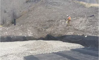
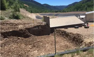
Mine Reclamation Surveys
Details
- Year established: 1988
Highlights and features
- We have over 30 years of experience in civil engineering and land surveying.
- Our team utilizes state-of-the-art LiDAR scanning and GPS technology.
- We maintain open communication to keep clients informed throughout projects.
- We specialize in navigating complex municipal regulations in southwestern Colorado.
- We deliver cost-effective solutions tailored to local community challenges.
Services
ALTA/NSPS Land Title Surveys
ALTA/NSPS Land Title Surveys provide detailed boundary, easement, and improvement data for commercial properties. Certified to stakeholders, these surveys meet national standards and verify parcel dimensions. Ideal for high-value transactions requiring lender and title company assurance.
Topographic Surveys
Topographic Surveys map natural and man-made features, including elevation changes, vegetation, and structures. Used for site planning and design, they ensure accurate terrain representation. Essential for construction and development projects requiring precise land analysis.
Subdivision Plats
Subdivision Plats divide or adjust land parcels, requiring municipal approval. We handle lot line adjustments, new subdivisions, and merger processes. Our plats meet legal standards and facilitate real estate transactions through official county recording.
FEMA Elevation Certificates
FEMA Elevation Certificates determine flood risk for properties in mapped flood zones. Required for insurance and compliance, they document elevation data relative to flood levels. Critical for securing accurate flood insurance rates and regulatory approvals.
Condominium Mapping
Condominium Mapping defines individual units and common areas within buildings. We detail interior spaces, limited common elements, and ownership boundaries. These maps enable legal sale and management of condominium units while meeting recording requirements.
Questions
What services does Foley Associates, Inc. offer?
We provide civil engineering, land surveying, planning, and design services, including ALTA/NSPS surveys, topographic mapping, subdivision plats, and FEMA elevation certificates.
How long has Foley Associates, Inc. been in business?
We have served clients in the southwestern United States since 1988, offering over 30 years of expertise in surveying and engineering.
What technology does Foley Associates use?
We utilize LiDAR scanning, GPS, and robotic surveying equipment to ensure precision and efficiency in all our projects.
Do you work with local municipalities?
Yes, we have extensive experience navigating municipal regulations in southwestern Colorado to streamline project approvals and compliance.
What areas do you serve?
We primarily serve the southwestern United States, with a focus on southwestern Colorado and its unique development challenges.
How do you handle project communication?
We maintain open communication throughout projects, providing updates, cost estimates, and schedules to ensure client involvement and transparency.