
Business Details
15 Years
experience
Professional Land Surveying Services in Augusta, GA
Augusta Land Surveying has been delivering professional land surveying services to builders, contractors, land developers, and landowners in the Augusta, Georgia area since 2011. Our team combines decades of collective experience with advanced surveying techniques to provide accurate, cost-effective, and time-efficient solutions for residential, commercial, and municipal projects. Fully insured and committed to exceeding client expectations, we maintain certifications in Workers Compensation, General Liability, and professional liability coverage. Our founder, Brad, brings 15 years of field experience and a Professional Land Surveying License obtained in 2009, ensuring every project benefits from technical expertise and local knowledge. We serve Columbia County, Richmond County, Burke County, McDuffie County, Wilkes Taliaferro County, and Lincoln County, with special discounts for active duty and retired military personnel.Client satisfaction is our priority, evidenced by our high rate of repeat business and referrals. Our services include topographic mapping, ALTA/ACSM land title surveys, construction staking, and GPS control networks, all executed with precision and adherence to industry standards. We pride ourselves on clear communication, legal compliance, and delivering actionable data that protects property investments. With a loyal, multi-talented staff and a commitment to 100% satisfaction, we guide clients through every phase of their surveying needs. Our work supports critical real estate transactions, infrastructure development, and boundary dispute prevention, establishing Augusta Land Surveying as a trusted partner in the CSRA region.
Services
Land Surveying
FEMA Flood Services
Land Planning
Construction Staking
Topographic Mapping
ALTA/ACSM Surveys
Tree Surveys
GPS Control Networks
Details
- Year established: 2011
Highlights and features
- We offer 15+ years of field experience with licensed professionals.
- Our team provides 100% satisfaction guaranteed surveying services.
- We serve 6 Georgia counties with local market expertise.
- Special discounts available for active duty and retired military.
- Fully insured with Workers Compensation and General Liability coverage.
Services
Land Surveying
Our land surveying services precisely determine property boundaries using advanced equipment and legal research. We serve builders, developers, and landowners needing accurate boundary documentation for transactions or development. Our team ensures compliance with Georgia surveying standards while protecting property investments through detailed mapping and documentation.
Construction Staking
We provide construction staking services to mark precise building locations and infrastructure placements. Our surveyors use GPS technology and total stations to ensure accurate layout for foundations, utilities, and roadways. This service helps contractors maintain compliance with design plans and zoning regulations during development projects.
Topographic Mapping
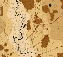
Our topographic mapping service creates detailed elevation models showing natural and man-made features. This data supports land development, drainage planning, and environmental assessments. We use high-precision instruments to capture terrain details that inform engineering designs and construction planning.
ALTA/ACSM Surveys
We conduct ALTA/ACSM land title surveys meeting national standards for commercial property transactions. These comprehensive surveys identify boundary details, easements, and improvements to satisfy lender and title insurance requirements. Our certified professionals deliver accurate documentation for real estate closings and legal records.
FEMA Flood Services
Our FEMA flood services determine property flood zone classifications and provide elevation certificates. This information helps property owners secure appropriate insurance coverage and comply with floodplain management regulations. We use precise elevation data to assess flood risk and support flood mitigation efforts.
People
Brad
Owner
Brad earned his Business degree from Augusta College in 1998 and worked with Southern Land Surveying for 15 years before founding Augusta Land Surveying in 2011. He obtained his Professional Land Surveying License in 2009 after extensive field training and continues to lead the firm with technical expertise and local knowledge.
Questions
Why get a land survey before property transactions?
A land survey identifies boundaries and potential issues before buying, selling, or developing property, preventing future disputes.
What qualifications should I look for in a surveyor?
Hire licensed professionals with local experience, proper insurance, and a track record of accurate documentation.
How long does a survey remain valid?
Survey results remain valid indefinitely as legal records, though new surveys may be needed for property transfers or development.
What services do you offer in Augusta?
We provide boundary surveys, topographic mapping, construction staking, ALTA/ACSM surveys, and FEMA flood certifications.
Do you offer military discounts?
Yes, we provide discounted rates for active duty and retired military personnel as a token of appreciation.