
Business Details
49 Years
experience
Your Trusted Land Surveyors in Uvalde, TX
Since 1977, Smyth Surveyors has established itself as a premier land surveying firm in Texas, delivering precise and legally sound surveying solutions. Our team combines 90+ years of cumulative expertise with advanced methodologies to address projects ranging from simple mortgage surveys to complex pipeline right-of-way acquisitions. As a family-owned business headquartered in Uvalde, we prioritize integrity, technical excellence, and client collaboration across boundary surveying, topographic mapping, and oil/gas well location services.Our Registered Professional Land Surveyors (RPLS) maintain rigorous standards for accuracy, ensuring defensible data for residential, commercial, and industrial clients. With operations spanning 15+ Texas counties, we leverage deep local knowledge to resolve boundary disputes, support infrastructure development, and provide flood elevation certifications. Our commitment to continuous improvement and transparent communication has solidified our reputation as a trusted partner for surveying needs of all scales.
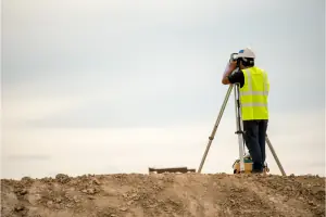

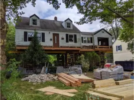
Services
Boundary Surveying
Pipeline Surveying
Topographic Mapping
Gas/Oil Well Location
Subdivision Mapping
Flood Elevation Certificates
Construction Staking
Title Boundary Surveys
Geographic Control Surveys
River/Lake Boundary Mapping
Details
- Year established: 1977
Highlights and features
- We offer 90+ combined years of surveying expertise across Texas.
- Our RPLS-certified team handles complex boundary and pipeline projects.
- Family-owned firm with 45+ years of localized industry knowledge.
- Comprehensive services from mortgage surveys to oil/gas well mapping.
- Proven track record in 15+ Texas counties including Uvalde and Kinney.
Associations and certifications
- RPLS
What people say
Experts in their field
Detail oriented
Very helpful
Thorough and helpful
Professional and reliable
Services
Boundary Surveying
Our boundary surveying service establishes precise property lines using historical records and modern technology. Clients receive legally defensible documentation for real estate transactions, dispute resolution, or development planning. This foundational service ensures compliance with Texas land regulations.
Pipeline Surveying
Specialized pipeline route surveys support oil and gas projects through accurate alignment mapping and right-of-way acquisition assessments. We provide data essential for construction permitting and environmental compliance across Texas energy corridors.
Topographic Mapping
Detailed topographic surveys document natural and man-made land features for development projects. Our elevation data informs construction design, drainage planning, and regulatory submissions with high-precision measurements.
Flood Elevation Certificates
We provide FEMA-compliant elevation certificates for insurance requirements and floodplain management. These documents verify building elevations relative to flood risk zones, supporting accurate premium calculations for Texas property owners.
Construction Staking
Our construction staking service translates engineering plans into physical markers for accurate project implementation. This ensures proper placement of structures, roads, and utilities according to approved designs and zoning regulations.
People
Mark E. Logrbrinck
Owner
Registered Professional Land Surveyor with 40 years of field and office experience, leading Smyth Surveyors since 2016. Specializes in complex boundary resolution and state land acquisitions.
Kerry Nolasco
Surveyor
RPLS and Engineer-in-Training with 15+ years of experience. Expertise in topographic surveys and digital data processing, contributing to major infrastructure projects across South Texas.
Tamara Gelles
Office Manager
25-year customer service professional managing client communications and operations since 2018. Ensures seamless coordination between field teams and clients for efficient project delivery.
Jennifer Thomas
Project Coordinator
8-year customer service veteran coordinating surveying projects since 2021. Maintains documentation workflows and client timelines to support timely delivery of survey products.
Matt
Project Manager
Experienced project manager overseeing field operations since 2015. Specializes in property history research and survey data interpretation to maintain accuracy in complex boundary determinations.
Questions
What surveying services do you offer?
We provide boundary surveys, pipeline mapping, topographic assessments, flood elevation certificates, construction staking, and oil/gas well location services across South Texas.
How long have you served Texas clients?
Smyth Surveyors has delivered land surveying solutions since 1977, with our current team holding 90+ combined years of Texas-specific expertise.
Which areas do you cover?
We operate in Uvalde, Medina, Bandera, Real, Kinney, Maverick, Zavala, Frio Counties and surrounding regions including Del Rio, Eagle Pass, and San Antonio areas.
Are your surveyors licensed?
All field personnel hold Texas Registered Professional Land Surveyor (RPLS) certifications, ensuring compliance with state standards and legal defensibility of all work products.
How do you handle complex boundary disputes?
Our team combines historical record research with modern GPS technology to resolve disputes, providing court-admissible documentation for contested property lines and title issues.
Videos